Country:
 City:
City:


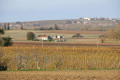
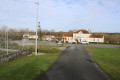
(S/E) Leave the car park next to the stadium, carefully taking the D152 road to the right towards Saint-Maigrin. At the bend immediately after this, cross the road and take the small road heading east. Continue to the second junction.
(1) Take the road on the right leading to the hamlet of Chez Coustant. The road immediately enters the woods and passes through them. As you approach Chez Coustant, take the path opposite heading south, leaving the hamlet on your left. Follow the path to the small road known as l’Ouche Mullon. Turn left onto this road and follow it to the junction with the Peubreau roads.
There, turn left to follow the Route de Louche, which descends slightly to pass the northern end of the pond east of Maine Roullet, before climbing straight up the hillside towards a wood.
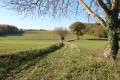
(2) Just as the road takes a right-angled bend to the left, continue straight ahead along the path heading eastwards, which leads to a road in the Bois de la Tuilerie. Turn right carefully onto the road for about 150 metres, then take the path on the left into a large clearing just after a house. The path enters the woodland and heads north-east. At the next crossroads, turn left to reach a small road.
(3) Carefully follow the road to the right, heading north-east. Continue to the junction where three roads and a forest track meet in the second clearing.
(4) Continue by turning onto the farm track furthest to the left, which climbs northwards. At the T-junction a little further on, turn onto the farm track on the right, which descends and joins aPR®® a short distance further on. The track eventually emerges from the woods and joins a north-south farm track.
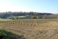
(5) Head north by turning left onto the roughly level track which runs alongside a vineyard plot before entering the woodland. On emerging from the woods, the track passes through an area planted with trees (orchards) and reaches a road known as ‘Chez Fonteneau les Bois’. Follow it to the left for the length of a bend – about eighty metres – until you reach a farm track on the right, just before a small copse.
(6) Take the farm track on the right and immediately cross a stream before passing through vineyards and heading towards a woodland. Continue to a crossroads and turn right, heading north-east. Walk for about four to five hundred metres to the next crossroads at the edge of the woodland in the Champ Roussy area (by the orchard and before the vineyard). The route leaves thePR®® path here.
(7) Turn left and cross the Bois de Trotte-Dorne to reach the vineyards on the western side of the woodland. Continue to the T-junction, which you’ll reach just after crossing the vineyards. Take the farm track on the left and follow it uphill to a T-junction. Turn right onto the track, which quickly becomes a small road as you reach the hamlet of Chez Genty.
Here you’ll see the well, built into a small shell-shaped structure in the centre of the hamlet.
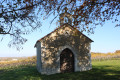
Continue down the road and, after about a hundred metres, visit the chapel on the edge of a cultivated field and a spring in a grassy patch on your right. Return to the road and follow it downhill to a crossroads.
(8) Turn right onto the road to reach the junction with the Route de Chez Colas immediately on the left. Turn onto the Route de Chez Colas and then immediately right onto the road leading to Chez Cardot. At the next junction, in the hamlet, carry on straight ahead along a farm track heading south-west. Carry on to the Route de Chez Marquet. Turn left and follow it carefully for just over a hundred metres until you reach a farm track on the right.
(9) Take the farm track on the right, which descends into a small valley. Cross a seasonal stream and climb up the other side of the valley. The track soon reaches the edge of a wood on the right-hand side. Continue to a road known as the ‘Route de Bourget’. Head carefully to the right for about 150 metres before taking the farm track on the left, which descends into a small valley before climbing again and entering a small wood, eventually reaching the road known as the ‘Route de Croix de Bert’. Continue by carefully following the road to the right. It descends and passes through the hamlet known as ‘Chez Francillon’. Carry on to the junction with a road on the left a little further on.
(10) Turn onto the road on the left and, just as it turns sharply right, continue straight ahead onto a forest track running along the hillside. At the junction of forest tracks further on, turn right to descend into a small valley. Cross an intermittent stream and you will immediately reach a road known as Chez les Bis. Just before the road, you will see a spring on your right.
Follow the road to the right towards Chez les Bis and carry on to the first farm track on the left, leaving the main part of the hamlet on your right.
(11) Turn left onto the track that climbs into the Bois de Chez les Bis towards the D152 road. When you reach it, cross the D152 road with care and continue straight ahead along the gently sloping track into the woods.
(12) At the next four-way junction, take the path on the left, which joins the D152 a little further on. Carefully follow the D152 to the right and head for the nearby car park (S/E).

 Visorando Member

 Easy
Easy 
 Tourist office