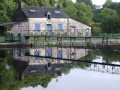
From Saint-Adrien to Sainte-Barbe in Quistinic

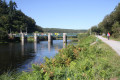
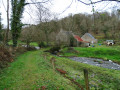
Starting from the Saint-Adrien bridge, set off to explore the eastern part of Quistinic. Head up to the heights of Lann Velin Avel, then return along the Blavet Valley. As you walk, enjoy the beauty of the lush green landscapes and the views over the river. As you wander along the paths, let yourself be surprised by the chapels, fountains, hamlets, bridges and locks… This route follows the eastern section of the Chapels Route.

Details

63530874
Creation:
Last update:
Last review:
  • Walking
    Activity: Walking
  • ↔
    Distance: 9.03 mi
  • ◔
    Average duration: 4h 50 
  • ▲
    Difficulty: Moderate

  • ⚐
    Back to start: Yes
  • ↗
    Ascent: + 751 ft
  • ↘
    Descent: - 725 ft

  • ▲
    Highest point: 486 ft
  • ▼
    Lowest point: 82 ft
  • ⚐ Country: France
  • ⚐ City: Quistinic (56310)
  • ⚑
    Start/End: N 47.909544° / W 3.078773°
  • ❏
    IGN map(s): Ref. 0820SB
  • Hour-by-hour weather

Photos

Description of the walk

Starting point: Saint-Adrien Bridge on the Quistinic side. Access is possible from Pont-Augan via the D3 towards Baud, then the D327. Turn left onto the track after the bridge when coming from Saint-Adrien; there is a grassy car park on the left.

(S/E) From the car park, head towards the bridge. Without crossing it, turn left and walk alongside the Blavet. Then take a moment to walk up the small road on the left to admire the view from the Chapelle du Temple.

(1) Retrace your steps and continue to the left until you reach a fork in the road.

(2) Head up to the left into the woods. Make sure you follow the yellow markings at the crossroads, turning right until you reach the next junction.

(3) Turn right, then keep left at the next junction to reach the Lann Velin Avel headland.

(4) At the end, take the path on the left. Continue along the signposted path, making sure to keep heading in the same direction until you reach a road.

(5) Cross it and take the path opposite. At the next road, turn right, then left towards Pestigo.

(6) Turn onto the path on the right at the entrance to the hamlet and follow it to the D3.

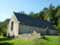
(7) Carefully follow the road to the right to discover the Chapel of Saint Roch.

(8) Retrace your steps.

(7) Turn right. Continue straight on along this wide track, then turn left at the next junction to reach a road, opposite the entrance to Léhart.

(9) Turn left, cross the D3 with care and continue straight ahead to reach the entrance to Roduic.

(10) Turn right, then follow the path marked in yellow closely; it winds several times to the left and right before heading south-east.

(11) At the stream, take a short detour to the left to admire the Sainte-Barbe Fountain. Retrace your steps, cross the stream and follow the path on the left until you reach the road.

(12) If you’d like to explore the site of the Sainte-Barbe Chapel, turn right and take the small path that climbs up to the chapel situated on the promontory – a private site open to the public: a 600-metre round trip. Otherwise, continue left along the road running parallel to the Blavet and pass the turn-off for Leniotenn.

(13) Turn right and carry on straight ahead at the crossroads to reach the railway bridge.

(14) Admire the Trémorin railway bridge and carry on to the left. Continue straight on, passing close to the lock and the Trémorin power station. At the road, turn left (watch out for the station at a place called Le Garff on the right) and carry on to the bend.

(15) Turn slightly to the right. Back on the road, turn right towards Coët Blavet.

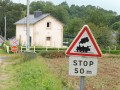
(16) Take the path on the left. Don’t miss the restored Coët Blavet railway station on your right; in the summer months, this is a stop on the Lambel Camors–Pontivy narrow-gauge railway. Carry on straight ahead and take the path opposite at the next junction.

(17) Leave the path leading to Le Cosquer on your left and carry on to the right. Follow the path that runs as close as possible to the railway line, pass the power station and you’ll come out onto a road. Turn left towards Pont Saint-Adrien to return to the car park (S/E).

Waypoints

  1. S/E : mi 0 - alt. 102 ft - Saint-Adrien, Quistinic side
  2. 1 : mi 0.4 - alt. 213 ft - Temple, chapel
  3. 2 : mi 0.79 - alt. 108 ft - Junction
  4. 3 : mi 1.26 - alt. 282 ft - Junction
  5. 4 : mi 1.74 - alt. 459 ft - Lann Velin Avel
  6. 5 : mi 2.37 - alt. 436 ft - Route
  7. 6 : mi 2.71 - alt. 397 ft - Pestigo
  8. 7 : mi 3.01 - alt. 390 ft - D3
  9. 8 : mi 3.11 - alt. 407 ft - Saint-Roch Chapel
  10. 9 : mi 3.72 - alt. 361 ft - Road junction
  11. 10 : mi 4.16 - alt. 354 ft - Roduic
  12. 11 : mi 4.9 - alt. 128 ft - Fontaine Sainte-Barbe junction
  13. 12 : mi 5.15 - alt. 92 ft - Road junction
  14. 13 : mi 5.8 - alt. 135 ft - Leniotenn, turn right
  15. 14 : mi 6.39 - alt. 85 ft - Trémorin Bridge
  16. 15 : mi 6.94 - alt. 138 ft - Turn right
  17. 16 : mi 7.82 - alt. 125 ft - Coët Blavet, on the left
  18. 17 : mi 8.13 - alt. 131 ft - Cosquer junction, on the right
  19. S/E : mi 9.03 - alt. 102 ft - Saint-Adrien, Quistinic side

Notes

This route is organised by Lorient Agglomération

This route is included in the Morbihan Departmental Plan for Walking and Hiking Routes and has been accredited by the French Hiking Federation. You can follow the yellow markings. There is an information board with a map and details of heritage sites at the start.

Worth a visit

Before setting off again, you can explore the left bank of Saint-Adrien and its chapel (1 km round trip).

- Chapelle du Temple (17th century)
- Lann Velin Avel headland (heathland where the windmill once stood; now demolished).
- Saint-Roch Chapel (17th century) and its fountain and washhouse complex
- Sainte-Barbe Fountain (19th century) and Sainte-Barbe Chapel (1684)
- Blavet Valley: 163 km of river (Nantes–Brest Canal, 1806–1825, with towpaths, navigation and goods transport), the locks at Sainte-Barbe, Trémorin and Saint-Adrien, and the power stations at Trémorin and Saint-Adrien
- Railway line: the Auray–Pontivy line, opened in 1865; summer service on the narrow-gauge railway (Lambel–Camors–Pontivy). Railway bridges at Trémorin and Saint-Adrien; Garff and Coët Blavet stations.
- Saint-Adrien.

Reviews and comments

4.4 / 5
Based on 3 reviews

Reliability of the description
4.3 / 5
Ease of following the route
4.3 / 5
Route interest
4.7 / 5
RégineH
RégineH

Overall rating : 5 / 5

Date of your route : Sep 02, 2025
Reliability of the description : ★★★★★ Very good
Ease of following the route : ★★★★★ Very good
Route interest : ★★★★★ Very good
Very busy route : No

A beautiful hike through the woods, discovering the many chapels of Brittany. Easy to follow the well-marked trail. A short stretch of road at the end of the route, but it is not very busy.
Worth doing again in winter to really appreciate the views.

Machine-translated

Le Carrer Sylvie
Le Carrer Sylvie

Overall rating : 5 / 5

Date of your route : Mar 30, 2025
Reliability of the description : ★★★★★ Very good
Ease of following the route : ★★★★★ Very good
Route interest : ★★★★★ Very good
Very busy route : No

A lovely walk that forms part of the Quistinic Chapel Route, especially in the glorious sunshine of early spring.
Stunning scenery through fields and woodland.
We’ve already done this route as part of the chapel trail, but that was in late autumn.
We’ll be doing it again in a month or two so that we can visit the chapels.

Machine-translated

Lorient Agglomération

Hello,
We have taken note of your comments. However, you mention Ria and the coast, whereas we are inland in Quistinic, along the Blavet and on the hills.
Kind regards

Machine-translated

Ksg
Ksg

Overall rating : 3.3 / 5

Date of your route : Oct 29, 2024
Reliability of the description : ★★★☆☆ Average
Ease of following the route : ★★★☆☆ Average
Route interest : ★★★★☆ Good
Very busy route : No

a lovely walk along the coast and then, towards the end, along the ria;
a rather unremarkable stretch inland between the two
It’s best to use your sat-nav once you’ve left the coast, as the signposting could be better.

Machine-translated

Other walks in the area

For more walks, use our search engine .

The GPS track and description are the property of this route's author. Please do not copy them without permission.