Cime Nègre via the Col de Crous, starting from Roya

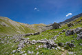
A challenging hike, rarely visited on the Mont Mounier side, with a gradual ascent and magnificent scenery.
You are in the Mercantour National Park; there are regulations to be observed, and failure to do so may result in a fine of up to €1,500 – see the practical information section.

Details

9875452
Creation:
Last update:
Last review:
  • Walking
    Activity: Walking
  • ↔
    Distance: 10.86 mi
  • ◔
    Average duration: 8h 20 
  • ▲
    Difficulty: Difficult

  • ⚐
    Back to start: Yes
  • ↗
    Ascent: + 3,819 ft
  • ↘
    Descent: - 3,819 ft

  • ▲
    Highest point: 8,337 ft
  • ▼
    Lowest point: 4,793 ft

Photos

Description of the walk

Take the M2205 towards Saint-Étienne-de-Tinée, then turn left at Le Bourguet towards Roya. Park in the small car park behind the church.

(S/E) Walk to the lodge (marker 137) then head towards the Col de Crous, due west. You will pass through the hamlet and reach another car park and the end of the track at marker 140.

(1) From there, simply stay on the track that runs alongside Las Donas further up, until you reach marker 142, where you should continue towards the Col de Crous.

(2) At the marker, head down to the left along the path until you reach a bridge. Cross it and enter the Mercantour National Park. Follow the well-marked and signposted path. There are no particular difficulties until you reach the Col de Crous at marker 95.

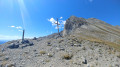
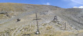
(3) From there, you’ll be off the beaten track, though it’s nothing too complicated. Follow the path, which is well marked with cairns. Head eastwards uphill and pass the bunker at the pass. Be careful: there’s a hole a little further up in one of the remaining structures. Continue south-eastwards until you reach the first plateau.

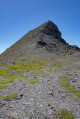
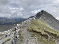
(4) From there, follow the ridge more or less all the way to the Cime Nègre, which finally comes into view.

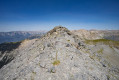
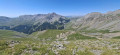
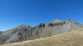
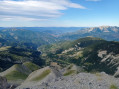
(5) Go round the peak via the north face, following the cairns, until you see them heading up to the right towards the Cime Nègre. Enjoy the magnificent views all around you, with the Mounier to the east, Péone to the south and the Ténibre range to the north-east.

(6) From there, you have two options:
- the first, which I recommend, is to make a leisurely descent to the Col de Crous at marker 95 (as shown on the route).

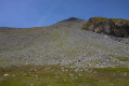
- The second option, however, is reserved for experienced and well-equipped walkers, as it involves descending directly towards the Sallevieille hut by taking the scree slope heading north-east. You must head straight on, keeping the hut in your sights, as this is the only possible route; the grassy section further to the west, which you’ll see as you descend, leads to a precipice. I’ll post a photo at the foot of the scree slope in the gallery so that you can clearly identify the direction to follow.

(3) Back at marker 95 for the recommended route, turn right, heading due north, towards the Vallon de Sallevieille, following the path that skirts around Mont Férant. This will take you to the Sallevieille hut at marker 110.

(7) Please note: from June to October, the hut is occupied by the shepherd, his flocks and his dogs. Be careful and do not disturb the animals!
Continue down to the left, heading north-west towards Roya along theGR®5.

(8) The bridge has been repaired; cross it carefully and carry on towards the hamlet.
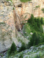
Please note: there’s a slightly tricky section as you pass in front of the waterfall; the path is a bit muddy and less stable, so do take care.

(9) Cross one final bridge and return to Roya. Follow the path back up until you reach the church and the car park (S/E).

Waypoints

  1. S/E : mi 0 - alt. 4,984 ft - Roya
  2. 1 : mi 0.44 - alt. 5,236 ft - End of the road
  3. 2 : mi 1.03 - alt. 5,292 ft - Marker 140 – Heading for the pass
  4. 3 : mi 3.69 - alt. 7,215 ft - Marker 95 - Col de Crous
  5. 4 : mi 4.07 - alt. 7,684 ft - Plateau
  6. 5 : mi 4.66 - alt. 8,186 ft - Bypass route around the summit
  7. 6 : mi 4.78 - alt. 8,337 ft - Cime Nègre
  8. 7 : mi 8.74 - alt. 6,391 ft - Sallevieille Hut
  9. 8 : mi 9.42 - alt. 5,696 ft - Bridge
  10. 9 : mi 10.62 - alt. 4,803 ft - Bridge
  11. S/E : mi 10.86 - alt. 4,984 ft - Roya

Notes

Mercantour National Park regulations – full details can be found via this link:
- Bivouacking and camping: permitted only more than an hour’s walk from road access points and the park boundaries, between 7.00 pm and 9.00 am. It is forbidden to spend the night in your vehicle in a car park or at the side of the road within the heart of the Mercantour National Park.
- Dogs are not permitted, even on a lead
- Fires are prohibited in the core area of the park and also throughout the Alpes-Maritimes department
by prefectural decree.
- Parking may be prohibited at the start of certain hikes due to the risk of
torrential mudslides and rockfalls.

I didn’t come across any water sources before returning to the Vallon de Sallevieille, so please plan accordingly.

For the return route via the scree slope from the Cime (6), do not attempt this without a basic knowledge of the mountains and the necessary equipment!

This route passes through a protected area, which may be subject to special regulations:

Worth a visit

(3) The Col de Crous and its disused bunker dating from the Second World War. It was never actually completed and did not see any fighting, as the Italian troops were halted at Isola.
(6) The Cime Nègre and its breathtaking view over both valleys.

Always be cautious and plan ahead when you're outdoors. Visorando and the author of this route cannot be held responsible for any accidents occurring on this route.

The GR® and PR® markings are the intellectual property of the Fédération Française de Randonnée Pédestre.

Reviews and comments

4.3 / 5
Based on 3 reviews

Reliability of the description
4.3 / 5
Ease of following the route
4.7 / 5
Route interest
4 / 5
Barroudeur
Barroudeur

Overall rating : 5 / 5

Date of your route : Jun 22, 2026
Reliability of the description : ★★★★★ Very good
Ease of following the route : ★★★★★ Very good
Route interest : ★★★★★ Very good
Very busy route : No

Very good, nothing has changed, exactly as described.

Machine-translated

oenolatre
oenolatre

Overall rating : 4.7 / 5

Date of your route : Aug 12, 2025
Reliability of the description : ★★★★☆ Good
Ease of following the route : ★★★★★ Very good
Route interest : ★★★★★ Very good
Very busy route : No

This is a beautiful hike in an area that is not too popular with hikers. I did a variation of the suggested route, continuing from the Cime Nègre to the Col de Crousette via the ridges. From there, I joined the GR5 to return to Roya. The path I followed is great but requires sure footing as there are a few tricky sections after the Cime Nègre.
At this time of year, you also need to be prepared for herds of cattle in the mountain pastures, which may require you to make detours (as I did) to avoid the dogs that guard them.

Machine-translated

randobalise
randobalise

Yes, I don’t understand why you’d need to head back down to the B95 – you should carry on to Crousette and follow the GR5 to Roya… it’s much simpler… Admittedly, I know the area too, but if you look at a map you’ll soon realise that… Besides, it’s a trip you can easily do in a day…

Machine-translated

randobalise
randobalise

Overall rating : 3.3 / 5

Date of your route : Jul 06, 2022
Reliability of the description : ★★★★☆ Good
Ease of following the route : ★★★★☆ Good
Route interest : ★★☆☆☆ Disappointing
Very busy route : Yes

But why retrace your steps from the Cime Nègre back to the Col de Crous Admittedly, I know the area well, which is precisely why I’m surprised......You should carry on to Crousette and head down through Salevieille, even if it’s a bit more of a challenge.....that’s my view!

Machine-translated

Other walks in the area

For more walks, use our search engine .

The GPS track and description are the property of this route's author. Please do not copy them without permission.