


Refine your search for walks in Sers (Hautes-Pyrénées)
Sers (Hautes-Pyrénées) walks


 In search of the old Bolou stopover lodge
 Visorando Member
 6.35 mi
 +1,558 ft
 -1,542 ft
 4h 15
 Moderate
 Departure from Betpouey (Hautes-Pyrénées)
A long time ago, a group of young people spent a memorable week at the Bolou stopover lodge, between Luz-St-Sauveur and Barèges. Although the accommodation no longer exists, the building is still as it was when we found it during a beautiful walk under, in, and almost above the clouds. I invite you to follow us into one of the valleys that leads to the Néouvielle Massif.
A route taking in two of the Toy region’s gems, Viey and Sers
2.43 mi
+879 ft
-879 ft
1h 55
Moderate
Departure from Viey (Hautes-Pyrénées)
A short, very easy walk which, by following the paths once used by the area’s former inhabitants, allows you to discover two magnificent little villages in the Toy region near Luz-Saint-Sauveur.
The Croix de Saint-Justin circular via the Adret trails in Barèges
 3.85 mi
+1,165 ft
-1,155 ft
2h 45
 Easy
Departure from Barèges (Hautes-Pyrénées)
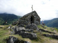
This is an easy and relaxing summer walk, perfect for filling a few hours if, like us, you are passing through Barèges, or if you want to explore the village for the first time after settling there for a few days. It is also a good warm-up before setting off on one of the more challenging hikes offered by the resort in the Néouvielle Nature Reserve.
Saint-Justin Oratory via Courratge from Barèges
3.61 mi
+892 ft
-886 ft
2h 25
Easy
Departure from Barèges (Hautes-Pyrénées)
A very pleasant short hike between Barèges and Saint-Justin via Courratge. The route is not difficult and mostly through forest. The view from the Oratoire Saint-Justin is magnificent, both towards the Luz Saint-Sauveur valley and towards the Tourmalet. The route is well marked and shared with the GR®10 between Barèges and Saint-Justin.
Pic d’Ayré from Lienz
 8.57 mi
+3,045 ft
-3,018 ft
6h 35
Moderate
Departure from Barèges (Hautes-Pyrénées)
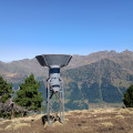
A fairly short hike, but more physically demanding than it appears, featuring a short, exposed ridge to reach thesecond summit of the Pic d’Ayré, which is slightly higher. The summit offers a beautiful view of the 3,000-metre peaks of the Néouvielle range.
La Glère mountain refuge and Lac det Mail
 8.13 mi
+2,772 ft
-2,772 ft
6h 10
 Difficult
Departure from Barèges (Hautes-Pyrénées)
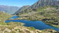
From the Ayré Forest, the hike begins by climbing up the Glère Valley. A trough-shaped profile, winter avalanche slides, a torrent at the bottom of the valley and groves of pines and rhododendrons; a classic approach to the high mountains. Nothing suggests that at the top of the main ridge, the Refuge de la Glère opens the door to the crystalline empire of Néouvielle, a universe where a constellation of lakes, large and small, sparkle, each more charming than the last.
Luz-St-Sauveur – Lac d’Aubert
 15.87 mi
+6,621 ft
-1,978 ft
12 hrs
 Very difficult
Departure from Luz-Saint-Sauveur (Hautes-Pyrénées)
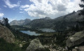
The seventh stage of the trek sets off from Luz-Saint-Sauveur, taking us to Lac d’Aubert, situated in the heart of the Néouvielle Nature Reserve.
Turon de Néouvielle and Pic des Trois Conseillers from Lienz
 12.00 mi
+5,167 ft
-5,144 ft
10h 00
 Extremely difficult
Departure from Barèges (Hautes-Pyrénées)
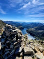
The Néouvielle Massif is impressive for the diversity of its landscapes, peaks, lakes, "eternal ice" and abundant wildlife. The Turon de Néouvielle is named after this prestigious massif and is located in one of the easternmost areas of the "Core Zone of the Pyrenees National Park". This area of the PNP extends over territories with altitudes never falling below 1,067 m and peaking at 3,298 m at the Pique Longue du Vignemale. It is home to extremely varied landscapes.
On the Turon de Néouvielle trail, there are numerous glacial mountain lakes, granite rocks, sharp ridges and a few grassy areas with diverse wildlife. An exceptional sight! This route takes you to two of the 3000-metre peaks in the area. It can be done in one or two days, with a break at the Refuge de la Glère, in a heavenly location.
Turon de Néouvielle
 13.67 mi
+5,039 ft
-5,036 ft
8 hrs
Very difficult
Departure from Barèges (Hautes-Pyrénées)
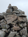
One of the most beautiful hikes you can do! A 3,000-metre peak, a multitude of lakes and tarns, torrents, mountain pastures, forests, rocky terrain and a ridge path. All this combined in a single hike! Its commanding position offers panoramic views of the magnificent Néouvielle Nature Reserve and its highest point, the Pic de Néouvielle. A feast for the eyes!
You can split the hike over two days by staying overnight at the Refuge de La Glère.
Château Sainte-Marie and a panoramic view of Luz-Saint-Sauveur
 1.90 mi
+764 ft
-764 ft
1h 30
Moderate
Departure from Esquièze-Sère (Hautes-Pyrénées)
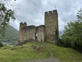
Panoramic view of Luz-Saint-Sauveur, situated at the confluence of three valleys. From the site, which has been developed as a viewing point, you can see the whole of the Central Pyrenees.
The Napoleon - Eugénie route in Luz-Saint-Sauveur
3.81 mi
+627 ft
-627 ft
2h 20
Easy
Departure from Luz-Saint-Sauveur (Hautes-Pyrénées)
It was following Napoleon III's visit that this small town in the Pyrenees began to flourish. This route highlights the buildings that the Emperor was directly or indirectly responsible for. Firstly, there is the spa district of Saint-Sauveur, then the bridge that bears his name and spans the Gavarnie river, and finally the small Solférino chapel, a reminder of his victory over the Prussians.
Route of the Five Churches from Esquièze-Sère
5.22 mi
+1,365 ft
-1,335 ft
3h 35
Moderate
Departure from Esquièze-Sère (Hautes-Pyrénées)
On this route, there are five 11th- and 12th-century churches to see:- The 12th-century Church of Saint-Julien in Sazos.- The churches of Saint John the Baptist and Saint Nicholas in Esquièze-Sère: listed historic monuments from the 11th century. One is in the basilica style, whilst the other houses ancient chapels. Visits in July/August, 4pm–6pm.- The 12th-century Saint-Michel Church in Vizos.- The Church of Saints Peter and Paul in Saligos, dating from the 12th century.
The villages of Labatsus from Esquièze-Sère
7.30 mi
+2,198 ft
-2,182 ft
5h 15
Moderate
Departure from Esquièze-Sère (Hautes-Pyrénées)
An unmissable hike, visiting five villages that look like something out of a mountain ecology textbook. The men and women have tamed the slopes, working tenaciously to make a year-round living from livestock farming, which now boasts an appellation d'origine contrôlée (AOC) designation. It is thanks to this activity that we have these charming landscapes of high-altitude gardens, flower-filled meadows meticulously bordered by ash hedges, balcony paths and terraces on retaining walls.
Turon de Hailla from Vizos
 6.29 mi
+3,304 ft
-3,330 ft
5h 45
Difficult
Departure from Vizos (Hautes-Pyrénées)
A beautiful, little-known hike offering superb 360° views from Léviste to Pibeste via Luz, Bergons, Gavarnie and Viscos. The climb is steep but not difficult, and your thighs will feel the burn on the descent. There is a loop variant starting lower down (Saligos) and returning via Coueylas.
Lake Maucapéra
 7.22 mi
+2,434 ft
-2,438 ft
5h 25
Difficult
Departure from Luz-Saint-Sauveur (Hautes-Pyrénées)
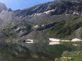
This is a must-see hike for fishermen and mountain lake enthusiasts, offering a quiet, unspoilt spot that is rarely visited. Lake Maucapéra is nestled in a basin at the foot of the Maucapéra peak (2,589 m), Cumadiére peak (2,623 m) and Lettious peak (2,589 m).
Lac de Maucapéra circular
 5.51 mi
+2,454 ft
-2,457 ft
4h 40
Moderate
Departure from Luz-Saint-Sauveur (Hautes-Pyrénées)
A circular hike, much of which follows old shepherds' paths.
A good sense of direction is necessary on the climb up the left bank of the stream.
The GPX track can be very useful from (S/E) to (4).
This circular can also be done in the opposite direction.
Please close electric fences and cabin doors. Thank you.
Pic de Bergons
 3.66 mi
+1,988 ft
-1,988 ft
3h 25
Moderate
Departure from Luz-Saint-Sauveur (Hautes-Pyrénées)
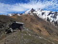
You will be captivated by this short route, which leads to a breathtaking panorama of the Estaubé and Gavarnie cirques, the Pic de Cestrède and the Ardiden and Pic du Midi massifs.
Pic de Néouvielle via the Refuge de la Glère
 9.73 mi
+5,056 ft
-5,056 ft
10 hrs
Very difficult
Departure from Barèges (Hautes-Pyrénées)
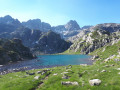
A 9-hour hike of high difficulty. Wilder, longer and less frequented than the ascent from Lac d’Aubert (which it joins for the final 300 metres of ascent), it passes numerous lakes and torrents.
It combines many different types of terrain: from tracks suitable for vehicles to sections where you’ll need to use your hands, as well as scree slopes of all sizes and snowfields.
A challenging mountain hike requiring physical stamina and a good sense of direction.
You will be entering the Néouvielle National Nature Reserve, which is protected by regulations. Please respect these regulations (see practical information).
The Estelat Lakes via the Refuge de la Glére
 6.41 mi
+2,402 ft
-2,454 ft
5h 00
Moderate
Departure from Barèges (Hautes-Pyrénées)
This is a hike not to be missed for lovers of mountain lakes and wide open spaces.
Moderator's addition on 23/08/2021: The start of the circuit has changed. It is now at the Chez Louisette restaurant and the hike is therefore longer. See the comments at the bottom of this page
Lake Bastampe from Agnouède, Luz-Saint-Sauveur
 7.90 mi
+4,780 ft
-4,787 ft
7h 50
Moderate
Departure from Sazos (Hautes-Pyrénées)
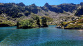
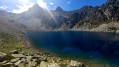
Nestled at 2,019 metres in the Ardiden Massif, above Luz-Saint-Sauveur, Lake Bastampe is a little glacial gem in the Luz Valley. Off the beaten track, it lies nestled in a rocky cirque where the Pic de Carlis is reflected in its shallow waters. Its charm? A wooded island of mountain pines, sitting in the centre like a picturesque detail from a postcard!To reach it, you’ll face a lovely climb, long and steep towards the end. But the effort is well worth it for the route itself, which is quite simply magnificent: woodland, stony grassy slopes, and sweeping views towards the jagged ridges of the Pic de Badet d’Aubiste (2,741 m), the Soum de Culaus (2,577 m), the Pic de Bastampe (2,783 m) and the Pic de Barbe de Bouc (2,964 m), the latter being the very embodiment of these jagged, tapered peaks!The effort pays off: by the water’s edge, we treat ourselves to photos, a picnic and a nap whilst walking round the lake.
A circular route around Lake Bastampe and Pic de Litouèse from Agnouède
 11.23 mi
+5,315 ft
-5,315 ft
9h 50
Very difficult
Departure from Sazos (Hautes-Pyrénées)
In the Ardiden Massif, two high-altitude lakes, two peaks and you. There are places we don’t talk about too much, for fear they might change. The Cirque de Litouèse is one of them. Up there, at over 2,000 metres above Luz-Saint-Sauveur, time seems to have stood still: first, the Lac de Bastampe, so picturesque with its island in the middle and its calm waters… Then, after a discreet pass between large granite boulders, Lake Litouèse comes into view: 42 metres deep, with waters so crystal-clear that you feel you can see right to the bottom. In days gone by, black trout used to live there! Above, the rocky, sun-drenched cirque beckons: first the Pic de Litouèse (2,420 m), from where the reward is immense – Gavarnie, the Vignemale and the Pic du Midi lined up as if to greet you, then the Soum de Caubarole (2,386 m). At the lakeside, a well-maintained hut guarantees peace and quiet. It’s one of those circular walks, with unforgiving slopes that will test your legs and stay with you for a long time!
 Pic de Barbe from Barèges-Tournaboup in winter
 5.90 mi
+3,094 ft
-3,084 ft
7 hrs
Difficult
Departure from Sers (Hautes-Pyrénées) (Hautes-Pyrénées)
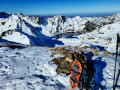
Above Barèges, the Pic de Barbe (2,468 m) remains a rather unassuming peak. Yet it offers one of the most stunning views in the Hautes-Pyrénées: from the summit, the vista stretches from the Pic du Midi to the Néouvielle, from Mont Perdu to the Brèche de Roland, all the way to the Vignemale and the Balaïtous. Five hundred metres below, the Lac Bleu lies dormant beneath the snow.The route climbs round the Ruisseau de Mousquère, a sun-drenched southern slope, passing through the Plateau d’Aoube, then the Plateau de la Lahude, which offers two opportunities to take a break. Higher up, the mountain becomes tranquil yet rugged: steeper slopes and fewer tracks, just the sound of snowshoes and the silence of the ridges.A challenging yet accessible winter hike, requiring good snow cover and a high level of fitness. In return: a peaceful summit, a 360-degree view and a beautiful descent through the snow.
Circular loop of the Col and Lac d'Oncet from Super-Barèges
 5.98 mi
+3,337 ft
-3,330 ft
7 hrs
Very difficult
Departure from Sers (Hautes-Pyrénées) (Hautes-Pyrénées)
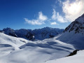
This beautiful winter circular route in the high mountains circles La Bonida and the Pic d’Oncet, taking in the stunning, secluded Aouda Valley and the southern flank of Pène Blanque, at the foot of the Pic du Midi de Bigorre.The views are exceptional and, although the route is used by a few ski tourers, peace and quiet are guaranteed.
Pic Crémat via the Col d'Aoube, a circular route from Super-Barèges
 5.32 mi
+3,786 ft
-3,766 ft
8 hrs
Very difficult
Departure from Sers (Hautes-Pyrénées) (Hautes-Pyrénées)
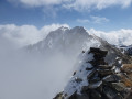
This little-visited peak is part of a series of four peaks along the stunning and challenging ridge stretching from Lac Bleu de Lesponne (2,021 m) to Pic du Midi de Bigorre (2,876 m). The pass is somewhat technical in winter conditions or at the end of the winter season, but it nevertheless provides fairly easy access to the peak itself. From the top, there is an exceptional 360° view, stretching from the nearby Pic du Midi Observatory to the border range and the 3,000-metre peaks of Gavarnie.The circular route through the superb, secluded hanging valley of Aoube to Lac Bleu, via the Col Bédéra (2,404 m), adds a wild, untamed flavour to this ascent.
Pic de Pène Blanque via Lac and Col d'Oncet from Super-Barèges
 5.39 mi
+3,547 ft
-3,543 ft
8 hrs
Difficult
Departure from Sers (Hautes-Pyrénées) (Hautes-Pyrénées)
This little-visited peak is the last in a series of four along the ridge from Lac Bleu du Chiroulet to the Pic du Midi de Bigorre (2,876 m). Somewhat technical in winter conditions or at the end of the winter season, it offers a fairly easy and very enjoyable final ridge. From the summit, there is an exceptional 360° view stretching from the nearby Pic du Midi Observatory to the border range and the 3,000-metre peaks of Gavarnie. You can choose to stop at the Col d’Oncet if the ascent of Pène Blanque seems too difficult.
Crête de la Pègue from Super-Barèges
 3.48 mi
+2,336 ft
-2,329 ft
7 hrs
Very difficult
Departure from Sers (Hautes-Pyrénées) (Hautes-Pyrénées)
If you enjoy steep, long climbs in a beautiful, snow-covered high-mountain cirque, whilst still not being alone in the world – as many snowshoers and skiers enjoy and frequent these slopes – this route is for you.At the top of the ridge, the view over the Vallon d’Aygues-Cluses and Lac des Coubous is the finest reward of all!
Lake Aouda and Lake Oncet
 7.29 mi
+2,323 ft
-2,290 ft
5h 20
Moderate
Departure from Sers (Hautes-Pyrénées) (Hautes-Pyrénées)
A lovely circular walk passing two beautiful lakes and three mountain passes.
Pic du Midi de Bigorre
 9.26 mi
+3,140 ft
-3,143 ft
7h 00
Difficult
Departure from Sers (Hautes-Pyrénées) (Hautes-Pyrénées)
Please note: access to the Pic du Midi is prohibited until 1 November 2024 by municipal decree
The Pic du Midi de Bigorre is a classic in the Pyrenees. Apart from its length, this hike is very accessible. The approach via the Ruisseau d'Oncet is magnificent, where you will encounter marmots and llamas.
Once you reach the summit, you'll be blown away by the view of all the legendary peaks, including Aneto, Vignemale, Balaïtous and the Néouvielle massif. Below, you can see Lac d'Oncet, which you passed on the way up.
Circular route along the Pic de Merlheu ridge from the Tourmalet
 9.43 mi
+4,419 ft
-4,419 ft
8h 10
Very difficult
Departure from Sers (Hautes-Pyrénées) (Hautes-Pyrénées)
The beautiful Pic de Merlheu is just one aspect of this pleasant circular route, comprising three peaks, an exposed ridge and two lakes, in a very wild area that is less frequented than many of the classic Pyrenean routes.From the summits and the ridge, there are a succession of incredible views over the Piedmont, the surrounding valleys and the peaks of the border range, 30 km away.The route is somewhat demanding due to its elevation gain, its length and the fact that it follows unmarked paths, some of which are not shown on maps. It is reserved for mountaineers accustomed to trekking in remote high-mountain terrain.
Lac Bleu via the Col d'Aoube from the Toue bend
 8.11 mi
+2,533 ft
-2,523 ft
5h 55
Difficult
Departure from Sers (Hautes-Pyrénées) (Hautes-Pyrénées)
Beyond the Tourmalet summer pastures, on the far side of a high pass, discover a vast, deep-blue lake.Lac Bleu lies at the same altitude as the starting point, in a neighbouring valley. To reach it, you must cross the easy Col d’Aoube, moving from the gentle bustle of the Col du Tourmalet to a wild valley home to the small Lac Vert and the immense Lac Bleu. A pleasant hike in the company of herds, with large Pyrenean birds of prey soaring overhead.
More walks in Sers (Hautes-Pyrénées)
Select a point of interest below: