


 Country:

 City:
City:


Access via the Tarentaise: at Bourg Saint-Maurice, head towards the Cormet de Roselend and, after 5 km, turn right towards Bonneval and Versoy. The road is very narrow; it’s impossible for vehicles to pass each other except on hairpin bends and in designated areas. There are then 10 km of road, which remains just as narrow, alternating between tarmac and gravel (it’s easy to drive on) as far as the Pont de Chézari. There is a car park on the left after the Pont de Chézari.
(S/E) From the car park, cross the bridge and head up the access path. Cut across the hairpin bend, cross the road again and head straight up the slope to the west.
(1) Cross the track, then the canal, and continue westwards, passing to the right of the points with altitudes 2294 and 2365 to reach the Grand Lac.
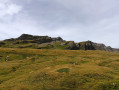
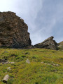
(2) Climb straight up the steep slope to reach the Plan de la Saulire. Turn north-west, then north, following a chamois track towards the base of the Tête Noire rocks. Cross a scree field and arrive at a rocky slope.
(3) You’ll see two moraines: the first is grassy and the second is rocky. Continue along the trail.
(4) Leave the track to reach the first moraine, then the second, making the most of the grassy sections. Reach a flat area.
(5) Look out for the small pass between the summit of the Grandes Aiguilles and the 2704 high point. A few cairns mark the ascent and a track is visible. Reach an unnamed small pass.
(6) Set off along the south-east ridge, which is not particularly difficult, and head higher up, below the summit, towards a small ledge that climbs gently to the right. Reach the summit. 360° views towards Mont Blanc, the Aiguille des Glaciers, the Beaufortin, Mont Pourri, etc.
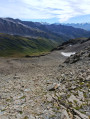
(7) The start of the descent presents no difficulty. Then follow the ridge line, which proves tricky and exposed in places. Choose the best route, taking great care with your footing and handholds. Descend to the small pass of Plan des Teppes, which marks the end of the major difficulties.
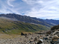
(8) Descend down the centre of the somewhat steep slope, then head right. Further down, aim for a couloir bordered on its right-hand side by a cliff. This is the entrance to the Vallon du Fornet.
(9) Descend the couloir and rejoin the path leading to Le Fornet, finding the best route to cross the stream depending on the season. After Le Fornet, a yellow arrow painted on the ground on a flat stone points to the left, to cross the Versoyen.
(10) Head south, then keep to the right to reach the car park (S/E).
 Tourism professional
 Difficult
 Visorando Member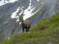
 Moderate
  Tourist office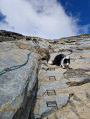
 Easy
Easy 
 Association / Club / Walk leader
