A circular route via the Col and Pic de la Gardette from Les Gourniers

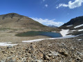
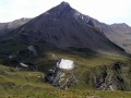
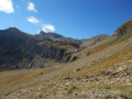
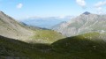
A lovely circular route through the mountain pastures of the Réallon valley (Écrins National Park), offering stunning views amidst the wildlife. The panoramic view from the heights looks out over the southern Écrins, including the Mourre Froid and the Aiguilles de Chabrières.
The suggested route has several alternatives. It is possible to shorten it considerably (saving 1 to 1½ hours) by not continuing on to the peak after the Col de la Gardette, and by cutting across towards Les Tomelles rather than descending to the stream.
It is also possible to do a simple round trip by returning along the same route once you reach the pass.

Details

45385369
Creation:
Last update:
Last review:
  • Walking
    Activity: Walking
  • ↔
    Distance: 8.40 mi
  • ◔
    Average duration: 6h 25 
  • ▲
    Difficulty: Moderate

  • ⚐
    Back to start: Yes
  • ↗
    Ascent: + 2,966 ft
  • ↘
    Descent: - 2,963 ft

  • ▲
    Highest point: 7,539 ft
  • ▼
    Lowest point: 4,659 ft

Description of the walk

From the N94 road, head towards the village of Réallon (not the resort). Drive through the village and follow the D241 to the end, to the hamlet of Les Gourniers. Park in the car park before the hamlet and before crossing the stream.

(S/E) Cross the stream and take the small road westwards for 200 m towards the ‘Lodge of the Three Cols’.
Pass the Ranch des Penas and, via an uphill climb along wooded and stony paths, reach the hamlet of Les Ollieux and then that of Les Tomelles.

(1) Take the signposted path on the right which climbs north-westwards. This is the circular Col de la Gardette path for 200 m, until you reach the first Y-junction.

(2) Turn left towards the Col de la Gardette, leaving the path on your right which heads towards the Cabane du Vallon and the Col de la Coupa. You’ll reach the sign for Les Usclas.

(3) Continue along the path that branches off to the right and follow the red markings to the Gardette hut.
Please note: do not follow the numerous drovers' roads created by livestock.
Carry on along the path, passing the ‘Les Clots’ sign, until you reach the crossroads.

(4) Leave the path to the right, still following the red markings, to join the old, little-used and hard-to-spot path.

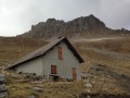
(5) Continue the ascent, following the red markings. You’ll arrive just below the Cabane de la Gardette.

(6) Continue due south across the mountain pasture to reach the Col de la Gardette.

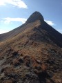
(7) Carry on straight ahead, following the path along the ridge to reach the Pic de la Gardette.
Note: this peak, which is not shown on the map, is indeed the point with an altitude of 2303.

(8) Retrace your steps to return to the pass.

(7) Turn right, begin the descent and reach the edge of the woodland.

(9) Walk alongside the woodland to reach the Cabane de Corbières.

(10) Turn right into the woods via a wide track suitable for vehicles. After two wide hairpin bends, you’ll reach the junction withthe GR®50.

(11) Turn left onto it and follow it to the ford on the Torrent de la Martinasse.

(12) Here you have two options:
- keep left on theGR® to reach the Tomelles junction (which you passed on the way out), turn right and easily reach the Gourniers car park (S/E),
- leave theGR® – this is the route shown on the map – and head for the bridge over the Torrent de Réallon at a place called La Cure.

(13) Ignore the bridge, continue along the left bank of the torrent to complete the descent, then take the bridge on the right before reaching the Gourniers car park (S/E).

Waypoints

  1. S/E : mi 0 - alt. 4,806 ft - Les Gourniers car park - Marmite de Géant
  2. 1 : mi 0.52 - alt. 5,138 ft - Les Tomelles hamlet
  3. 2 : mi 0.68 - alt. 5,276 ft - Y-junction at Les Tomelles
  4. 3 : mi 0.88 - alt. 5,561 ft - Signpost for Les Usclas
  5. 4 : mi 1.21 - alt. 5,863 ft - Y-junction
  6. 5 : mi 1.47 - alt. 6,178 ft - Old path
  7. 6 : mi 2.71 - alt. 6,952 ft - Below the Gardette hut
  8. 7 : mi 3.3 - alt. 6,972 ft - Col de la Gardette
  9. 8 : mi 3.81 - alt. 7,526 ft - Pic de la Gardette
  10. 9 : mi 5.02 - alt. 6,614 ft - Edge of the woodland
  11. 10 : mi 5.55 - alt. 6,184 ft - Corbières Hut
  12. 11 : mi 6.75 - alt. 5,584 ft - GR50
  13. 12 : mi 7.07 - alt. 5,276 ft - Ford
  14. 13 : mi 7.72 - alt. 4,669 ft - La Cure
  15. S/E : mi 8.4 - alt. 4,806 ft - Les Gourniers car park - Réallon (torrent) - Affluent de la Durance

Notes

The Col de la Gardette is a beautiful pass through which you can cross into the Durance valley.
Please note that there may be herds in these mountain pastures, guarded by Patou dogs. Their role is to keep you away from the herd, which you must, of course, do.
(8) Although not shown on the map, point 2303 is indeed the summit of the Pic de la Gardette.

Worth a visit

(S/E) In the hamlet of Les Gourniers, notable for its beech trees, the Chapel of the Nativity of the Blessed Virgin is well worth a visit, as are the Pissarotte Waterfall and the ‘giant’s cauldron’ (a hollow carved out by the torrent) on the nature trail.
In the village of Réallon, the Pisse Waterfall and the 12th-century fort, situated above the village, are worth seeing. These are now ruins, as the fort was razed to the ground in 1558 at the request of the Archbishop of Embrun.

Shorter alternative route: at the Col de la Gardette (7), head straight down to reach the point (9). At the point (12), keep left on the GR® to reach the ford across the Martinasse torrent, then head towards Le Bourget to return to Les Tomelles (1) and rejoin the original route on the right, continuing to the (S/E) car park at the start.
(Elevation gain 700 m, total time 5 hours 30 minutes).

Always be cautious and plan ahead when you're outdoors. Visorando and the author of this route cannot be held responsible for any accidents occurring on this route.

The GR® and PR® markings are the intellectual property of the Fédération Française de Randonnée Pédestre.

Reviews and comments

4.5 / 5
Based on 2 reviews

Reliability of the description
4.5 / 5
Ease of following the route
4 / 5
Route interest
5 / 5
geliv
geliv

Overall rating : 4.3 / 5

Date of your route : Jun 21, 2026
Reliability of the description : ★★★★☆ Good
Ease of following the route : ★★★★☆ Good
Route interest : ★★★★★ Very good
Very busy route : No

A lovely walk with a beautiful view of the Pic de la Gardette. Just a quick note: at the Col de la Gardette (point 7), where the descent begins, the path is still marked with Red Circles, but the GPS track takes you onto an unmarked grassy track 200 metres before the pass. The two paths rejoin 1 km further down. We opted for the grassy track, following the GPS track.

Machine-translated

Randophil57
Randophil57

Overall rating : 4.7 / 5

Date of your route : Jun 08, 2025
Reliability of the description : ★★★★★ Very good
Ease of following the route : ★★★★☆ Good
Route interest : ★★★★★ Very good
Very busy route : No

It's a great hike from Les Gourniers, which I recommend you do as far as the Pic de la Gardette, with its magnificent 360° panorama of the Aiguilles de Chabrières in front of you, and a few vultures in the sky today.
The climb up into the mountain pastures is superb, but you have to follow the red round markings, otherwise it's very easy to lose the trail.

Machine-translated

Other walks in the area

For more walks, use our search engine .

The GPS track and description are the property of this route's author. Please do not copy them without permission.