The Oussella Circular Route

A pleasant circular family walk with a beautiful view over the Réallon valley.

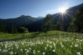
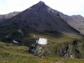
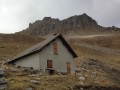
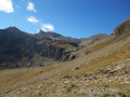
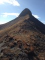
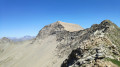
The ascent begins in the cool shade of a beech wood, then through a beautiful larch forest, before reaching old hay meadows, a reminder of past activities. The ruins of old alpine chalets evoke what life in the mountains used to be like. As the path reaches a balcony-like section, the landscape opens up to a sweeping view of the Réallon valley.

Details

35003925
Creation:
Last update:
Last review:
  • Walking
    Activity: Walking
  • ↔
    Distance: 4.12 mi
  • ◔
    Average duration: 3h 00 
  • ▲
    Difficulty: Moderate

  • ⚐
    Back to start: Yes
  • ↗
    Ascent: + 1,296 ft
  • ↘
    Descent: - 1,286 ft

  • ▲
    Highest point: 6,089 ft
  • ▼
    Lowest point: 4,777 ft

Photos

Description of the walk

(S/E) From the car park, cross the bridge; at the crossroads in the hamlet, turn right towards Chargès, and walk up the street to the last house.

(1) Take the path on the right towards l’Oussella. Pass the Marmite de Géant and the bridge.

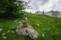
(2) Continue to the left towards l’Oussella. Cross the stream by the waterfall and stay on the main path through the beech forest. After a few hairpin bends, as you emerge from the larch forest, cross the old hay meadows and a stream. Cross the Ravin and the Torrent de la Pissarotte to reach the foot of another area of old hay meadows, which you must climb up (cairns and arrow). Turn right and walk to the crossroads (signpost), marking the end of the climb and a viewpoint.

(3) Follow the sign for Les Gourniers via Le Villard, opposite. Pass the old alpine chalets and Fouents (viewpoint) and head down towards Le Villard. Walk along the edge of the ravine to the signpost (right-pointing arrow). After a series of hairpin bends, you’ll reach a crossroads. Turn right into the field before the drinking troughs, then left 50 metres further down (small signpost with an arrow). Walk alongside a stone-clearing and continue along a series of small hairpin bends (cairns). Cross the valley. Continue to the right and join the fort trail.

(4) Stay on the path to the right towards Les Gourniers until you reach the track.

(5) Then follow the signs for Les Gourniers to the right (red and whiteGR® markings). At the top of a climb, leave the track and continue straight ahead (post with an arrow). Stay on theGR® until you reach the road.

(6) Return to the car park by turning right. (S/E)

Waypoints

  1. S/E : mi 0 - alt. 4,806 ft
  2. 1 : mi 0.24 - alt. 4,941 ft
  3. 2 : mi 0.33 - alt. 4,921 ft
  4. 3 : mi 1.63 - alt. 6,053 ft
  5. 4 : mi 2.93 - alt. 4,941 ft
  6. 5 : mi 3.06 - alt. 4,826 ft
  7. 6 : mi 3.83 - alt. 4,783 ft
  8. S/E : mi 4.12 - alt. 4,813 ft

Notes

Access:
From Savines-Le-Lac (17km), take the D41 to Réallon. Then follow the D241 to the hamlet of Les Gourniers at the bottom of the valley.

Public transport:
Consider car-sharing: https://www.blablacar.fr/

Car park:
Les Gourniers car park, Réallon

Advice:
To avoid conflicts, pets are prohibited on the mountain pasture between 15 June and 15 September by municipal by-law. From June to October, there may be a herd accompanied by livestock guard dogs. Find out more about the role of livestock guard dogs and how to behave if you encounter them: watch the video!

Livestock guard dogs:

On the mountain pastures, herding dogs are there to protect the flocks from predators (wolves, etc.).

When I’m out walking, I adjust my behaviour by walking round the herd and pausing briefly so that the dog can get a look at me.

Find out more about how to behave in the guide ‘Livestock guard dogs: background and how to behave’.

If you encounter any problems, please report your encounter by completing this survey.

Worth a visit

Martagon lily
In the undergrowth at the start of the route, it stands out for its long, upright flower stalk. It bears between three and ten purplish-pink flowers dotted with crimson, revealing long orange stamens. Admire it from a distance but don’t breathe it in – it’s as beautiful as it is foul-smelling!

Beech forest
These beech trees are virtually the last ones as you head up the Durance valley. This tree can grow up to 40 metres tall; it is distinguished by its smooth, slender, steel-grey trunk, its horizontal branches and its oval, entire leaves with wavy edges and cilia. The fruits, known as beechnuts, are encased in a spiny husk that opens in early autumn.

Black Woodpecker
This curious black bird with a red crest and a long, pale beak is the largest woodpecker in the Alps. It is difficult to spot as it is very solitary and wary. However, thanks to the many signs that reveal its presence, it is possible to recognise its very distinctive and resonant song and calls. It drums relentlessly to defend its territory or to locate bark beetles or carpenter ants.

Old hay meadows and stone-clearing huts
In the old hay meadows we pass through, the low stone walls and stone-clearing piles bear witness to several centuries of work by the mountain folk. The stones removed from the fields were piled up at the edges. The cut hay was taken down to the village in cloth sacks, loaded onto mules or sledges, or carried on people’s backs.

Larch
A pioneer tree at high altitudes, its deciduous needles are fine enough to let light through. In autumn, they take on magnificent yellow-orange hues. In spring, its cones are a distinctive dark purple.

Black Grouse
The black grouse, also known as the ‘little heath cock’, belongs to the Galliformes family. About the size of a hen, the male has black plumage with blue sheen. Its tail is shaped like a lyre. The more inconspicuous female is brown and russet in colour. In winter, it burrows deep into the snow to avoid the night-time cold. It can spend long periods in this ‘igloo’ if the weather is bad.

Rock Partridge
The rock partridge is a galliform, like the black grouse. Perched on a rocky outcrop, it sings in a staccato manner. It is recognisable by its grey back, striped flanks, white throat and red beak. It lives in the mountains on sun-exposed slopes and favours rocky areas and open heathland where the young can feed on the insects essential for their growth.

Green lizard
This large, bright green lizard with black markings can grow up to 40 cm. During the breeding season, the male is distinguished by its blue throat. In the Écrins, it can be found at altitudes of up to 2,000 m, on the best-exposed south-facing slopes. It is active from mid-March to mid-October, with notable exceptions during winter thaws.

Short-toed Eagle
The Short-toed Eagle is a large bird of prey, easily recognisable by its white underparts and large head, which is often chocolate brown. However, it can be confused with certain very pale common buzzards. This trans-Saharan migrant feeds mainly on reptiles, which it hunts in steppe areas, heaths, wasteland and rocky habitats, as well as in the mountains, even in alpine grasslands. Its fairly small nest is often built in pine trees.

Always be cautious and plan ahead when you're outdoors. Visorando and the author of this route cannot be held responsible for any accidents occurring on this route.

The GR® and PR® markings are the intellectual property of the Fédération Française de Randonnée Pédestre.

Reviews and comments

4.4 / 5
Based on 4 reviews

Reliability of the description
4.5 / 5
Ease of following the route
4.5 / 5
Route interest
4.3 / 5
Chrisisa07
Chrisisa07

Overall rating : 4.7 / 5

Date of your route : Jul 06, 2026
Reliability of the description : ★★★★☆ Good
Ease of following the route : ★★★★★ Very good
Route interest : ★★★★★ Very good
Very busy route : Yes

A lovely walk – at the start you walk through a lovely woodland, then the view opens out onto the mountains.
No difficulty

Machine-translated

Mariefrez
Mariefrez

Overall rating : 4.3 / 5

Date of your route : Sep 01, 2025
Reliability of the description : ★★★★★ Very good
Ease of following the route : ★★★★☆ Good
Route interest : ★★★★☆ Good
Very busy route : No

A very pleasant hike through the woods at the start. Beautiful views of the mountains.
No problem following the route.

Machine-translated

brageole
brageole

Overall rating : 4 / 5

Date of your route : Jun 03, 2025
Reliability of the description : ★★★★☆ Good
Ease of following the route : ★★★★☆ Good
Route interest : ★★★★☆ Good
Very busy route : No

A relatively easy and very pleasant hike, especially at this time of year when the flow of the river and the waterfall are impressive.
I should mention that when walking through the tall grass along the Réallon stream, I got a tick on the bottom of my trousers, even though several hikers I met during my hikes in the Hautes Alpes told me that there were no ticks in the area because it was too high and too dry. Be careful.

Machine-translated

Randophil57
Randophil57

Overall rating : 4.7 / 5

Date of your route : Jun 06, 2025
Reliability of the description : ★★★★★ Very good
Ease of following the route : ★★★★★ Very good
Route interest : ★★★★☆ Good
Very busy route : No

Nice little afternoon walk with no difficulties. A pleasant descent on a balcony with views of the Aiguilles de Chabrières massif.

Machine-translated

Other walks in the area

For more walks, use our search engine .

The GPS track and description are the property of this route's author. Please do not copy them without permission.