Le Mourre Froid via the southern ridge, starting from Les Gourniers

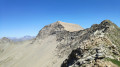
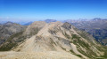
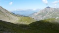
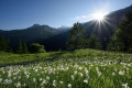
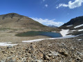
A lovely, challenging hike with a stunning 360° panorama at Mourre Froid.
The walk presents no technical difficulties up to the Col de la Règue, apart from the distance and the elevation gain.
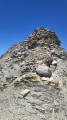
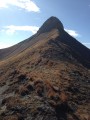
Please note: the route along the ridge requires the ability to read the terrain, as the start of the route is poorly marked: the simplest approach is to try to stay on the ridge at all times, which involves a few short sections of easy scrambling.

Details

n°24322158
Creation:
Last update:
Last review:
  • Walking
    Activity: Walking
  • ↔
    Distance: 12.99 mi
  • ◔
    Duration according to the author: 12 hrs 
  • ▲
    Difficulty: Very difficult

  • ⚐
    Back to start: Yes
  • ↗
    Ascent: + 5,525 ft
  • ↘
    Descent: - 5,518 ft

  • ▲
    Highest point: 9,810 ft
  • ▼
    Lowest point: 4,806 ft

Photos

Description of the walk

Park in the car park at the entrance to the village of Les Gourniers.

(S/E) Set off along the path on the right bank of the Torrent des Gourniers and continue on to reach the Chapelle Saint-Marcellin.

(1) Continue along the most visible track until you reach the Torrent Serre-Reyna.

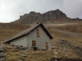
(2) Cross the footbridge, continue along the clearly marked path and pass the hut, still following the marked route. Carry on to the Cabane de Chargès du Pré d’Antoni and then reach the Ravin de la Combe la Règue.

(3) Turn right and climb a few hairpin bends to reach the junction at the Cabane de Chargès.

(4) Stay on the path on the left and reach another junction where several streams meet.

(5) Continue along the path to reach another junction by the Ruisseau des Cordeillas.

(6) Turn right to reach the Col de la Règue.

(7) Turn left to quickly reach the southern ridge of the Mourre Froid. Head due north along the ridge leading to the Mourre Froid and, after about fifty metres, you’ll reach the main difficulty.

(8) Here, negotiate two short climbing sections (3c) and shift slightly towards the western side as you climb. Then take the route that runs along the ridge on the eastern side. Continue due north to the Mourre Froid, staying as close to the ridge as possible.
Note: on the few sections where it is not possible to continue along the ridge, favour the western face of the ridge.

(9) Descend via the same route, although there are a few possible variations at points 7 and 5, to reach the Gourniers car park (S/E).

Waypoints

  1. S/E : mi 0 - alt. 4,813 ft - Les Gourniers car park on the edge of the - Réallon (torrent) - Affluent de la Durance
  2. 1 : mi 1.38 - alt. 5,673 ft - Saint-Marcellin Chapel
  3. 2 : mi 2.29 - alt. 5,738 ft - Footbridge to cross the Serre-Reyna torrent
  4. 3 : mi 3.39 - alt. 6,371 ft - Combe de la Règue
  5. 4 : mi 4.11 - alt. 7,211 ft - Cabane de Chargès (2206m)
  6. 5 : mi 4.48 - alt. 7,421 ft - Crossroads by the streams
  7. 6 : mi 5.13 - alt. 8,143 ft - Cordillas Ravine
  8. 7 : mi 5.62 - alt. 8,839 ft - Col de la Règue (2706m)
  9. 8 : mi 5.76 - alt. 9,065 ft - Climbing section
  10. 9 : mi 6.52 - alt. 9,810 ft - Mourre-Froid
  11. S/E : mi 12.99 - alt. 4,810 ft - Les Gourniers car park

Notes

As the summit is close to 3,000 m, make sure you check the conditions and weather forecast before setting off (even in summer).
Please note: a helmet is advisable on the ridges: you may find yourself with people above you.
(7) Unlike on the IGN map, the Col de la Règue is clearly marked here by a sign.

Worth a visit

It is possible to do a circular route: from the Cabane de Chargès, head north, then slightly east, towards the ridge to reach IGN point 2,764 m. Then, follow the ridge to the Mourre-Froid and descend via the southern ridge – I’ve never done this myself, but I’ve met hikers who told me this route isn’t pleasant (steep scree).

Nearby: for those seeking a real thrill, there’s the Pointe de la Diablée via the southern slope (a description of the walk is available on Visorando: it’s rated TD, but personally, I’d rate it ED without hesitation).

Reviews and comments

4.2 / 5
Based on 2 reviews

Reliability of the description
4 / 5
Ease of following the route
4 / 5
Route interest
4.5 / 5
Toine
Toine

Overall rating : 4 / 5

Date of your route : Aug 12, 2024
Reliability of the description : ★★★★☆ Good
Ease of following the route : ★★★★☆ Good
Route interest : ★★★★☆ Good
Very busy route : No

As mentioned in the route description, the hike is very challenging. Only two people out of the group of 16 made it to the summit; most of us stopped at the Col de la Règue. It was very hot. Despite this, we enjoyed the scenery along the way and the view from the pass.

Machine-translated

Mimizen38
Mimizen38
• Edited:

Thanks for the feedback; I’m glad you enjoyed it.
If you’re planning to go back and tackle a more challenging route, I’d recommend taking the southern slope of the Pointe de la Diablée – it’s one of my favourite routes… Be warned, this straddles the line between alpine climbing and hiking: it’s a technical route up to the summit of the Pointe and a long trek down to the Mourre Froid… At nearly 3,000 metres, this makes the route more challenging.
Do not attempt if there is snow on the south-facing slopes.
https://www.visorando.com/randonnee-3673...

Machine-translated

romain.bertrand@gmail.com

Overall rating : 4.3 / 5

Date of your route : Jul 19, 2024
Reliability of the description : ★★★★☆ Good
Ease of following the route : ★★★★☆ Good
Route interest : ★★★★★ Very good
Very busy route : No

I’ve just finished this hike today – it certainly lives up to its ‘very difficult’ rating!
The scenery is magnificent; the view from the top of La Mourre is well worth it.
The final stretch along the ridge is the trickiest part of this hike (sections 7 to 9): I’d advise you to stay on the ridge the whole way – in the end, it’s easier than trying to go round some of the tricky sections on either side (and less dangerous).
Some sections don’t have many markings or cairns (particularly the final climb up to the Col de la Règue).
No other walkers today, but plenty of marmots.
The estimated time is no doubt an overestimate (it took me 8 hours).

Machine-translated

Other walks in the area

For more walks, use our search engine .

The GPS track and description are the property of this route's author. Please do not copy them without permission.