


Refine your search for walks in Marmite de Géant
Marmite de Géant walks


 Saint-Marcellin Chapel at the start of the Gourniers route via the discovery trail
 Visorando Member
 3.22 mi
 +1,263 ft
 -1,240 ft
 2h 35
2h 35
 Moderate
 Departure from Réallon (Hautes-Alpes)
A short, easy walk starting from Les Gourniers (in the commune of Réallon) to reach the Saint-Marcellin Chapel via the discovery trail.
Col du Barle from Les Gourniers
 8.07 mi
+3,963 ft
-3,953 ft
7h 10
8.07 mi
+3,963 ft
-3,953 ft
7h 10
 Difficult
Departure from Réallon (Hautes-Alpes)
Difficult
Departure from Réallon (Hautes-Alpes)
This round-trip route is one of many hiking options available from the hamlet of Les Gourniers, offering views of, amongst other things, the highest peak in the Embrunais region, the Mourre Froid at an altitude of 2,993 metres.
Col de la Gardette en boucle depuis les Gourniers (variante courte)
7.47 mi
+2,306 ft
-2,287 ft
5h 25
Moderate
Departure from Réallon (Hautes-Alpes)
Une belle boucle dans les alpages du vallon de Réallon (Parc National des Écrins), avec des belles vues au milieu de la faune sauvage. Le panorama en hauteur donne sur le Sud des Écrins avec le Mourre Froid, les Aiguilles de Chabrières. Il s'agit d'une variante courte de la boucle, sans aller jusqu'au pic après le Col de la Gardette, et en "coupant" vers les Tomelles plutôt que de descendre jusqu'au torrent.
A circular route via the Col and Pic de la Gardette from Les Gourniers
8.40 mi
+2,966 ft
-2,963 ft
6h 25
Moderate
Departure from Réallon (Hautes-Alpes)
A lovely circular route through the mountain pastures of the Réallon valley (Écrins National Park), offering stunning views amidst the wildlife. The panoramic view from the heights looks out over the southern Écrins, including the Mourre Froid and the Aiguilles de Chabrières.
The suggested route has several alternatives. It is possible to shorten it considerably (saving 1 to 1½ hours) by not continuing on to the peak after the Col de la Gardette, and by cutting across towards Les Tomelles rather than descending to the stream.
It is also possible to do a simple round trip by returning along the same route once you reach the pass.
Walks near Marmite de Géant
Lac des Sirènes, starting from Prapic
 6.38 mi
+2,884 ft
-1,864 ft
5h 25
Difficult
Departure from Orcières (Hautes-Alpes)
6.38 mi
+2,884 ft
-1,864 ft
5h 25
Difficult
Departure from Orcières (Hautes-Alpes)
A walk with almost no descent thanks to the Télémix and the car left beforehand at the Orcières Merlette resort.The Diolon Valley is beautiful and little-known. It takes you from Prapic to Lac des Sirènes. From there, it’s easy to reach Roche Rousse.This hike should only be undertaken when the Merlette resort is open in summer (July and August) so you can return via the Roche Rousse Télémix. (The descent is much shorter as it includes the ride down on the Télémix!)
Fressinières Pass (Col)
 13.19 mi
+4,482 ft
-4,911 ft
10h 00
Difficult
Departure from Orcières (Hautes-Alpes)
13.19 mi
+4,482 ft
-4,911 ft
10h 00
Difficult
Departure from Orcières (Hautes-Alpes)
From Prapic to Dormillouse via the Fressinières Pass.
Please note: the height difference is only 1200 m.
From Roche Rousse to Prapic via the lakes of Orcières and Les Pisses
 7.85 mi
+978 ft
-3,373 ft
4h 30
Moderate
Departure from Orcières (Hautes-Alpes)
7.85 mi
+978 ft
-3,373 ft
4h 30
Moderate
Departure from Orcières (Hautes-Alpes)
A magnificent hike taking you to discover the lakes of Orcières, Lac des Pisses and the pretty village of Prapic
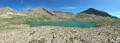
The six lakes of Orcières-Merlette, including Les Estaris
 4.13 mi
+299 ft
-1,447 ft
2h 10
4.13 mi
+299 ft
-1,447 ft
2h 10
 Easy
Departure from Orcières (Hautes-Alpes)
Easy
Departure from Orcières (Hautes-Alpes)
This hike has been suitable for all ages since 2020. Using the chairlifts (Drouvet 1 and 2 for the outward journey and Roche Rousse for the return journey) makes it easy. The six large lakes are visited on the way down. A variant towards the Col de Freissinières is possible. The landscapes are magnificent, especially at the starting point at the top of Drouvet. The lakes are all very beautiful and diverse.
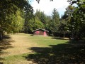
The Pierre Arnoux Belvedere
 3.72 mi
+1,601 ft
-1,552 ft
3h 05
Easy
Departure from Savines-le-Lac (Hautes-Alpes)
3.72 mi
+1,601 ft
-1,552 ft
3h 05
Easy
Departure from Savines-le-Lac (Hautes-Alpes)
The walk begins with a stroll through a beautiful forest and ends with a splendid view of Lake Serre Ponçon.
Up the Gap Canal: from Pont de Frappe to Les Ricous
 6.71 mi
+328 ft
-489 ft
3h 20
Easy
Departure from Chabottes (Hautes-Alpes)
6.71 mi
+328 ft
-489 ft
3h 20
Easy
Departure from Chabottes (Hautes-Alpes)
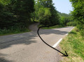
A lovely, idyllic walk with virtually no elevation gain, easy and shaded. Ideal for families. You can walk part of the route and turn back, or tackle it in short sections. Of course, it’s possible to do this walk in the opposite direction.
The canal is always covered, so you can’t see the water.
Please note that between the start and point 2 there is a steep descent through the woods.
From Chaillol 1600 to Chantaussel
 3.05 mi
+121 ft
-1,138 ft
1h 30
Easy
Departure from Saint-Michel-de-Chaillol (Hautes-Alpes)
3.05 mi
+121 ft
-1,138 ft
1h 30
Easy
Departure from Saint-Michel-de-Chaillol (Hautes-Alpes)
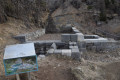
A short walk, with very little uphill climb and no difficulty, starting from Chaillol 1600 to the hamlet of Chantaussel (municipality of Saint-Julien-en-Champsaur).
Round-trip walk: you’ll need at least two cars.
The Col des Terres Blanches
11.81 mi
+4,259 ft
-3,822 ft
9h 10
Difficult
Departure from Freissinières (Hautes-Alpes)
From Dormillouse to Prapic via the Col des Terres Blanches.
Pré de la Chaumette Mountain Hut - Vallonpierre Mountain Hut
 6.50 mi
+3,783 ft
-2,215 ft
6h 15
Difficult
Departure from Champoléon (Hautes-Alpes)
6.50 mi
+3,783 ft
-2,215 ft
6h 15
Difficult
Departure from Champoléon (Hautes-Alpes)
The12th stage of this route features three passes to cross, the last of which is particularly technical and difficult.
The panoramic views remain as exceptional as ever, with vistas of the majestic Chaillol, the Sirac and the Champoléon valley. The refuge is set in lush greenery at the bottom of a cirque at the foot of the Sirac and on the shores of the magnificent Lac de Vallonpierre. A campsite in a beautiful meadow at the foot of the Sirac, with a splendid view of the lake.
Ravin des Serres - Vallonpierre refuge
 10.03 mi
+5,138 ft
-5,220 ft
9h 05
Difficult
Departure from L'Argentière-la-Bessée (Hautes-Alpes)
10.03 mi
+5,138 ft
-5,220 ft
9h 05
Difficult
Departure from L'Argentière-la-Bessée (Hautes-Alpes)
The hike begins with the ascent of the Pas de la Cavale, which rises to an altitude of 2,735 metres. After this climb, you will reach the Pré de la Chaumette refuge. From there, another climb will take you along the imposing Sirac, passing through the Vallette, Gouiran and Vallonpierre passes. The route ends at the Vallonpierre refuge.