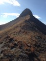
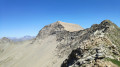
Pointe de la Diablée (southern slope)

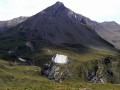
Seen from the outskirts of the village of Les Gourniers, climbing this perfect pyramid is a dream come true; all the more so because of the slope facing us; it seems impossible, and yet it’s doable!

Details

2284575
Creation:
Last update:
Last review:
  • Walking
    Activity: Walking
  • ↔
    Distance: 8.84 mi
  • ◔
    Duration according to the author: 8 hrs 
  • ▲
    Difficulty: Extremely difficult

  • ⚐
    Back to start: Yes
  • ↗
    Ascent: + 5,351 ft
  • ↘
    Descent: - 5,331 ft

  • ▲
    Highest point: 9,603 ft
  • ▼
    Lowest point: 4,806 ft

Photos

Description of the walk

(S/E) From the car park before the bridge below the village of Les Gourniers, cross the bridge and follow the road heading north as you enter the village. Head towards the Chapelle Saint-Marcellin, which you’ll reach via a track that quickly turns into a footpath.

(1) Walk past the chapel and continue along the path towards the Cabane de Pré Antoni.

(2) Ignore the path branching off to the left on the flat section and continue north-east.

(3) After crossing the footbridge, stay on the path for a further 250 m.

(4) Then climb the slope on the left diagonally to reach the top of this slope (half grassy, half stony). Emerge above the last larch trees well to the left, or take the vague stony gully just before that leads to the foot of the rock face. Now take the chamois track which runs horizontally to the right to reach the small gap formed by the rocky outcrop.

(5) From the gap, climb to the left (easy scrambling) following the chamois tracks. Pass alongside a small felled tree trunk. Climb a few more metres vertically and veer right to reach the overhanging grassy slope that follows.

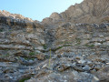
Now climb diagonally to the right to go round the rocky spur overhanging 150 metres higher up. Continue the climb straight up, 80–100 metres from the Ravin de la Dublée on your right, crossing the small rocky ridges that cut across the slope.

(6) Once past this ridge, continue up the slope above, cross the next ridge and veer gently to the right to reach, further up, the ravine further to the right which cuts through the larger ridge.

(7) Enter this ravine via a steep 2-metre section at the start (though easy), then follow it to its summit (at the level of the small rock outcrop on the ridge line to the left).
Reach the ridge line by crossing to the left.

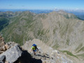
(8) You’ll come to the bastion; follow it to the left for about thirty metres to find the easiest way to cross this first ledge, climb above it by leaning slightly to the right, and cross the second ledge from right to left. The slope soon steepens slightly; continue close to the ridge line.

To cross the next and final step, head left towards a sloping limestone slab and climb up its right-hand side, using it for support. After a few easy zigzags across the step, you’ll emerge onto the ridge 20 metres from the summit.

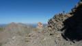
(9) For the descent, head to the north summit (2,919 m) then follow the east-facing ridge down to a small rock pinnacle.

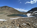
(10) From there, choose the route that seems best to reach the lake below.
Do not attempt to descend directly down the face from the 2,919 m point (crumbly rock outcrops).

(11) Pass via the Col de la Reyna.

(12) Downstream from the lake, keep to the right bank of the torrent to find the start of the path (cairn).
Descend by sight: the route runs along a ledge above the torrent and never comes close to it.

(13) At the end of the small plateau (cairn), veer sharply to the left to find the passage through the large rock barrier further down. Once you reach the old Cabane de la Petite Selle, cross the flat meadow to rejoin the path at the dry stream at the far end of the meadow.

(14) 100 m further on (at the cairn), follow the path which climbs 40 m in altitude. At the next cairn, the descent begins to the left. At the 1,800-metre mark, continue straight ahead along the path to reach Les Planiers, which you passed on the way up.

(2) Continue straight ahead and, following the reverse route of the outward journey, reach Les Gourniers (S/E).

Waypoints

  1. S/E : mi 0 - alt. 4,806 ft - The village of Les Gournier on the edge of the - Réallon (torrent) - Affluent de la Durance
  2. 1 : mi 1.36 - alt. 5,676 ft - Saint-Marcellin Chapel
  3. 2 : mi 1.82 - alt. 5,764 ft - Les Planiers
  4. 3 : mi 2.25 - alt. 5,741 ft - Footbridge
  5. 4 : mi 2.46 - alt. 5,906 ft - Junction
  6. 5 : mi 2.78 - alt. 6,903 ft - Access to the breach
  7. 6 : mi 3.02 - alt. 7,769 ft - Passage de la Barre
  8. 7 : mi 3.22 - alt. 8,474 ft - Entrance to the ravine
  9. 8 : mi 3.36 - alt. 9,157 ft - Epaulement
  10. 9 : mi 3.54 - alt. 9,603 ft - Summit of the - Pointe de la Diablée
  11. 10 : mi 3.85 - alt. 9,245 ft - Descent to the - Lac Reyna
  12. 11 : mi 4.13 - alt. 8,914 ft - Col de la Reyna
  13. 12 : mi 4.65 - alt. 8,701 ft - Start of the trail
  14. 13 : mi 5.37 - alt. 7,779 ft - Turn left up the steep slope at the cairn
  15. 14 : mi 6.53 - alt. 6,250 ft - Turn left up the steep slope at the cairn (path)
  16. S/E : mi 8.84 - alt. 4,806 ft - A quick dip for your feet in the stream

Notes

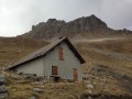
Shelter: the old ‘Cabane de la Vieille Selle’ is open; it has a stove and a table.
No springs were spotted on the circular loop.
A helmet is advisable.
An ice axe and crampons are required if tackling the route in early summer for the ascent to the summit and the descent to Lake Reyna.
Allow between 7 and 8 hours for the circular route.
Only attempt the face in stable weather conditions.

You’ll be hiking in the heart of the Écrins National Park.

The Écrins massif is an exceptional area, open to all, with a natural, cultural and scenic heritage that is truly unique. To protect these treasures, the heart of the park is marked by blue-white-red flags, and certain regulations must be observed. Please familiarise yourself with these regulations on the website whilst preparing for your hike, in order to preserve this shared heritage.

Worth a visit

The Chapel of Saint-Marcellin.
The ‘giant’s potholes’ at the entrance to the village of Les Gourniers on the way back.
A beautiful 360° view with Mont Viso standing out in the distance.

Reviews and comments

4.2 / 5
Based on 3 reviews

Reliability of the description
3.7 / 5
Ease of following the route
4 / 5
Route interest
5 / 5
chris05
chris05

Good evening, ulena. I think you need to go via the guide to be able to add photos! It would be great to see some from a different perspective! Have a lovely evening

Machine-translated

ulena
ulena

I would have loved to share some photos, but I couldn’t work out how! I didn’t see any animals, but I’d recommend it to very experienced hikers! Thank you for the route!

Machine-translated

chris05
chris05

Hello ulena, thank you for your positive feedback: yes, it’s a process that isn’t easy to describe precisely; it’s more a case of knowing how to read the terrain as you go along that counts! Have a great season in the mountains
Christian

Machine-translated

ulena
ulena

Overall rating : 3.7 / 5

Date of your route : Jul 08, 2023
Reliability of the description : ★★★☆☆ Average
Ease of following the route : ★★★☆☆ Average
Route interest : ★★★★★ Very good
Very busy route : No

Don’t set out on this hike unless you’re very experienced in the mountains. It’s magnificent – the lake is stunning – but it’s a very, very challenging hike with exposed sections all the way along. Absolutely beautiful, but for experts only.

Machine-translated

chris05
chris05
• Edited:

Overall rating : 4.3 / 5

Date of your route : Aug 23, 2022
Reliability of the description : ★★★★☆ Good
Ease of following the route : ★★★★☆ Good
Route interest : ★★★★★ Very good
Very busy route : No

I did the route yesterday, Monday; the conditions were excellent. I went up the grassy slope to reach the gap rather than taking the short detour towards Pré Antoni to avoid the diagonal climb up the scree slope – it’s no easier in terms of effort as the slope is quite steep. In a comment much further up, someone suggested using logger’s crampons – I really can’t see the point of them, and they might even be a bit of a risk. I’ve changed the difficulty rating (to ‘extremely difficult’) as ‘very difficult’ didn’t suit some people who didn’t even do the hike.
Enjoy the rest of the hiking season

Machine-translated

chris05
chris05

Good evening, Mimizen38

For me, it’s the opposite – I’ve never used the site’s guidebook or anything else about books; I plan my outings based on the appeal of a particular slope or a photo that speaks to me! So I don’t know the actual grade to give – I rate it based on how it feels to me!

Machine-translated

Mimizen38
Mimizen38

Hello Christian,
Yes, that hike was brilliant!

On the ascent, forest crampons and an ice axe aren’t essential (I only had poles), but I reckon if the ground had been a bit damp, they would have come in handy… using the poles to stop or anchor yourself isn’t ideal.
What’s more, I think I’d have been more efficient on the grassy climb.
… though that might just be down to my lack of experience: it was the first time I’d ventured onto a slope like that over such a long distance.
I’ve already done several Visorando hikes rated TD and even one rated ED, and I found them all easier… hence my suggestion to classify this one as ED.

Machine-translated

chris05
chris05

Hello Mimizen38
Thanks for your generally positive feedback!
Yes, an ice axe and crampons are needed if you’re heading down to Lake Reyna early in the summer! On the way up, I’ve never felt a lack of grip on the grassy slope
Tomorrow, Monday, I’m due to go up there with my daughter, so I’ll reassess the situation!
I’ll make sure to pack crampons and an ice axe for the descent!

Enjoy the rest of the season
Christian

Machine-translated

Mimizen38
Mimizen38
• Edited:

Overall rating : 4.7 / 5

Date of your route : Aug 14, 2021
Reliability of the description : ★★★★☆ Good
Ease of following the route : ★★★★★ Very good
Route interest : ★★★★★ Very good
Very busy route : No

A superb hike completed in 9 hours… when you stand in front of this monster, you wonder if it’s really possible to get past it: 1 hour for the approach, 4½ hours for the ascent (I got a bit lost at point 8… thanks for the GPS track – it’s accurate and helped me spot my mistake… I was walking along the bottom of the cliff instead of the top), half an hour for a lunch break, and 3 hours for the descent.

However, I’d rate it ED for the following reasons:
- You’re constantly on a steep slope where there’s little room for error (average gradient of 30 per cent).
- A few climbing sections (grade 3 and 4).
- No tracks to guide you… be careful not to stray into the wrong places
- Virtually no chance of finding anyone to come to your aid if you get into trouble (you’re in the middle of nowhere).

Equipment tip: an ice axe and forest crampons to secure yourself on the grassy slope and for any potential snowfields on the descent are a plus (though I managed without them).

Only attempt this in dry conditions and when there’s no risk of rain.

Machine-translated

Other walks in the area

For more walks, use our search engine .

The GPS track and description are the property of this route's author. Please do not copy them without permission.