Champagny-le-Haut – Refuge du Col du Palet

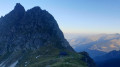
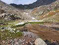
Day1 of a two-circular route in the Vanoise National Park, from Champagny-le-Haut to the Refuge du Col du Palet. A fairly demanding ascent of 1,100 metres, but with a beautiful panorama to reward your efforts, particularly the view over Lac de la Plagne.

This walk is part of a multi-day hike: Circuit de 5 jours à deux boucles autour de la Grande Casse

Details

n°35966
Creation:
Last update:
Last review:
  • Walking
    Activity: Walking
  • ↔
    Distance: 9.25 mi
  • ◔
    Average duration: 8h 25 
  • ▲
    Difficulty: Difficult

  • ⚐
    Back to start: No
  • ↗
    Ascent: + 4,757 ft
  • ↘
    Descent: - 1,115 ft

  • ▲
    Highest point: 8,556 ft
  • ▼
    Lowest point: 4,816 ft
  • ⚐ Country: France
  • ⚐
    Areas: Alps, Vanoise
  • ⚐ City: Champagny-en-Vanoise (73350)
  • ⚑
    Start: N 45.458928° / E 6.744338°
  • ⚑
    End: N 45.45833° / E 6.861049°
  • ❏
    IGN map(s): Ref. 3532ET, 3532ETR, 3532OT, 3532OTR, 3534OT, 3534OTR, 3633ET, 3633ETR
  • Hour-by-hour weather

Photos

Description of the walk

(S) Setting off from the Refuge du Bois in the beautiful, steep-sided valley of Champagny-le-Haut, with the Grande Motte in your sights, walk past the church and turn right at the crossroads.

(1) When you reach the stream, follow it to the hamlet of Friburge.

(2) Cross the bridge, then after 200 metres take the small path on the left. Follow the stream in this way to the Laisonnay d’en Bas bridge, which you must cross.

(3). Walk past the car park to the next bridge spanning the Py waterfall and immediately turn left onto the steep, ascending path. The slope is steep as you begin a significant climb of 1,000 m. Keep following the waterfall all the way, then continue past the Refuge de Plaisance.

(4) Cross the waterfall and go round the Cul du Nant cirque on the right. Continue along this path, which passes close to Lac du Plan Séry.

(5) You will then reach the pass of the same name.

(6) Carry on until you reach a Y-junction with a view of Lac de La Plagne below.

(7) Do not head down towards the lake refuge but carry on to the right. The path follows the same contour line for a while, offering a beautiful view of Lac de La Plagne all along the way. The path then climbs towards a ridge, joining theGR®5a little further on.

(8) Turn right onto it and continue straight on until you reach Lake Gratteleu.

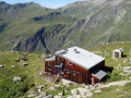
(9) Go over a hill. 50 metres after the lake, leave theGR®5to the left and, finally, begin the climb towards the Refuge du Palet (E), just a stone’s throw away.

Waypoints

  1. S : mi 0 - alt. 4,816 ft - Refuge du Bois
  2. 1 : mi 0.11 - alt. 4,843 ft - Once you reach the stream, follow it along
  3. 2 : mi 0.88 - alt. 4,954 ft - Fribourg
  4. 3 : mi 2.14 - alt. 5,157 ft - Refuge du Laisonnay
  5. 4 : mi 3.74 - alt. 7,146 ft - Refuge de Plaisance
  6. 5 : mi 5.55 - alt. 8,533 ft - Lac de Plan Séry
  7. 6 : mi 5.73 - alt. 8,556 ft - Col du Plan Séry (2609m)
  8. 7 : mi 6.66 - alt. 7,615 ft - Crossroads before Lac de Gratteleu
  9. 8 : mi 7.73 - alt. 7,635 ft - GR5 junction
  10. 9 : mi 8.88 - alt. 8,264 ft - Lac du Grattaleu
  11. E : mi 9.25 - alt. 8,484 ft - Refuge du Palet

Notes

IGN 1:25,000 map or GPS.
A good hooded sleeping bag and, if necessary, a groundsheet for chilly nights.

Always be cautious and plan ahead when you're outdoors. Visorando and the author of this route cannot be held responsible for any accidents occurring on this route.

The GR® and PR® markings are the intellectual property of the Fédération Française de Randonnée Pédestre.

Reviews and comments

5 / 5
Based on 1 review

Reliability of the description
5 / 5
Ease of following the route
5 / 5
Route interest
5 / 5
flofid
flofid

Overall rating : 5 / 5

Date of your route : Sep 03, 2018
Reliability of the description : ★★★★★ Very good
Ease of following the route : ★★★★★ Very good
Route interest : ★★★★★ Very good

A lovely walk up to the Col du Palet
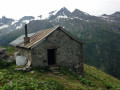
A cosy mountain hut
A day trip
The weather forced us to head back down via the Landonnay

Machine-translated

Other walks in the area

For more walks, use our search engine .

The GPS track and description are the property of this route's author. Please do not copy them without permission.