Refine your search for walks in Col du Cheval Noir (2527m)
Col du Cheval Noir (2527m) walks


 Pic du Cheval Noir
 Association / Club / Walk leader
 5.05 mi
 +3,130 ft
 -3,133 ft
 5h 05
5h 05
 Difficult
 Departure from Saint-François-Longchamp (Savoie)
Discover a peak with a 360° view of the Savoie mountains.
A gallop on the Cheval Noir
 Visorando Member
 16.09 mi
+5,207 ft
-5,210 ft
More than 12 hrs
16.09 mi
+5,207 ft
-5,210 ft
More than 12 hrs
 Very difficult
Departure from Les Avanchers-Valmorel (Savoie)
Very difficult
Departure from Les Avanchers-Valmorel (Savoie)
A superb hike, not technically demanding but requiring plenty of stamina, rewarded with breathtaking scenery and an abundance of flowers.
Le Cheval Noir via the Combe Pierreuse
 Tourism professional
 7.68 mi
+4,072 ft
-4,055 ft
7 hrs
Very difficult
Departure from Saint-Jean-de-Belleville (Savoie)
7.68 mi
+4,072 ft
-4,055 ft
7 hrs
Very difficult
Departure from Saint-Jean-de-Belleville (Savoie)
If you’ve had enough of paths overcrowded with slow-moving tourists and you like to get off the beaten track, if you enjoy a proper slog through scree and up steep slopes, then this hike is for you.
Please pay attention to the recommendations set out in the ‘Practical Information’ section.
Walks near Col du Cheval Noir (2527m)
Alpine pastures and waterfalls of Valmorel
 5.83 mi
+1,253 ft
-1,532 ft
3h 45
5.83 mi
+1,253 ft
-1,532 ft
3h 45
 Moderate
Departure from Les Avanchers-Valmorel (Savoie)
Moderate
Departure from Les Avanchers-Valmorel (Savoie)
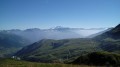
A short hike with moderate elevation gain, suitable for a family outing with young children. The route takes you through working mountain pastures, offering beautiful views of the surrounding mountains, and passes by the foot of three stunning waterfalls.
Valbuche – Montpascal
5.98 mi
+2,096 ft
-4,669 ft
5 hrs
Very difficult
Departure from Saint-Jean-de-Belleville (Savoie)
The second day of a two-day hike in the Maurienne region, including a bivouac.
Montpascal – Valbuche
 8.10 mi
+4,413 ft
-1,834 ft
5 hrs
Very difficult
Departure from Pontamafrey-Montpascal (Savoie)
8.10 mi
+4,413 ft
-1,834 ft
5 hrs
Very difficult
Departure from Pontamafrey-Montpascal (Savoie)
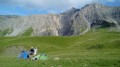
First day of a two-day hike in the Maurienne with a bivouac.
Hike completed in 2016 with a break at the Col de la Baisse, another above the Chalet des Brunes and a final one at the Chalet du Tovet.
Note: The route shown is based on my GPS watch, which I never paused, which explains the circular patterns in certain places.
Descent from Tougnète to Le Molard in summer using the ski lifts
 3.03 mi
+0 ft
-1,985 ft
1h 25
3.03 mi
+0 ft
-1,985 ft
1h 25
 Easy
Departure from Saint-Martin-de-Belleville (Savoie)
Easy
Departure from Saint-Martin-de-Belleville (Savoie)
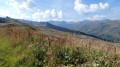
Tougnète is an easy peak to reach in summer via the ski lifts and allows you to admire magnificent panoramic views with ease. The superb meadows come into view on the descent. There are no difficulties; just take the time to admire the scenery.
From Tougnète to Les Ménuires via the ski lifts
 3.18 mi
+299 ft
-614 ft
1h 45
Easy
Departure from Saint-Martin-de-Belleville (Savoie)
3.18 mi
+299 ft
-614 ft
1h 45
Easy
Departure from Saint-Martin-de-Belleville (Savoie)
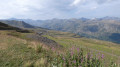
Spectacular panoramic views from the summit of Tougnète, at an altitude of 2,437 m. Magnificent panoramic views from vantage points along the entire route. Arrival at the top of the Roc 1 cable car, at 2,260 m.
This hike should be undertaken during the summer when the ski lifts are operating for hikers.
Along the ridges between Les Menuires and Le Molard
 3.64 mi
+279 ft
-531 ft
1h 55
Easy
Departure from Saint-Martin-de-Belleville (Savoie)
3.64 mi
+279 ft
-531 ft
1h 55
Easy
Departure from Saint-Martin-de-Belleville (Savoie)
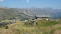
The walk climbs gently before descending towards Le Molard and the Saint-Martin 1 cable car. Throughout the route, you’ll be treated to sweeping views of the mountains and the Belleville valley. The alpine pastures offer magnificent scenery. Best done in summer whilst the ski lifts are operating.
 From Les Menuires to the Roc 1 cable car
5.51 mi
+1,673 ft
-272 ft
3 hrs
Moderate
Departure from Saint-Martin-de-Belleville (Savoie)
This route takes the Sentier des Girauds and then the Sentier des Teppes, before retracing its steps and ending with the Sentier des Girauds, which leads to the Roc 1 cable car arrival point. As the ski touring trail is not marked before the Christmas holidays and is impossible to find, it is still possible to take the footpath, which offers a beautiful, easily accessible hike, perfect for an introduction to ski touring.
From the Refuge du Saut to the Refuge de l'Orgère via the Col du Soufre
 10.24 mi
+3,576 ft
-4,196 ft
7h 50
Difficult
Departure from Les Allues (Savoie)
10.24 mi
+3,576 ft
-4,196 ft
7h 50
Difficult
Departure from Les Allues (Savoie)
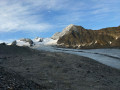
From the Refuge du Saut to the Refuge Porte de l'Orgère, the route passes close to the Gébroulaz Glacier via the Col du Soufre (2,817 m) before descending towards Lac Blanc and, via theGR®55, the Col de Chavière (2,796 m) and the Tête Noire rocks.