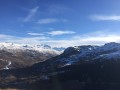
Valbuche – Montpascal

The second day of a two-day hike in the Maurienne region, including a bivouac.

This walk is part of a multi-day hike: Tour du Grand Coin

Details

333713
Creation:
Last update:
Last review:
  • Walking
    Activity: Walking
  • ↔
    Distance: 5.98 mi
  • ◔
    Duration according to the author: 5 hrs 
  • ▲
    Difficulty: Very difficult

  • ⚐
    Back to start: No
  • ↗
    Ascent: + 2,096 ft
  • ↘
    Descent: - 4,669 ft

  • ▲
    Highest point: 8,842 ft
  • ▼
    Lowest point: 4,629 ft

Description of the walk

(S) From the campsite (please ensure you leave the site clean), continue down the well-marked path to the Valbuche valley. You will reach the Valbuche chalet.

(1) Follow the directions on the signposts pointing towards the Col de Valbuche.
Please note: From this point onwards, it becomes difficult to follow the path. It is therefore important to have a map to know where to go.
Contrary to what is shown on the map (and on the route), continue climbing along the right bank of the stream to avoid the wetland in front of the chalet and cross the stream further up.

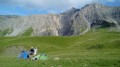
(2) Once past the wetland, head up a rough track/stream, skirting the rocks to the left (see photo). You will then arrive near a chalet.
You’ll come to another wetland, which is easier to cross; a cairn on a rock in the middle indicates that you’re on the right track. Carry on until you reach a visible path leading to the Col de Valbuche.

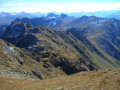
(3) A sign then points towards the Grand Coin on the left. Carry on until you find the path branching off to the left along the ridges. Follow it along the ridges to Crêt Lognant. Please note that the climb is sometimes steep over schist debris, which can be very slippery in wet weather. The ridge is vertiginous, so it is best not to suffer from vertigo.
Optional and not described: it is possible to continue along the ridge to the Grand Coin.

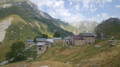
(4) Begin the descent along another ridge to the right on a generally well-marked path; once you reach the grassy sections, it may be more difficult to follow. You will reach Plan du Sapey, where there is a sheepfold.

(5) Continue to the left of the chalet to the Col du Chaussy.

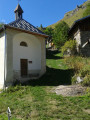
(6) Take the road on the left to return to the church at Montpascal (E). A 4x4 track on the right allows you to cut across the hairpin bends.

Waypoints

  1. S : mi 0 - alt. 7,218 ft - Bivouac in the Valbuche valley
  2. 1 : mi 0.8 - alt. 6,791 ft - Chalet de Valbuche
  3. 2 : mi 1.29 - alt. 7,283 ft - Wetland area
  4. 3 : mi 1.87 - alt. 7,844 ft - Col de Valbuche
  5. 4 : mi 2.78 - alt. 8,842 ft - Crêt Lognan
  6. 5 : mi 4.54 - alt. 6,486 ft - Map of Le Sapey
  7. 6 : mi 5.43 - alt. 5,033 ft - Col de Chaussy
  8. E : mi 5.98 - alt. 4,629 ft - Montpascal

Notes

You follow the rivers for the entire first part of the ascent up to the Col de Valbuche. After that, there is no water until the Col de Chaussy.

For this day’s hike, a map is essential and a compass is recommended, particularly in low cloud or fog. This is because a large part of the route is off the marked trail, and you must be able to navigate properly.

Reviews and comments

3.7 / 5
Based on 1 review

Reliability of the description
3 / 5
Ease of following the route
4 / 5
Route interest
4 / 5
ledouxc
ledouxc

Overall rating : 3.7 / 5

Date of your route : Aug 12, 2024
Reliability of the description : ★★★☆☆ Average
Ease of following the route : ★★★★☆ Good
Route interest : ★★★★☆ Good
Very busy route : No

The track from Monpascal is tedious, stony and very steep (and begins by descending to 1,340; it starts on the right, not the left. Towards Les Combes, it crosses a very rugged stream which is very deeply eroded). It is better to set off from the Col de Chaussy road at the hairpin bend with the signpost for the Col de la Baisse, which allows you to gain height more quickly and follow a more distinct path; you’ll reach the Col de la Baisse.
After the bivouac on the plateau just after crossing the small torrent, you can cut across off-trail to climb up to the next plateau, 70 metres higher, which is very scenic, and then stay at the same level beneath the large rock formation to rejoin the path coming from the lower Valbuche chalet. This involves off-trail walking across meadows and around a few rocks, following sheep tracks, but it saves you a 150-metre descent and subsequent climb.

Machine-translated

Other walks in the area

For more walks, use our search engine .

The GPS track and description are the property of this route's author. Please do not copy them without permission.