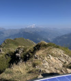
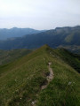
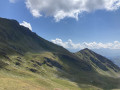
Le Cheval Noir via the Combe Pierreuse

If you’ve had enough of paths overcrowded with slow-moving tourists and you like to get off the beaten track, if you enjoy a proper slog through scree and up steep slopes, then this hike is for you.

Please pay attention to the recommendations set out in the ‘Practical Information’ section.

Details

2521886
Creation:
Last update:
Last review:
  • Walking
    Activity: Walking
  • ↔
    Distance: 7.68 mi
  • ◔
    Duration according to the author: 7 hrs 
  • ▲
    Difficulty: Very difficult

  • ⚐
    Back to start: Yes
  • ↗
    Ascent: + 4,072 ft
  • ↘
    Descent: - 4,055 ft

  • ▲
    Highest point: 9,275 ft
  • ▼
    Lowest point: 5,259 ft

Photos

Description of the walk

Park at the car park in the hamlet of La Sauce, above Saint-Jean-de-Belleville.

(S/E) Follow the tarmac road through the hamlet. Turn right at the hairpin bend.

(1) After the third hairpin bend, turn right.

(2) If the ground is dry, at 1,750m you can turn left straight up the slope (a gruelling 300m climb – you’ll need to be a bit of a masochist) to join the track further up and turn left.

(3) There isn’t much left of the Chalet du Barral, but contrary to the IGN map, the track hasn’t been replaced by a footpath; it continues to climb, winding round several hairpin bends. Follow it until you see a clear path ahead of you leading northwards (at around 2,200m), whilst the track continues eastwards.

(4) Follow this path north-north-west.

(5) Enter the Combe Noire, where you should spot a distinct scree slope on the right at the foot of the 2482m peak. Cross it at its base, then veer right to climb up the grassy couloir to the ridge.

(6) Then descend into the Combe Pierreuse, taking the usual precautions to avoid falling, and zigzag between the large boulders, keeping to the bottom of the valley or slightly to the right on the grassy slopes.

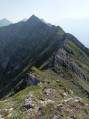
(7) At an altitude of 2,600 m, join the ridge on the left via the final grassy slope of the valley. Climb up this ridge, then traverse left to reach an easier grassy slope leading onto the ridge that takes you to the summit. Take care on the final steep slope, which is covered in slippery gravel.

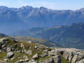
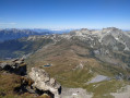
(8) The difficult sections are now behind you; an easy path leads to the summit (magnificent 360° view).

(9) Descend southwards, then turn right to join a grassy ridge; follow this south-westwards to the Col du Cheval Noir.

(10) Turn left and descend to the Lacs du Cheval Noir.

(11) Walk past the lakes and descend into a magnificent valley inhabited solely by marmots.

(12) Just before the Platière chalets, take the track on the left which takes you back to La Sauce, passing close to the Plan Lombardie refuge.

(13). Carry on to reach the junction from the outward journey.

(1) Turn right. After the hairpin bend to the right, instead of heading back down the road, turn left and cross the hamlet to return to the starting point (S/E).

Waypoints

  1. S/E : mi 0 - alt. 5,259 ft - The hamlet of La Sauce
  2. 1 : mi 0.43 - alt. 5,463 ft - Junction of the circular loop
  3. 2 : mi 1.03 - alt. 5,758 ft - To the left, a steep slope
  4. 3 : mi 1.81 - alt. 6,929 ft - Chalet du Barral
  5. 4 : mi 2.29 - alt. 7,277 ft - Path
  6. 5 : mi 2.58 - alt. 7,638 ft - The Combe Noire
  7. 6 : mi 2.85 - alt. 8,068 ft - The Combe Pierreuse
  8. 7 : mi 3.2 - alt. 8,507 ft - Reach the ridge
  9. 8 : mi 3.42 - alt. 9,131 ft - Directly below the summit
  10. 9 : mi 3.58 - alt. 9,275 ft - Le Cheval Noir
  11. 10 : mi 4.26 - alt. 8,304 ft - Col du Cheval Noir (2527m)
  12. 11 : mi 4.5 - alt. 8,015 ft - Cheval Noir Lakes
  13. 12 : mi 5.79 - alt. 6,444 ft - Chalets de la Platière
  14. 13 : mi 6.76 - alt. 5,853 ft - Refuge de Plan Lombardie
  15. S/E : mi 7.68 - alt. 5,259 ft - The hamlet of La Sauce

Notes

(2) If you’d rather not tackle the full slope, follow the track to the Orgentil chalets and, a little further up, take the track to the left, then the path to the right which climbs up the Combe du Barral.

I used my poles for the entire ascent and didn’t find them a hindrance on the few rocky sections.

There’s hardly any water to be found after Le Barral and all the way to the Ruisseau du Cheval Noir.

This hike should be undertaken only after several days of dry weather due to the steep slopes above the Combe Pierreuse. You’ll need a good sense of direction as, from the Combe Noire onwards, there’s no marked trail.

On the ridge, make the most of the grassy slopes, which are easier going than the scree slopes.

Reviews and comments

3.8 / 5
Based on 4 reviews

Reliability of the description
4.3 / 5
Ease of following the route
3.3 / 5
Route interest
4 / 5
fabalps
fabalps

Overall rating : 4 / 5

Date of your route : Aug 24, 2023
Reliability of the description : ★★★★☆ Good
Ease of following the route : ★★★☆☆ Average
Route interest : ★★★★★ Very good
Very busy route : No

Hello,
On 23 August 2023, in very hot weather, I did a variation on this route, so I’d like to add a few comments:
- As mentioned, the direct climb after 1,750 metres ‘is for masochists’; for me, this sets the tone right at the start of the hike (personally, I know the Orgentil and La Platière mountain pastures in the area very well and have never taken this ‘shortcut’ across the very grassy and steep fields
- Combe Noire and Combe Pierreuse are mountain locations: regardless of your fitness level – whether you’re into trail running, mountain biking or triathlon – it’s worth having at least some experience of the mountains off the ‘motorway’ trails, and a sure footing, to really enjoy a hike in this area. I’ve been exploring these wild places almost every year since the 1990s, and each time I’ve had the chance to peacefully observe chamois, for example.
- A ‘traditional route’ (used by shepherds, older locals, etc.) runs via the Col de Combe Noire / ‘Arête de la Frasse’; this route is fairly ‘obvious’ once you’re in the Cirque de Combe Noire, with a path that becomes visible underfoot at times, and a few sections where you’ll need to use your hands to reach the summit of the Cheval Noir by following the ridge
-It’s possible to take this route on the descent; then, upon exiting Combe Noire, as soon as you can see the Auges de Barral, head straight towards Plan Lombardie. You might even come across the local spring, as you’d expect, tucked away beneath a large boulder – though it’s often dry by the end of July–
- In my opinion, Combe Pierreuse is best enjoyed on the descent (you can get a good sense of the terrain from the summit); the traditional ascent takes you to the summit of the Cheval Noir without any ‘mountain-style’ difficulties
All in all, a brilliant route, very, very quiet and likely to stay that way
Enjoy the hike

Machine-translated

fletcher_fr
fletcher_fr

I thought I’d made it clear in the practical information that people who aren’t confident on steep slopes shouldn’t attempt this hike, but I fully understand your frustration at not having been able to reach the summit, and I’d recommend the Roc des Corneilles hike if you’re not familiar with it.

Machine-translated

JenniferBunout
JenniferBunout
• Edited:

Overall rating : 2.3 / 5

Date of your route : Aug 14, 2023
Reliability of the description : ★★★★☆ Good
Ease of following the route : ★★☆☆☆ Disappointing
Route interest : ★☆☆☆☆ Very disappointing
Very busy route : No

We’re keen walkers (CAP and trail running), yet we had to turn back at the Combe Noire, just before the Crête de la Combe Pierreuse (midway through stage 5), as it was becoming too dangerous. A steep slope with no marked path and unstable ground.
Disappointed not to have been able to reach the summit of the Cheval Noir, we’ll try again from the other side via the signposted path.
But yes, the view from the viewpoint is magnificent.

Machine-translated

laurence vayssiere
laurence vayssiere

Overall rating : 4 / 5

Date of your route : Jul 24, 2022
Reliability of the description : ★★★★☆ Good
Ease of following the route : ★★★☆☆ Average
Route interest : ★★★★★ Very good
Very busy route : No

A superb hike, with magnificent views from the summit.
However, the route via the Combe Pierreuse should be avoided by hikers with no experience of rock climbing, as it involves a very steep climb and a dangerous slope.

No marked path, no cairns, some very tricky sections – we were a bit scared!

Machine-translated

VCANET
VCANET

Overall rating : 5 / 5

Date of your route : Jun 03, 2022
Reliability of the description : ★★★★★ Very good
Ease of following the route : ★★★★★ Very good
Route interest : ★★★★★ Very good
Very busy route : No

We passed by the Orgentil chalets, as indicated in point (2) of the practical information.
The climb between points 5 and 8 is tough. (We did it in the rain, with wind, fog and cold. However, our boots gripped the ground well, so we didn’t feel we were taking any risks.) We’d brought ice axes and forest crampons but didn’t feel the need to use them.
Both on the ascent and the descent, patches of snow made our progress easier.
We saw a chamois and three marmots.

Machine-translated

Other walks in the area

For more walks, use our search engine .

The GPS track and description are the property of this route's author. Please do not copy them without permission.