


Refine your search for walks in Col des Ouides (582m)
Col des Ouides (582m) walks


 La Grande Etoile and return via the Col des Ouides
 Visorando Member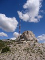
 6.37 mi
 +1,549 ft
 -1,532 ft
 4h 15
4h 15
 Average
 Departure from Marseille (Bouches-du-Rhône)
A beautiful hike in the Massif de l'Etoile, with superb views of Marseille, its surroundings and the Frioul Islands. The colours and scents of the heath accompany walkers throughout the circuit.
Ascent of the Étoile via the Santons loop
 6.77 mi
+1,434 ft
-1,430 ft
4h 20
6.77 mi
+1,434 ft
-1,430 ft
4h 20
 Difficult
Departure from Simiane-Collongue (Bouches-du-Rhône)
Difficult
Departure from Simiane-Collongue (Bouches-du-Rhône)
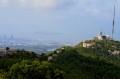
This hike involves climbing to the summit of the Étoile from the north. The start and finish are in a wooded valley, but the rest of the route is very open: you are on a summit ridge and the landscape is magnificent, provided the visibility is good (Marseille, Côte Bleue, Étang de Berre, Alpilles, Mont Ventoux, Aix, Sainte-Victoire, Pilon du Roi).
From Parc de la Nègre to Pilon du Roi
 7.56 mi
+1,978 ft
-1,952 ft
5h 10
Average
Departure from Marseille (Bouches-du-Rhône)
7.56 mi
+1,978 ft
-1,952 ft
5h 10
Average
Departure from Marseille (Bouches-du-Rhône)
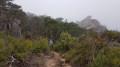
A fairly challenging walk from the Parc de la Nègre to the Pilon du Roi, returning via the Tête du Jacquot. The main attraction of this walk lies above all in the long stretch along the ridge of the Massif de l’Étoile, with superb views on both sides, rocks of all shapes and, finally, the arrival at the Pilon du Roi, an imposing monolith visible from across the region.
Please read the route description carefully at (7).
From La Nègre to Pas de la Colle via Puits de Luques
 9.07 mi
+2,474 ft
-2,454 ft
6h 20
Average
Departure from Marseille (Bouches-du-Rhône)
9.07 mi
+2,474 ft
-2,454 ft
6h 20
Average
Departure from Marseille (Bouches-du-Rhône)
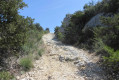
An alternative route, entitled ‘From La Nègre to L’Oasis’, runs between the southern and northern slopes of the Chaîne de l’Étoile. Starting from La Nègre, it takes you to the Col des Ouides, then down the Mérentiers stream towards the place known as L’Oasis. The climb back up to the Pas de la Colle, followed by the descent towards the Vallon de Mauvelle and a section passing close to the Tête du Jacquot, then leads back to the La Nègre area.
Walks near Col des Ouides (582m)
From La Treille to La Font de Mai
3.64 mi
+856 ft
-587 ft
2h 25
 Easy
Departure from Marseille (Bouches-du-Rhône)
Easy
Departure from Marseille (Bouches-du-Rhône)
The free Pays d'Aubagne et de l'Étoile bus network offers some unique routes. For example, line 10 (Aubagne Station – La Treille) will drop you off at La Treille, just a stone’s throw from Marcel Pagnol’s grave. You can then head into the hills where he filmed his movies. You will then pass through the magnificent Font de Mai estate. Afterwards, you can return to Aubagne on bus route 14 (Éoures – Aubagne Station). Please note that these buses do not run on Sundays.
From Peypin to La Destrousse via the Col du Marseillais
6.20 mi
+1,365 ft
-1,680 ft
4h 00
Average
Departure from Peypin (Bouches-du-Rhône)
This lovely walk, winding from valley to valley, takes you from Peypin to the Col du Marseillais. Stunning views of Sainte-Victoire, as well as of Roquevaire and the Huveaune valley from the pass. Then the descent back down to the village of La Destrousse.
- The walk is accessible at the start and finish via the free bus network of the Pays d’Aubagne et de l’Etoile (line 17).
The Corniche, from Notre-Dame de la Garde to the Old Port
 5.13 mi
+344 ft
-797 ft
2h 40
Easy
Departure from Marseille (Bouches-du-Rhône)
5.13 mi
+344 ft
-797 ft
2h 40
Easy
Departure from Marseille (Bouches-du-Rhône)
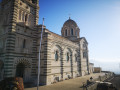
Starting from the Notre-Dame de la Garde Basilica, this route invites you to head down towards the Corniche, a magnificent winding balcony overlooking the Mediterranean. Here you’ll discover the charm of little hidden corners, such as the Malmousque Peninsula, the Endoume neighbourhood and the famous Vallon des Auffes.
From La Penne-sur-Huveaune to Le Charrel via La Candolle
5.32 mi
+1,099 ft
-1,040 ft
3h 25
Easy
Departure from La Penne-sur-Huveaune (Bouches-du-Rhône)
A lovely walk starting from La Penne-sur-Huveaune that takes you through pine forests to the summit of La Candolle. An easy path winds its way along the cliff face, offering magnificent views of Sainte-Baume, the Huveaune valley, Garlaban and the Bay of Marseille. The descent takes you back down to La Pérussonne and Le Charrel. The free bus on Line 6, which connects with the free tram, takes you back to the starting point, and the tram takes you back to the city centre.
You are in the Calanques National Park, which is subject to specific regulations. Failure to comply with these regulations may result in a fine of up to €1,500.
The historic centre of Aix-en-Provence
 4.31 mi
+72 ft
-98 ft
2h 05
Easy
Departure from Aix-en-Provence (Bouches-du-Rhône)
4.31 mi
+72 ft
-98 ft
2h 05
Easy
Departure from Aix-en-Provence (Bouches-du-Rhône)
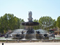
A family outing, a cultural outing, an architectural outing... and a culinary outing if you like! Fountains, cathedrals, churches, museums, theatres, hotels, squares and other attractions... The main things to discover when you come to Aix-en-Provence, a city of water, art, history and well-being!
From Niolon Station to the Port of Carry-le-Rouet, Côte Bleue, the Calanques
8.15 mi
+1,654 ft
-1,752 ft
5h 10
Average
Departure from Le Rove (Bouches-du-Rhône)
This walk is straightforward in terms of the route; simply follow the blue markings. As for difficulty, there is nothing to report; avoid doing it in wet weather as the stones can be slippery, wear suitable footwear and you’re all set.
From Niolon to l’Estaque
5.79 mi
+968 ft
-925 ft
3h 30
Average
Departure from Le Rove (Bouches-du-Rhône)
End of the Côte Bleue trail from Niolon, comprising the wild section in the Calanques and the suburban section along the RD568 to the Estaque district.
From Niolon to La Redonne via the customs officers' path
 4.37 mi
+823 ft
-827 ft
2h 45
Difficult
Departure from Le Rove (Bouches-du-Rhône)
4.37 mi
+823 ft
-827 ft
2h 45
Difficult
Departure from Le Rove (Bouches-du-Rhône)
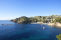
A short, very classic hike in the rocky inlets north of Marseille harbour between the ports of Niolon and La Redonne.
In the heart of the Cirque des Pételins via the Vallon de la Fenêtre
 8.48 mi
+2,582 ft
-2,881 ft
6h 10
8.48 mi
+2,582 ft
-2,881 ft
6h 10
 Very difficult
Departure from Marseille (Bouches-du-Rhône)
Very difficult
Departure from Marseille (Bouches-du-Rhône)
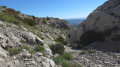
The Cirque des Pételins is a sight of unparalleled beauty. It is a very little-used trail in the Calanques National Park of Marseille. A superb but demanding hike requiring sure-footedness, good physical fitness and the ability to use a GPS effectively in certain places where the path is harder to find. This hike is not circular; it requires a shuttle service between the Logisson car park and the Col de la Gineste car park.
Please note: you are hiking in a national park; please respect the rules and avoid straying from the paths. Before setting off, please familiarise yourself with the regulations of the Calanques National Park: Calanques National Park Regulations
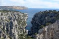
Calanques from Marseille to Cassis - Stage 2
 12.85 mi
+3,140 ft
-3,514 ft
8h 40
Difficult
Departure from Marseille (Bouches-du-Rhône)
12.85 mi
+3,140 ft
-3,514 ft
8h 40
Difficult
Departure from Marseille (Bouches-du-Rhône)
From Luminy to Cassis via the Devenson Cliffs.
Panoramic hike passing through the most beautiful eastern calanques of Marseille: Sugiton, En-Vau and Port-Pin.
You are in the Calanques National Park, which is subject to specific regulations. Failure to comply with these regulations may result in a fine of up to €1,500.