Notre-Dame de la Garde

Hiking route organised by the École Maternelle Extérieur and FFRandonnée13.

Starting from the Estrangin metro station, the route climbs to the Basilica of Notre-Dame de la Garde via Parc de la Colline Puget, then descends towards Place Castellane.

Details

n°23038137
Creation:
Last update:
Last review:
  • Walking
    Activity: Walking
  • ↔
    Distance: 2.39 mi
  • ◔
    Average duration: 1h 30 
  • ▲
    Difficulty: Easy

  • ⚐
    Back to start: No
  • ↗
    Ascent: + 433 ft
  • ↘
    Descent: - 397 ft

  • ▲
    Highest point: 469 ft
  • ▼
    Lowest point: 36 ft
  • ⚐ Country: France
  • ⚐ City: Marseille (13000)
  • ⚑
    Start: N 43.290247° / E 5.377825°
  • ⚑
    End: N 43.286353° / E 5.383685°
  • ❏
    IGN map(s): Ref. 3145ET
  • Hour-by-hour weather

Description of the walk

(S/E) From Estragin metro station, head towards the Palais de Justice. Walk up the Cours Pierre Puget to the statue of Pierre Puget at the bottom of the park.

(1) Walk through Puget Hill Park, taking your time to explore, until you reach the top of Puget Park, on the IRSAM side (statues of Abbé Dassy and Louis Braille, and toilets).

(2) Walk up Rue de Vauvenargues to the Jeanne d’Arc monument.

(3) Take the Montée de l’Oratoire, then the steps to reach the Basilica of Notre-Dame de la Garde and walk around it.

(4) Head down towards Place Castellane via Rue Fort du Sanctuaire. Cross the square to take the Montée Notre-Dame (pedestrianised) and emerge onto Boulevard Notre-Dame. Walk down to the left for a few metres, then turn right onto Boulevard Paul Doumer. Join Boulevard Vauban and walk down it to the left until you reach Rue Breteuil.

Walk back up Rue Stanislas Torrents to the right for a few metres, then turn left onto Rue Beaujour. Continue along Rue Beaujour to the right (passing the Traverse du Villageon on your left) until you reach Rue Stanislas Torrents. Cross the street and, turning left then right, take the steps next to the Noilly Paradis building, which lead to Rue Paradis.

Walk down it, keeping slightly to the left, then turn right onto Rue des Vignerons, which leads to Square Edmond Rostand. From the square, turn right onto Rue Saint Suffren, which leads to Rue de Rome and then to Place Catsellane and its metro station (E).

Waypoints

  1. S : mi 0 - alt. 36 ft - Estrangin metro station
  2. 1 : mi 0.53 - alt. 112 ft - Statue of Pierre Puget
  3. 2 : mi 0.83 - alt. 194 ft - Top of Puget Hill Park
  4. 3 : mi 1.15 - alt. 318 ft - Joan of Arc tank
  5. 4 : mi 1.31 - alt. 466 ft - Basilique Notre-Dame de la Garde (Marseille)
  6. E : mi 2.39 - alt. 72 ft - Castellane Metro station

Notes

Water points and toilets at Puget Hill Park and at the Notre-Dame-de-la-Garde Basilica.

Worth a visit

On the first part of the route, between the Estrangin metro station and the statue of Pierre Puget: the Palais de Justice.
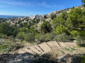
At Puget Hill Park: the viewpoint overlooking Marseille, and the statues of Braille and Abbé Dassy__
At the top of Vauvenargues: the Joan of Arc statue.
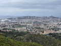
The Basilica of Notre-Dame de la Garde and the magnificent views of Marseille, its islands and the surrounding hills.

Reviews and comments

5 / 5
Based on 1 review

Reliability of the description
5 / 5
Ease of following the route
5 / 5
Route interest
5 / 5
sophie13
sophie13

Overall rating : 5 / 5

Date of your route : Nov 16, 2022
Reliability of the description : ★★★★★ Very good
Ease of following the route : ★★★★★ Very good
Route interest : ★★★★★ Very good
Very busy route : Yes

The first part of the route is very busy (from the Jardin Puget to Notre-Dame-de-la-Garde). It’s much quieter on the stretch from Notre-Dame-de-la-Garde to Place Castellane. The route is signposted from Notre-Dame-de-la-Garde, which makes the walk much easier. Thank you for introducing me to these little streets that I didn’t know about.

Machine-translated

Other walks in the area

For more walks, use our search engine .

The GPS track and description are the property of this route's author. Please do not copy them without permission.