


Refine your search for walks in Col de Sacroux (2034m)
Col de Sacroux (2034m) walks


 Lac Vert, the Cirque de la Glère and the Hospice de France
 Visorando Member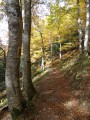
 11.08 mi
 +4,682 ft
 -3,858 ft
 7 hrs
7 hrs
 Very difficult
 Departure from Castillon-de-Larboust (Haute-Garonne)
A truly beautiful walk leading from the Vallée du Lys to the Hospice de France via the Lac Vert. The route is varied and the elevation gain is certainly significant, but this is more than made up for by the magnificent views over the Haut-Luchonnais and the ridge marking the border with Spain.
Walks near Col de Sacroux (2034m)
Aiguallut Waterfall and Forau d’Aiguallut
9.62 mi
+1,942 ft
-1,962 ft
6h 05
 Difficult
Departure from Benasque/Benás (Huesca)
Difficult
Departure from Benasque/Benás (Huesca)
A beautiful succession of landscapes including a plateau, a mountain refuge, a pass and a waterfall…
Park in the car park accessible to tourists. Alternatively, there is a paid shuttle bus from Bénasque to La Besurta.
Water is available at the La Besurta car park, at the refreshment bar and at the mountain refuge.
Refuge du Maupas – Pic de Maupas – Lys Valley
8.09 mi
+2,457 ft
-6,703 ft
6 hrs
Very difficult
Departure from Castillon-de-Larboust (Haute-Garonne)
On this day’s hike, you’ll need to find your own way up to the Pic de Maupas over rounded boulders, where the numerous cairns mean you’ll have to locate the next one each time to continue the ascent to the ‘Mal Pas’, which gave the peak its name. This is the only pass – difficult to access – allowing you to cross over to the western slope and complete the ascent with a few easy climbing moves. The return will follow the same route as the ascent, with a pleasant alternative route via Lac Vert.
Plan d’Abaixo – Fuente de la Pubiya
6.17 mi
+630 ft
-2,231 ft
3h 25
 Moderate
Departure from Benasque/Benás (Huesca)
Moderate
Departure from Benasque/Benás (Huesca)
The route runs from Plan d’Abaixo to Fuente de la Pubiya. This final stage, approximately 10 km long, will take you back to the starting point of the route. You’ll follow mountain paths offering beautiful views of the valley before finishing with a gentle descent to Fuente de la Pubiya, thus completing this circular walk.
Lys Valley - Maupas Refuge
4.62 mi
+4,245 ft
-3 ft
5h 50
Difficult
Departure from Cazeaux-de-Larboust (Haute-Garonne)
This first stage, which serves as an approach walk, is difficult. The climb is steep and sustained along the Torrent de Houradade up to the junction at the Cabane de la Coume. Continuing the route to reach the Cabane de Pratlong allows you to catch your breath a little before tackling the final stretch via the numerous tight hairpin bends leading to the pumping station and then to the Refuge du Maupas, where the warm welcome will quickly make you forget the day’s exertions.
Maupas Mountain Hut via the Cirque des Crabioules
 6.12 mi
+4,839 ft
-581 ft
6 hrs
Very difficult
Departure from Cazeaux-de-Larboust (Haute-Garonne)
6.12 mi
+4,839 ft
-581 ft
6 hrs
Very difficult
Departure from Cazeaux-de-Larboust (Haute-Garonne)
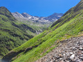
An alternative route to climb up and spend the night at the Refuge du Maupas: this is longer than the standard ascent but less busy, offering splendid views over the Lys Valley and the 3,000-metre peaks overlooking the Cirque des Crabioules. Best undertaken in good weather, as the path is sometimes poorly marked after the Anciennes Mines des Crabioules.
Superbagnères – Lac d’Oô – Granges d’Astau
 10.50 mi
+2,723 ft
-4,820 ft
7h 10
Difficult
Departure from Saint-Aventin (Haute-Garonne)
10.50 mi
+2,723 ft
-4,820 ft
7h 10
Difficult
Departure from Saint-Aventin (Haute-Garonne)
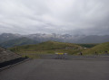
Easily accessible without a car, this walk offers views of the surrounding valleys and peaks, as well as the magnificent Lac d’Oô. A perfectly signposted and well-maintained path where it is impossible to get lost. The return journey will be by public transport back to Luchon station.
Lake Espingo - Granges d'Astau
 3.84 mi
+72 ft
-2,746 ft
1h 50
3.84 mi
+72 ft
-2,746 ft
1h 50
 Easy
Departure from Oô (Haute-Garonne)
Easy
Departure from Oô (Haute-Garonne)
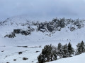
A gentle descent after the exertions of the previous days. From the Col d’Espingo, the Lac d’Oô below accompanies us for a long while. Once at the stone bridge, don’t hesitate to make a short detour to the Auberge du Lac d’Oô, where you can enjoy the view of the great waterfall, which will help you forget, if only for a moment, the increasingly obvious and cruel shortage of water. The return to Les Granges d’Astau brings this getaway in one of the most beautiful spots in the Luchon area to a pleasant close.
Fuente de la Pubiya – Prados de Llosás
5.63 mi
+3,074 ft
-476 ft
5h 15
Difficult
Departure from Benasque/Benás (Huesca)
Starting from Fuente de la Pubiya and ending at Prados de Llosás. The first day covers around 10 km with a climb of nearly 1,000 m. A lovely, gradual climb through the heart of the valley, with superb scenery and a finish in a magnificent setting.
Granges d'Astau - Lac du Portillon
6.39 mi
+4,918 ft
-226 ft
7h 15
Difficult
Departure from Oô (Haute-Garonne)
Starting from Les Granges d'Astau, there is a long climb with some steep sections, made more pleasant by the presence of several lakes. Lac d'Oô and its inn, and Lac d'Espingo in its magnificent setting are ideal places to stop for a break. After Lac du Saussat (pronounced Sa-ou-sat), the much smaller Lac de la Coume de l'Abesque marks the start of the steep, winding climb that leads to a plateau dotted with smooth rocks and small lakes, and then to the Jean Arlaud refuge.
Estos Mountain Hut – Viados Mountain Hut
 6.80 mi
+2,487 ft
-3,028 ft
5h 20
Moderate
Departure from Benasque/Benás (Huesca)
6.80 mi
+2,487 ft
-3,028 ft
5h 20
Moderate
Departure from Benasque/Benás (Huesca)
The second day of the Tour du Posets begins with a steady climb along the GR®11 to reach the Col d’Estos. The second part of the day is a long descent leading to the Refuge de Viados. There are stunning views of the valleys, followed by views of the summit of Posets and its neighbouring peaks during the second part of the day.