Refine your search for walks in Col de l'Alpettaz (1580m)
Col de l'Alpettaz (1580m) walks


 Route de la Belle Étoile and La Négresse / Roc Rouge
 Visorando Member
 5.64 mi
 +3,159 ft
 -3,133 ft
 5h 20
 Difficult
 Departure from Mercury (Savoie)
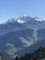
A very lovely hike on the border between Savoie and Haute-Savoie, on the iconic peaks of Albertville: the beautiful Étoile and the Négresse.
In the background, the Bauges massif, the Beaufortain, the Lauzière, Mont Blanc and Lake Annecy.
A hike best undertaken in dry weather, featuring exposed sections equipped with ladders and handrails.
Dent de Cons from Allondaz
 Tourism professional
 9.48 mi
+4,928 ft
-4,934 ft
7 hrs
 Very difficult
Departure from Allondaz (Savoie)
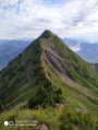
Here is a circular route that allows you to prolong the pleasure of walking along a very narrow ridge with vertiginous slopes.
From the Baraque de l'Abbaye to the Chalet de l'Alpettaz
 9.20 mi
+3,583 ft
-2,201 ft
7h 20
Difficult
Departure from Seythenex (Haute-Savoie)
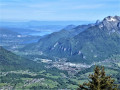
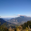
This hike takes you to the heart of the Faverges-Seythenex valley, following the Lac d'Annecy with the Torrent de Saint-Ruph, which is the lake's main source of water, ending with a view of Albertville and Mont Blanc at the Col de l'Alpettaz (alt. 1,580 m).
Walks near Col de l'Alpettaz (1580m)
From Albertville station to the Refuge du Soplat des Streams
 7.03 mi
+4,177 ft
-604 ft
6h 50
Difficult
Departure from Albertville (Savoie)
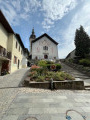
A lovely climb starting from Albertville, passing through the medieval town of Conflans and pretty mountain hamlets with views of the Tarentaise Valley, before reaching the Refuge du Soplat des Stream. The refuge is ideally located near the Tour du Beaufortain with a beautiful view of Albertville and the Olympic Park. Hike to be done from May to November: avalanche risk in winter above 1,100 metres.
Chalets de l’Eau Froide – Stream Fourchu car park
10.52 mi
+2,142 ft
-4,190 ft
6h 40
Difficult
Departure from Giez (Haute-Savoie)
The second day of a two-day route around the Pointe d’Arcalod, the highest point in the Bauges, passing through wild areas, valleys and along rivers. The proposed route mainly follows the western section of the GR® de Pays Tour de l’Arcalod, marked in yellow and red. Spectacular views of the mountains and Lake Annecy. This wild and little-used route is situated mainly within a sensitive, regulated area. The terrain is good and presents no particular difficulties.
Molliessoulaz Lodge - Les Saisies
9.49 mi
+4,888 ft
-2,579 ft
8h 35
Difficult
Departure from Queige (Savoie)
The final stage of the Tour du Beaufortain, between Molliessoulaz and Les Saisies.
Nant Fourchu stream car park – Chalets de l’Eau Froide
8.13 mi
+4,140 ft
-2,103 ft
7h 20
Very difficult
Departure from École (Savoie)
First day of a two-day route around the Pointe d’Arcalod, the highest point in the Bauges, crossing wild areas, valleys and rivers. The proposed route mainly follows the eastern section of the GR® de Pays Tour de l’Arcalod, marked in yellow and red. Spectacular views of the mountains and Lake Annecy. This wild and little-used route is situated mainly within a sensitive, regulated area.The terrain is good and presents no particular difficulties.
Combe refuge - Le Reposoir
 6.84 mi
+2,021 ft
-3,307 ft
4h 55
 Moderate
Departure from Chevaline (Haute-Savoie)
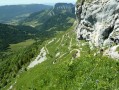
Second day of the hike: Around Charbon Mountain with a stop at Dent des Portes.
Le Reposoir - Refuge de la Combe
 3.14 mi
+1,719 ft
-436 ft
2h 55
Moderate
Departure from Bellecombe-en-Bauges (Savoie)
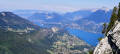
This hike can be done either:
- as a day trip,
- or as part of a longer hike (first stage of the circular route: Around Charbon Mountain). It was during this tour that it was completed.
Refuge de la Thuile – Col de l’Arc
9.24 mi
+4,009 ft
-3,770 ft
7h 45
Very difficult
Departure from Sainte-Hélène-sur-Isère (Savoie)
A change of scenery: the view opens out towards the Beaufortain, the Tarentaise, the Aravis and then the Vanoise. You pass beneath the Grand Arc, descend towards the Vallon de Bayet, cross the Col Basmont, then spend the night at the Col de l’Arc in the unmanned hut
Le Trelod via Dent de Pleuven
 6.70 mi
+4,544 ft
-3,638 ft
7h 00
Very difficult
Departure from Doucy-en-Bauges (Savoie)
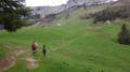
360° view of the Bauges Massif from the summit of Trélod.Arrange for a car at the finish point.