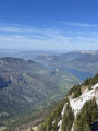
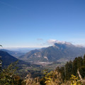
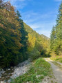
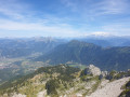
Chalets de l’Eau Froide – Stream Fourchu car park

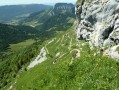
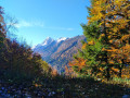
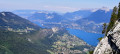
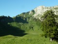
The second day of a two-day route around the Pointe d’Arcalod, the highest point in the Bauges, passing through wild areas, valleys and along rivers. The proposed route mainly follows the western section of the GR® de Pays Tour de l’Arcalod, marked in yellow and red. Spectacular views of the mountains and Lake Annecy. This wild and little-used route is situated mainly within a sensitive, regulated area. The terrain is good and presents no particular difficulties.

This walk is part of a multi-day hike: Tour de l’Arcalod

Details

99857336
Creation:
Last update:
Last review:
  • Walking
    Activity: Walking
  • ↔
    Distance: 10.52 mi
  • ◔
    Average duration: 6h 40 
  • ▲
    Difficulty: Difficult

  • ⚐
    Back to start: No
  • ↗
    Ascent: + 2,142 ft
  • ↘
    Descent: - 4,190 ft

  • ▲
    Highest point: 5,367 ft
  • ▼
    Lowest point: 2,546 ft
  • ⚐ Country: France
  • ⚐
    Areas: Alps, Bauges
  • ⚐ City: Giez (74210)
  • ⚑
    Start: N 45.718179° / E 6.236036°
  • ⚑
    End: N 45.6457° / E 6.237032°
  • ❏
    IGN map(s): Ref. 3432ET, 3432OT, 3432OTR
  • Hour-by-hour weather

Description of the walk

(S) Take the path southwards through the mountain pastures to reach the Plan de France crossroads.

(1) Turn right and continue down the slope until you reach the junction with a wide track.

(2) Turn left onto it and begin the ascent towards the Col de Chérel. Note: you can take the path that runs alongside the track to avoid the hairpin bends, but it is sometimes overgrown; however, it is passable with a little care.

(3) At the Col de Chérel, take the path on the right (GRP® Variante) and head downhill. Cross a track and reach the Pont de Leyat via the correct path through the forest (follow the sign).

(4) Continue the descent until you emerge at the Précherel car park.

(5) Carry on along the road for 300 m, then continue on the GRP® to the right and arrive at the village of Jarsy.

(6) Keep left on the D60b for 300 m and continue left, still following the GRP® trail through the Massif des Bauges, approaching the Ruisseau du Chéran before completing the descent to the village of Carlet.

(7) Turn left at almost 180° and follow the path uphill to reach the hamlet of Très Roche.

(8) Carry on uphill until you reach the Source des Chaudannes.

(9) Stay on the GRP® ‘Tour du Massif des Bauges’ trail at all times. After a series of ascents and descents, reach the Pont de l’Étang.

(10) Now follow the Chéran river as it rises slightly, cross it at the Pont du Plan du Bout before arriving at the Nant Fourchu stream park (S/E).

Waypoints

  1. S : mi 0 - alt. 5,322 ft - Chalets de l’Eau Froide
  2. 1 : mi 1.12 - alt. 5,102 ft - Map of France
  3. 2 : mi 2.13 - alt. 4,373 ft - Col de Chérel trail
  4. 3 : mi 2.97 - alt. 4,908 ft - Col de Chérel – GRP Variant
  5. 4 : mi 4.26 - alt. 3,465 ft - Pont de Leyat
  6. 5 : mi 5.02 - alt. 3,228 ft - Précherel
  7. 6 : mi 5.9 - alt. 2,756 ft - Jarsy
  8. 7 : mi 7.21 - alt. 2,546 ft - Carlet - Chéran (rivière)
  9. 8 : mi 7.86 - alt. 3,182 ft - Hamlet of Très Roche
  10. 9 : mi 8.25 - alt. 3,448 ft - Source des Chaudannes
  11. 10 : mi 9.75 - alt. 3,074 ft - Pont de l'Étang
  12. E : mi 10.52 - alt. 3,281 ft - Nant Fourchu car park

Always be cautious and plan ahead when you're outdoors. Visorando and the author of this route cannot be held responsible for any accidents occurring on this route.

The GR® and PR® markings are the intellectual property of the Fédération Française de Randonnée Pédestre.

Other walks in the area

For more walks, use our search engine .

The GPS track and description are the property of this route's author. Please do not copy them without permission.