


Refine your search for walks in Col de Beyrède
Col de Beyrède walks


 Bassia ridge
 Visorando Member
 4.86 mi
 +2,064 ft
 -2,064 ft
 4h 00
4h 00
 Difficult
 Departure from Beyrède-Jumet (Hautes-Pyrénées)
The Crête de Bassia from the Col de Beyrède offers a magnificent panoramic view of the Baronnies de Bigorre to the north and the Pyrenees mountain range from Arbizon to the Pic du Midi de Bigorre to the south.
 Beyrède Pass from Espiadet
 5.44 mi
+1,358 ft
-1,332 ft
4 hrs
5.44 mi
+1,358 ft
-1,332 ft
4 hrs
 Moderate
Departure from Campan (Hautes-Pyrénées)
Moderate
Departure from Campan (Hautes-Pyrénées)
A lovely snowshoe hike from the Payolle marble quarry. This is an unmarked trail, so a basic sense of direction is required.N.B. In some places, the IGN map is not up to date. The GPX track can be very useful.
Col de Beyrède from Sarrancolin
 10.20 mi
+2,644 ft
-2,621 ft
7h 00
Moderate
Departure from Sarrancolin (Hautes-Pyrénées)
10.20 mi
+2,644 ft
-2,621 ft
7h 00
Moderate
Departure from Sarrancolin (Hautes-Pyrénées)
A fairly long circular hike from Sarrancolin. This ascent to the Col de Beyrède from the Arreau Valley allows you to rediscover the old paths that once enabled shepherds to drive their flocks up to the summer pastures. Of course, some sections of these paths have been modified by motorised vehicles.Please note: this walk is unmarked from (3). The GPX track may prove useful, particularly from (10) to (14).
Walks near Col de Beyrède
Fréchet-Aure - Sarrancolin
 3.18 mi
+446 ft
-807 ft
1h 50
3.18 mi
+446 ft
-807 ft
1h 50
 Easy
Departure from Fréchet-Aure (Hautes-Pyrénées)
Easy
Departure from Fréchet-Aure (Hautes-Pyrénées)
Fourth stage of the Ténarèze: this section of the route takes you back to the GR®105 from Fréchet-Aure.
The route continues through Camous, a picturesque village with a rich mining heritage. You will then take a path towards Ilhet, following the old railway line, an industrial relic that adds a touch of nostalgia to the hike.
The walk continues to Sarrancolin, the end point of this stage.
From the village of Artigues to Tournaboup
8.91 mi
+3,907 ft
-3,077 ft
7h 30
Difficult
Departure from Campan (Hautes-Pyrénées)
Third day of a three-day circular route. After a restful night in Artigues, set off having filled your water bottle and packed a packed lunch. To round off this circular route on a high note, take this path between the Col du Tourmalet and the Pic du Midi de Bigorre. A very pleasant walk, with the Pic du Midi towering above you. Return by heading down towards the Tournaboup car park.
From Artigues to the Campana de Cloutou refuge
 7.24 mi
+4,439 ft
-1,119 ft
7h 10
Difficult
Departure from Campan (Hautes-Pyrénées)
7.24 mi
+4,439 ft
-1,119 ft
7h 10
Difficult
Departure from Campan (Hautes-Pyrénées)
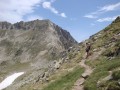
Ascent to the Hourquette de Caderolles, the Col de Bastanet and overnight stay at the Campana de Cloutou refuge.
This first stage is classified as difficult because there is a lot of elevation gain.
From Ancizan to Fréchet-Aure
 5.60 mi
+984 ft
-1,083 ft
3h 25
Moderate
Departure from Ancizan (Hautes-Pyrénées)
5.60 mi
+984 ft
-1,083 ft
3h 25
Moderate
Departure from Ancizan (Hautes-Pyrénées)
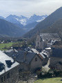
Third stage of the Ténarèze. From Ancizan, follow the GR® 105 north-east, crossing summer pastures and beech woods with views of the Pic du Midi de Bigorre. After Cadéac, the trail leads to Arreau, the former capital of the Aure Valley. Then take the old railway line (now disused), a flat path lined with ferns, to Fréchet-Aure. This balcony village, listed as one of the "Most Beautiful Villages in France", offers a panorama of the Pyrenees and a preserved pastoral heritage.
Du Refuge du Campana de Cloutou à Artigues par le Lac de Montarrouye
 7.55 mi
+974 ft
-4,285 ft
4h 20
Difficult
Departure from Bagnères-de-Bigorre (Hautes-Pyrénées)
7.55 mi
+974 ft
-4,285 ft
4h 20
Difficult
Departure from Bagnères-de-Bigorre (Hautes-Pyrénées)
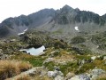
This second stage, after spending the night at the Refuge de Campana de Cloutou, returns to Artigues, off the beaten track, with the discovery of the little-known Montarrouye valley.This day is classified as difficult because you need to know how to find your way.
Bastan refuge - Chalet Hôtel d'Orédon
 5.60 mi
+2,126 ft
-3,330 ft
4h 25
Moderate
Departure from Vielle-Aure (Hautes-Pyrénées)
5.60 mi
+2,126 ft
-3,330 ft
4h 25
Moderate
Departure from Vielle-Aure (Hautes-Pyrénées)
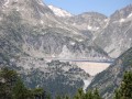
Second stage of the Three Days in the Néouvielle Reserve and its lakes.
From the Bastan refuge to the Chalet-Hôtel d'Orédon.
The tour and contemplation of the 20 lakes continues.
You are entering the Néouvielle National Nature Reserve, which is protected by regulations. Please respect these regulations (see practical information).
Aygues-Cluses Refuge - Campana de Cloutou Refuge
 4.62 mi
+2,146 ft
-1,867 ft
4h 00
Difficult
Departure from Barèges (Hautes-Pyrénées)
4.62 mi
+2,146 ft
-1,867 ft
4h 00
Difficult
Departure from Barèges (Hautes-Pyrénées)
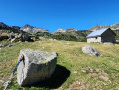
Day three of the four-day Tour du Massif de Néouvielle, the shortest route of the four days, but no less magnificent.This hike is classified as difficult due to the ascent of Pic d'Aygues-Cluses (T5 ridge). See the variants if you wish to avoid the peak or climb it in the other direction (less complicated).
From Pla d’Adet to the village of Saint-Lary-Soulan
4.46 mi
+62 ft
-2,628 ft
2h 05
Moderate
Departure from Saint-Lary-Soulan (Hautes-Pyrénées)
A family-friendly hike consisting entirely of a descent. It’s (slightly) steep at the start, then you join an old road that used to lead to Les Granges de Lias and beyond. You’ll need to take a cable car or gondola lift up.
From Saint-Lary-Soulan to Ancizan
 5.00 mi
+318 ft
-443 ft
2h 35
Easy
Departure from Saint-Lary-Soulan (Hautes-Pyrénées)
5.00 mi
+318 ft
-443 ft
2h 35
Easy
Departure from Saint-Lary-Soulan (Hautes-Pyrénées)
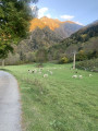
The second stage of the Ténarèze, at the bottom of the Aure valley, runs alongside the Neste river through fields. In places, the path widens, suggesting the trace of the old drovers' road, particularly near the Nourde footbridge. A peaceful route that passes through several small rural villages set on a plain ideal for resting herds before the climb to the summer pastures.
From the Refuge de l’Oule to the village of Artigues
10.75 mi
+2,365 ft
-4,377 ft
7h 00
Moderate
Departure from Saint-Lary-Soulan (Hautes-Pyrénées)
Second day of a three-day circular route. You can book a packed lunch if you’re staying overnight at the Refuge de l’Oule, as well as top up your water flasks. Afterwards, the trail is lovely as it runs alongside the lake. It passes through the Col de Bastanet and takes in magnificent lakes all along the route. At the Campana de Cloutou mountain refuge, you can sit at a table to eat your packed lunch and refill your water flask. The trail then descends, passing by pretty lakes, to the village of Artigues.