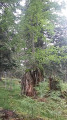
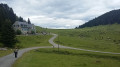
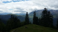
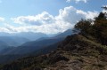
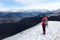
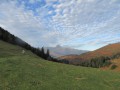
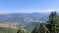
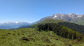
The summit of Tignous as seen from the Col d’Aspin forest road

A lovely walk through the woodland with a nice view from the summit.
Moderator’s note added on 11/08/2021: Some paths are difficult to access (vegetation, barbed wire). Possible alternatives: see the comments at the bottom of this page

Details

3390573
Creation:
Last update:
Last review:
  • Walking
    Activity: Walking
  • ↔
    Distance: 7.40 mi
  • ◔
    Average duration: 4h 30 
  • ▲
    Difficulty: Moderate

  • ⚐
    Back to start: Yes
  • ↗
    Ascent: + 1,280 ft
  • ↘
    Descent: - 1,273 ft

  • ▲
    Highest point: 5,308 ft
  • ▼
    Lowest point: 4,436 ft

Photos

Description of the walk

Parking is available at a bend where the road widens, at an altitude of 1,350 m: there is space for 4 to 5 cars.

(S/E) Then take the Coumelade Forest Road, which heads into the woods opposite, due west. This wide, easy forest road climbs steadily up to the Col de Beyrède.

(1) Before reaching the pass, turn left across the mountain pastures towards the Col de Beyrède inn, which can be seen opposite. Please note: the valley floor below is slightly marshy. rejoin the road coming from Payolle, turn left and pass the inn.

(2) After the inn, take the forest track on the right, heading due west.

(3) Turn left onto a footpath at the hairpin bend in the track. Join the track again further down.

(4) Leave the track and turn left. There are two options: either cross the mountain pasture to the right towards point 8, or follow it along the left-hand side to a gate, following the route description (updated by the moderator on 22/07/2020: see dani65’s comment dated 19/07/2020)

(5) Turn right off the track, but take care as you’ll be entering a fern-covered area with no clear path. You’ll need to follow the ridge more or less to rejoin the track.

(6) Once at the track, head left, still following the ridge. Cross a barbed-wire fence to reach the Sommet de Tignous.

(7) Turn round and head down.

(6) Turn left onto the track.

(8) Go through a gate and head down to the right into the mountain pasture to reach the junction you passed on the way up.

(4) Descend along the same path you took on the way up until you reach (S/E).

Waypoints

  1. S/E : mi 0 - alt. 4,436 ft - D918 road – Track
  2. 1 : mi 2.18 - alt. 4,692 ft - Turn left towards the inn at - Col de Beyrède
  3. 2 : mi 2.48 - alt. 4,560 ft - Auberge du Col de Beyrède
  4. 3 : mi 2.97 - alt. 4,731 ft - Path starts on the left
  5. 4 : mi 3.05 - alt. 4,839 ft - Common junction for the out-and-back route. Options.
  6. 5 : mi 3.26 - alt. 4,875 ft - Turn right towards a fern grove
  7. 6 : mi 3.42 - alt. 5,030 ft - Common junction for out-and-back route. Track
  8. 7 : mi 3.69 - alt. 5,302 ft - Sommet de Tignous (1263m)
  9. 8 : mi 4.13 - alt. 4,954 ft - Gate
  10. S/E : mi 7.4 - alt. 4,439 ft - D918 road – Track

Notes

A walk with no particular difficulties apart from between (6) and (7), where you’ll need to make your own way through a sparse fern grove. The climb is steeper from (6). A lovely walk in warm weather.

Reviews and comments

3.8 / 5
Based on 3 reviews

Reliability of the description
3.3 / 5
Ease of following the route
4 / 5
Route interest
4 / 5
duloup
duloup

Overall rating : 5 / 5

Date of your route : May 22, 2023
Reliability of the description : ★★★★★ Very good
Ease of following the route : ★★★★★ Very good
Route interest : ★★★★★ Very good
Very busy route : No

None .......................................

Machine-translated

Vador78
Vador78

Overall rating : 3.7 / 5

Date of your route : Aug 11, 2021
Reliability of the description : ★★★★☆ Good
Ease of following the route : ★★★★☆ Good
Route interest : ★★★☆☆ Average
Very busy route : No

A few details:
Between the start and point 1, i.e. the forest track: this is a road that used to be tarmacked, and is now quite potholed with sections that offer no shelter as the forest is being logged. Unless you want to wear out your soles, I don’t see the point of this section, especially as the fir forest isn’t dense enough to keep you cool. I think it’s better to start the walk at point 1, at the Col de Beyrède.
From point 1 to 8 or 5, you’ll be in the blazing sun, apart from a few rare moments.
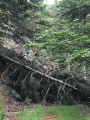
It’s best to avoid route 5 unless you’ve got a machete and a chainsaw, as you’ll find felled tree trunks and ferns blocking your path. I did manage to find my way through the barbed wire; there’s no need to climb over it
Take route 8 instead and brace yourself for the Battle of Britain, as you’ll be besieged by swarms of flies right up to route 7.
At route 7, try to note a few landmarks for the return journey, as there are no further signposts and it’s easy to lose your way. The summit is strewn with stones and branches, all covered in moss and very rich, dense vegetation; let’s avoid walking all over the place and twisting an ankle in the process.
All in all, I’m a bit disappointed with the section along the forest track. It would be better to set off from the pass and take the opportunity to stroll through the mountain pastures. If you’re travelling with children, you’ll get hot, as the altitude isn’t high enough to cool things down. From my point of view, it’s not as shady as you’d think, as the foresters cut down some large fir trees in early August.

Machine-translated

dani65
dani65

Overall rating : 2.7 / 5

Date of your route : Jul 18, 2020
Reliability of the description : ★☆☆☆☆ Very disappointing
Ease of following the route : ★★★☆☆ Average
Route interest : ★★★★☆ Good
Very busy route : No

Circular route. After point 4, DO NOT UNDER ANY CIRCUMSTANCES HEAD TOWARDS POINT 5. There are fences, including one towards the end which can only be crossed by climbing over it (barbed wire, etc.). The fern-covered area is very dense. The going is difficult as the ground is uneven. It’s a tick’s paradise. We came back with a whole brood of them. It’s best to carry on towards point 8, then follow the white fence to the summit. Return via the same route. Otherwise, it’s a pleasant, shaded walk.

Machine-translated

Other walks in the area

For more walks, use our search engine .

The GPS track and description are the property of this route's author. Please do not copy them without permission.