Refine your search for walks in Col d'Orgeval (1732m)
Randonnées Col d'Orgeval (1732m)


 The Col d'Orgeval
 Visorandonneur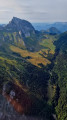
 6.19 mi
 +2,448 ft
 -2,448 ft
 5h 00
5h 00
 Moyenne
 Départ à École (Savoie)
The Col d'Orgeval is located on theGRP® trail in the Massif des Bauges. More than the pass or the chalets, it is the superb Orgeval valley with its gentle slopes that will remain in hikers' memories.
The mountain pasture is owned by the same family, who graze a pretty herd of heifers there.
Arcalod-Mont de la Coche circular from Bellevaux
 10.29 mi
+5,381 ft
-5,364 ft
8h
10.29 mi
+5,381 ft
-5,364 ft
8h
 Tres difficile
Départ à École (Savoie)
Tres difficile
Départ à École (Savoie)
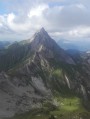
This is a beautiful circular that allows you to see three sides of Arcalod, climb to the summit via Orgeval and descend via a wilder route. It is a demanding but magnificent hike in good weather.
Please note that access to the Pointe d'Arcalod is not recommended with children or in wet weather.
Pointe d'Arcalod via the Chalets d'Orgeval
 7.21 mi
+3,999 ft
-3,999 ft
6h
Tres difficile
Départ à École (Savoie)
7.21 mi
+3,999 ft
-3,999 ft
6h
Tres difficile
Départ à École (Savoie)
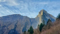
A beautiful, aerial and technical hike to climb to the highest point of the Bauges Massif (2,217 m).
Magnificent 360° panorama of the entire Bauges Massif and Mont Blanc.
Note on difficulty: following feedback from hikers, this hike has been classified as Very Difficult because the ascent and descent of the peak are quite technical.
Tour de l’Arcalod
18.64 mi
+6,283 ft
-6,293 ft
2 duration_days
 Difficile
Départ à École (Savoie)
Difficile
Départ à École (Savoie)
A two-day route around the Pointe d’Arcalod, the highest point in the Bauges, passing through unspoilt wilderness, valleys and rivers. The suggested route mainly follows the GR® de Pays Tour de l’Arcalod, marked in yellow and red. Spectacular views of the mountains and Lake Annecy. This wild and little-used route is mainly situated within a Regulated Sensitive Area.
Nant Fourchu stream car park – Chalets de l’Eau Froide
8.13 mi
+4,140 ft
-2,103 ft
7h 20
Tres difficile
Départ à École (Savoie)
First day of a two-day route around the Pointe d’Arcalod, the highest point in the Bauges, crossing wild areas, valleys and rivers. The proposed route mainly follows the eastern section of the GR® de Pays Tour de l’Arcalod, marked in yellow and red. Spectacular views of the mountains and Lake Annecy. This wild and little-used route is situated mainly within a sensitive, regulated area.The terrain is good and presents no particular difficulties.
Walks near Col d'Orgeval (1732m)
From the Baraque de l'Abbaye to the Chalet de l'Alpettaz
 9.20 mi
+3,583 ft
-2,201 ft
7h 20
Difficile
Départ à Seythenex (Haute-Savoie)
9.20 mi
+3,583 ft
-2,201 ft
7h 20
Difficile
Départ à Seythenex (Haute-Savoie)
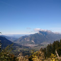
This hike takes you to the heart of the Faverges-Seythenex valley, following the Lac d'Annecy with the Torrent de Saint-Ruph, which is the lake's main source of water, ending with a view of Albertville and Mont Blanc at the Col de l'Alpettaz (alt. 1,580 m).
Chalets de l’Eau Froide – Stream Fourchu car park
10.52 mi
+2,142 ft
-4,190 ft
6h 40
Difficile
Départ à Giez (Haute-Savoie)
The second day of a two-day route around the Pointe d’Arcalod, the highest point in the Bauges, passing through wild areas, valleys and along rivers. The proposed route mainly follows the western section of the GR® de Pays Tour de l’Arcalod, marked in yellow and red. Spectacular views of the mountains and Lake Annecy. This wild and little-used route is situated mainly within a sensitive, regulated area. The terrain is good and presents no particular difficulties.
Le Trelod via Dent de Pleuven
 6.70 mi
+4,544 ft
-3,638 ft
7h 00
Tres difficile
Départ à Doucy-en-Bauges (Savoie)
6.70 mi
+4,544 ft
-3,638 ft
7h 00
Tres difficile
Départ à Doucy-en-Bauges (Savoie)
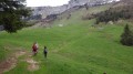
360° view of the Bauges Massif from the summit of Trélod.Arrange for a car at the finish point.
Combe refuge - Le Reposoir
 6.84 mi
+2,021 ft
-3,307 ft
4h 55
Moyenne
Départ à Chevaline (Haute-Savoie)
6.84 mi
+2,021 ft
-3,307 ft
4h 55
Moyenne
Départ à Chevaline (Haute-Savoie)
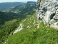
Second day of the hike: Around Charbon Mountain with a stop at Dent des Portes.
Le Reposoir - Refuge de la Combe
 3.14 mi
+1,719 ft
-436 ft
2h 55
Moyenne
Départ à Bellecombe-en-Bauges (Savoie)
3.14 mi
+1,719 ft
-436 ft
2h 55
Moyenne
Départ à Bellecombe-en-Bauges (Savoie)
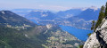
This hike can be done either:
- as a day trip,
- or as part of a longer hike (first stage of the circular route: Around Charbon Mountain). It was during this tour that it was completed.
From Albertville station to the Refuge du Soplat des Streams
 7.03 mi
+4,177 ft
-604 ft
6h 50
Difficile
Départ à Albertville (Savoie)
7.03 mi
+4,177 ft
-604 ft
6h 50
Difficile
Départ à Albertville (Savoie)
A lovely climb starting from Albertville, passing through the medieval town of Conflans and pretty mountain hamlets with views of the Tarentaise Valley, before reaching the Refuge du Soplat des Stream. The refuge is ideally located near the Tour du Beaufortain with a beautiful view of Albertville and the Olympic Park. Hike to be done from May to November: avalanche risk in winter above 1,100 metres.