The Semnoz

Crossing the Semnoz between the villages of Leschaux and Machevaz.

Details

62723
Creation:
Last update:
Last review:
  • Walking
    Activity: Walking
  • ↔
    Distance: 9.24 mi
  • ◔
    Average duration: 6h 25 
  • ▲
    Difficulty: Moderate

  • ⚐
    Back to start: No
  • ↗
    Ascent: + 2,513 ft
  • ↘
    Descent: - 3,406 ft

  • ▲
    Highest point: 5,564 ft
  • ▼
    Lowest point: 2,159 ft
  • ⚐ Country: France
  • ⚐
    Areas: Alps, Bauges
  • ⚐ City: Leschaux (74320)
  • ⚑
    Start: N 45.769572° / E 6.123334°
  • ⚑
    End: N 45.82799° / E 6.138161°
  • ❏
    IGN map(s): Ref. 3431OT, 3431OTR
  • Hour-by-hour weather

Photos

Description of the walk

Park in the car park at Leschaux Town Hall; a second vehicle should be left beforehand at the La Bergerie car park in Machevaz.

(S) From the car park, head up the street on the left until you reach the Col de Leschaux junction.

(1). Turn left into the narrow lane which leads onto a wide track. This track, marked RJ (Red-Yellow), forms part of theGRP® Tour du Lac d’Annecy route.
You’ll soon reach the footpath that continues from this track, and then begin the long climb. A series of hairpin bends takes you to the Route du Semnoz.

(2) Cross it at the 1,400-metre mark.
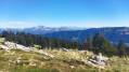
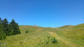
Then cross the Canadian gate opposite to enter the Semnoz mountain pasture; cross it for about 2 km before rejoining the D110 road.
Pass in front of the Chalet Nordique and reach the Crêt de Chatillon.

(3) Begin the descent towards the Hôtel du Semnoz.
To the left of the hotel, take the cross-country ski trail which forms part of theGRP®. Cross the road one last time, then continue the descent through the woods.
Reach the Chalet de Bénévent, still following the GRP®.

(4) At the chalet, where the paths cross, let theGRP® head off to the left and take the path on the right, signposted ‘La Bergerie’.
Stay on this path until you reach another junction at an altitude of 1050.

(5) Continue to the right towards La Bergerie.
You will then reach the La Bergerie car park (E), where you will find the second vehicle.

Waypoints

  1. S : mi 0 - alt. 3,051 ft - Leschaux Town Hall car park
  2. 1 : mi 0.68 - alt. 3,084 ft - Leschaux crossroads
  3. 2 : mi 1.95 - alt. 4,583 ft - Semnoz Route
  4. 3 : mi 3.62 - alt. 5,564 ft - Crêt de Chatillon
  5. 4 : mi 5.95 - alt. 4,419 ft - Chalet de Bénévent
  6. 5 : mi 7.48 - alt. 3,373 ft - Bergerie crossroads
  7. E : mi 9.24 - alt. 2,159 ft - La Bergerie car park

Notes

There are no water points on this route.
Refreshments are available at the summit of the Semnoz (Chalet Nordique and Hotel).
Standard hiking kit.
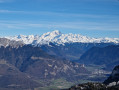
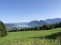
The Semnoz offers a remarkable view of the surrounding peaks, which you can explore at your leisure by following the directions on the two orienteering maps available at the summit.

This route passes through multiple protected areas, which may be subject to special regulations:

Worth a visit

The Bauges Massif with its traditional villages and dairy farms.
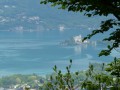
Annecy and its lake.

Reviews and comments

4.8 / 5
Based on 2 reviews

Reliability of the description
5 / 5
Ease of following the route
5 / 5
Route interest
4.5 / 5
jrcr
jrcr

Overall rating : 4.7 / 5

Date of your route : Jun 25, 2020
Reliability of the description : ★★★★★ Very good
Ease of following the route : ★★★★★ Very good
Route interest : ★★★★☆ Good
Very busy route : No

I just did the return trip from Leschaux to Semnoz, adding the Semnoz loop to it.
The route description is clear. It’s a pleasant walk through the woods with a good elevation gain.
Be careful on the descent – the rocks are slippery.

Machine-translated

Other walks in the area

For more walks, use our search engine .

The GPS track and description are the property of this route's author. Please do not copy them without permission.