Route in the footsteps of the Aubertière in Bazougers
This long circular route to the north of Bazougers will allow you to explore the Mayenne countryside whilst
walking along lovely greenways and sunken lanes.
Park in the car park by the lake in Bazougers (Route de Soulgé-sur-Ouette).
(S/E) Take the D20 (Route de Soulgé-sur-Ouette) on the right. At Chemin de Beausoleil, turn right onto it and follow it up to the high-speed rail line. Cross the railway bridge, pass the first track and then turn right onto the farm track.
(1) Follow the track for 500 m, then turn left. Continue straight on along this track until you reach the junction with the River Ouette.
(2) Turn right and carry on straight ahead until you reach the D281.
(3) There is an alternative route at this point (see ‘Practical information’). Otherwise, turn right onto this road and carry on until you reach the Rougeul cross. Turn left. Follow the track for 200 m, then turn right.
Continue to follow the paved road until you reach the junction with the track leading to Saint-Georges-le-Fléchard.
(4) Turn right and stay on the road until you cross the high-speed rail line. Once you’ve crossed the bridge, you’ll come to a junction.
(5) Take the wide path on the right. At the end, turn left and follow this road up to the Prieuré manor house, its final destination.
(6) At the Prieuré, turn left, then right at the first houses. Walk alongside the lake to reach the lake car park (S/E).
5 : mi 4.73 - alt. 331 ft - Junction after the high-speed rail line
6 : mi 6.4 - alt. 279 ft - The Priory
S/E : mi 6.79 - alt. 259 ft - Car park by the lake
Notes
At (4) in summer, you can go straight on for 100 m, then take the green path on the right. Once on the tarmac road, turn right.
Bazougers Town Hall – 1 bis Rue du Château, 53170 Bazougers // 02 43 02 31 86.
Restaurant: Le Menhir.
Toilets: town hall (behind the library), lakeside.
Worth a visit
Mounds of the ancient castle: situated on the edge of the cemetery, this feudal motte is 8 m high and 35 m in diameter. It formed part of an ancient medieval earthwork castle founded by Hamelin d’Anthenaise around 1080, which lost its military function during the Hundred Years’ War. The castle also included a bailey.
The Hune menhir: This menhir measures 5.60 metres and weighs approximately 36 tonnes. It bears witness to the presence of a settlement 2,000 years ago. Originally lying on the ground, it was the first centre of activity in Bazougers and was used as a grinding stone. The name ‘Hune’, of Celtic origin, means ‘raised’.
Saint-Victeur Church: The patron saint of this church was a4th-century bishop of Le Mans. The present building replaces an earlier one, first mentioned in 1097. Its plan is in the shape of a Latin cross and its style is transitional Romanesque. A crypt remains beneath the chancel, featuring a central pillar designed to support the vault.
Cotellerie Priory: Built between 1989 and 1994 in a austere, Romanesque-inspired architectural style, it is home to monks who follow the Rule of Saint Augustine. They have their own vegetable garden, a herd of cattle and beehives. Furthermore, the priory’s crypt is dedicated to the martyrs of the Revolution.
Reviews and comments
4.2 / 5
Based on 2 reviews
Reliability of the description 4.5 / 5
Ease of following the route 4 / 5
Route interest 4 / 5
User 28417824
Overall rating :
4 / 5
Date of your route : Feb 09, 2026 Reliability of the description : ★★★★☆ Good Ease of following the route : ★★★★☆ Good Route interest : ★★★★☆ Good Very busy route : Yes
Route corresponding to the route.
Fairly wet passage towards Ouette.
Machine-translated
PHISU53
Overall rating :
4.3 / 5
Date of your route : Apr 07, 2025 Reliability of the description : ★★★★★ Very good Ease of following the route : ★★★★☆ Good Route interest : ★★★★☆ Good Very busy route : Yes
Hello,
A lovely route, rarely used by motor vehicles, and peaceful for walking.
It might be best to avoid it during rainy winters, or during or after periods of heavy rain, particularly the sunken path section.
To open this route on your smartphone, you must have the Visorando app installed. If not, got to the Apple Store (iPhone) or Google Play Store (Android) to download the app.



 Country:
 City:
City:



 Tourist office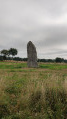
 Moderate
 Visorando Member