Landscapes and heritage in Saint-Denis-du-Maine

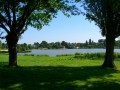
The Saint-Denis-du-Maine Landscape and Heritage Route will take you on a journey through the countryside of southern Mayenne. You’ll be able to enjoy the La Chesnaie lake in Saint-Denis-du-Maine (supervised swimming in July and August).
And to round off the day, why not have a go at Multigolf?

Details

n°409403
Creation:
Last update:
Last review:
  • Walking
    Activity: Walking
  • ↔
    Distance: 3.33 mi
  • ◔
    Average duration: 1h 35 
  • ▲
    Difficulty: Moderate

  • ⚐
    Back to start: Yes
  • ↗
    Ascent: + 26 ft
  • ↘
    Descent: - 26 ft

  • ▲
    Highest point: 259 ft
  • ▼
    Lowest point: 213 ft

Photos

Description of the walk

Starting from the church square.

(S/E) Facing the church, walk past it on the left until you reach a junction. There, turn left onto Rue de L’Ecrille. Follow this road for just over 250 metres.

(1) At the first junction, turn left. After just under 200 m, when the road bends to the left, turn right onto a tree-lined path. Continue straight ahead along this path.

(2) At the crossroads, turn right. After about 350 m, turn right onto a path that runs alongside the racecourse’s training track. Walk alongside a small copse on your right, come out onto a small road and follow it to the left.

(3) After the hamlet of La Talvasserie, take a path on the right and walk between the fields. You’ll come out onto a cycle path.

(4) Turn right and follow the track for about one kilometre to reach the Chesnaie lake near the Multigolf club.

(5) Turn right and walk along the lake on your left.

(6) At the campsite, take the path on the right. At the end, continue along a small street, Rue du Lavoir. At the first junction, turn right and you’ll reach the church square (S/E).

Waypoints

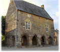
  1. S/E : mi 0 - alt. 233 ft - Église Saint-Denis (Saint-Denis-du-Maine)
  2. 1 : mi 0.17 - alt. 217 ft - Junction
  3. 2 : mi 0.74 - alt. 240 ft - Crossroads
  4. 3 : mi 1.7 - alt. 240 ft - Start of the footpath
  5. 4 : mi 2.03 - alt. 243 ft - Leisure trail
  6. 5 : mi 2.69 - alt. 220 ft - Plan d'eau de la Chesnaie
  7. 6 : mi 3.06 - alt. 220 ft - On the right at the campsite entrance
  8. S/E : mi 3.33 - alt. 233 ft - Église Saint-Denis (Saint-Denis-du-Maine)

Worth a visit

La Chesnaie lake (supervised swimming in July/August)
Swingolf and footgolf near La Chesnaie lake: Worth a visit

Reviews and comments

4.7 / 5
Based on 1 review

Reliability of the description
5 / 5
Ease of following the route
5 / 5
Route interest
4 / 5
JeanChrist49
JeanChrist49

Overall rating : 4.7 / 5

Date of your route : Feb 03, 2020
Reliability of the description : ★★★★★ Very good
Ease of following the route : ★★★★★ Very good
Route interest : ★★★★☆ Good

Another lovely route, despite some flooded sections.

Machine-translated

Other walks in the area

For more walks, use our search engine .

The GPS track and description are the property of this route's author. Please do not copy them without permission.