The Menhir de la Hune route in Bazougers

The Bazougers circular loop, which will allow you to explore the Mayenne countryside.

Details

210565
Creation:
Last update:
Last review:
  • Walking
    Activity: Walking
  • ↔
    Distance: 10.02 mi
  • ◔
    Average duration: 4h 40 
  • ▲
    Difficulty: Moderate

  • ⚐
    Back to start: Yes
  • ↗
    Ascent: + 98 ft
  • ↘
    Descent: - 98 ft

  • ▲
    Highest point: 331 ft
  • ▼
    Lowest point: 223 ft
  • ⚐ Country: France
  • ⚐ City: Bazougers (53170)
  • ⚑
    Start/End: N 48.016707° / W 0.581165°
  • ❏
    IGN map(s): Ref. 1519SB
  • Hour-by-hour weather

Photos

Description of the walk

Start from the church square in Bazougers.

(S/E) With your back to the church, cross the D130 and walk across the car park of the community hall (to the right of the hairdresser’s) to reach Rue d’Arquenay. There, turn left and continue straight on until you reach a wayside cross (on the right). Carry on straight ahead and, after about 500 metres, the road curves to the right and you’ll come to a three-way junction. Stay on the D282, veering slightly to the right.

(1) Continue along the D282 for about 1.2 km and, a few dozen metres past the turn-off for the hamlet of La Grulière (on the left), turn right onto the tree-lined stony track opposite a wayside cross (on the left).

(2) Continue along this track for about 1.7 km until you reach a junction with the D20. Cross it (take care, as it’s a busy road) and turn onto the small tarmac road situated opposite, slightly to the left, near the wayside cross. Continue straight on for 2.4 km until you reach a farm in the hamlet of La Grande Andouérie.

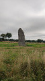
(3) The road veers to the right; follow it for 1.6 km until you reach a junction with another small tarmac road (C2). Just before this junction, in the field on the right, you’ll see the Menhir de la Hune.

(4) At the junction, turn right onto the tarmac road and continue along it for about 3.8 km until you reach the junction with the D 20 (a ‘give way’ sign on the right and a wayside cross on the left).

(5) Turn left towards the village of Bazougers and continue straight on for 700 metres.

(6) Turn right onto the Route de Beau Soleil and continue straight on until you reach the hamlet of La Gandonnière.

(7) Turn right onto the grassy, tree-lined track just after the “Le Clos du Maine” horse stud. Continue for 700 metres until you reach the junction with the D281 at the hamlet of Les Fillerons.

(8) Turn right and continue along the D281 for 600 metres, then turn left at the “Chambres d’Hôtes de la Houzardière”, situated on the right. Follow this road for 350 metres, then turn right onto the stony farm track between two fields until you reach a junction with the D130 after approximately 300 metres.

(9) Turn right and continue straight on for 850m to reach the village and the church square (S/E).

Waypoints

  1. S/E : mi 0 - alt. 272 ft - Church Square
  2. 1 : mi 0.5 - alt. 272 ft - Wide bend on the D 282
  3. 2 : mi 1.21 - alt. 315 ft - La Grulière, wayside cross
  4. 3 : mi 3.74 - alt. 328 ft - La Grande Andouérie hamlet
  5. 4 : mi 4.73 - alt. 236 ft - Menhir de la Hune junction
  6. 5 : mi 7.07 - alt. 282 ft - D20
  7. 6 : mi 7.49 - alt. 269 ft - Route de Beau Soleil
  8. 7 : mi 8.27 - alt. 289 ft - La Gandronnière / Horse farm
  9. 8 : mi 8.71 - alt. 305 ft - D281
  10. 9 : mi 9.51 - alt. 279 ft - D130
  11. S/E : mi 10.02 - alt. 272 ft - Church Square

Notes

Parking spaces are available near the church, the start and finish point of the walk. In the village, you will also find a bakery, a bar and a bar-restaurant.

Alternative route: you can shorten the 4.5 km route by heading straight to the church square after (5).

Worth a visit

Reviews and comments

4.4 / 5
Based on 3 reviews

Reliability of the description
4.7 / 5
Ease of following the route
5 / 5
Route interest
3.7 / 5
User 16706648

Overall rating : 4.3 / 5

Date of your route : Feb 20, 2023
Reliability of the description : ★★★★☆ Good
Ease of following the route : ★★★★★ Very good
Route interest : ★★★★☆ Good
Very busy route : No

A long drive

Machine-translated

Yopinet
Yopinet

Overall rating : 4.3 / 5

Date of your route : Aug 13, 2021
Reliability of the description : ★★★★★ Very good
Ease of following the route : ★★★★★ Very good
Route interest : ★★★☆☆ Average
Very busy route : No

A well-signposted route, with no difficulties whatsoever. Far too much tarmac for my liking.

Machine-translated

Bulawiniec
Bulawiniec

Overall rating : 4.7 / 5

Date of your route : Jun 01, 2017
Reliability of the description : ★★★★★ Very good
Ease of following the route : ★★★★★ Very good
Route interest : ★★★★☆ Good

An easy walk. No difficulties. The bar-restaurant on the church square in Bazougers is a pleasant way to round off this walk.

Machine-translated

Other walks in the area

For more walks, use our search engine .

The GPS track and description are the property of this route's author. Please do not copy them without permission.