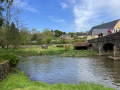
The Rochers Route in La Bazouge-de-Chemeré

Ideal for a family walk with children, this short circular walk will introduce you to the
of the local flora and fauna, particularly as you walk along the banks of the Vaige.

  • You can combine this route with route no. 5.

Details

208242
Creation:
Last update:
Last review:
  • Walking
    Activity: Walking
  • ↔
    Distance: 3.72 mi
  • ◔
    Average duration: 1h 50 
  • ▲
    Difficulty: Easy

  • ⚐
    Back to start: Yes
  • ↗
    Ascent: + 102 ft
  • ↘
    Descent: - 105 ft

  • ▲
    Highest point: 328 ft
  • ▼
    Lowest point: 217 ft

Description of the walk

From Meslay-du-Maine, take the D152 towards St-Denis-du-Maine, then on to La Bazouge-de-Chemeré. Park in the village hall car park.

(S/E) Turn left onto the main road (D130) towards Place de l’Église. Continue straight on along Rue du Porche. Turn left onto Rue de la Sablonnière, then right towards the lake. After the bridge, take the right-hand lane and follow the riverbank until you cross the footbridge over the Vaige. Head back up towards the road.

(1) Exit onto the D130. Turn left and head up the road, ignoring the first path on the left, then take the next one, opposite the two towers at the hamlet of La Cour. Turn right onto the tarmac road, then
turn right again at the three-way junction.

(2) Follow the green path uphill. At the tarmac path, first turn right then left to join the green path.
At the junction, turn left until you reach the tarmac track. Turn left and you’ll come to a crossroads.

(3) Turn right and head towards the hamlet known as La Basse-Chauvière before turning right again. Continue straight on to La Touche, then turn left and follow the track uphill. At the junction, turn left again and you’ll come to a second junction.

(4) Turn left again and head down the road until you rejoin the D130.

(5) Turn right onto Rue de l’Étang, then head towards the church square. Finally, take Rue du Porche
to rejoin the D130 and return to the car park where you started (E).

Waypoints

  1. S/E : mi 0 - alt. 269 ft - Car park at the village hall - église de la Bazouge-le-Chémeré
  2. 1 : mi 0.45 - alt. 236 ft - Take the D130 - Vaige (rivière)
  3. 2 : mi 0.85 - alt. 302 ft - Greenway
  4. 3 : mi 1.79 - alt. 299 ft - La Basse-Chauvière
  5. 4 : mi 2.74 - alt. 318 ft - Turn left and follow the road down to the D130
  6. 5 : mi 3.37 - alt. 246 ft - Turn right, then take Rue de l’Étang - église de la Bazouge-le-Chémeré
  7. S/E : mi 3.72 - alt. 272 ft - Car park at the village hall

Notes

The start and finish are at the village hall (to the right of the “Petit Comptoir” restaurant).

La Bazouge de Chémeré Town Hall – 1 rue du Pont, 53170 La Bazouge de Chémeré // 02 43 90 51 07

Restaurant: Le Petit Comptoir

Toilets: near the town hall, by the lake and in the courtyard behind the village hall

Worth a visit

Sensitive Natural Area: A veritable treasure trove of open-air ecosystems, this area, situated near the
lake and the River Vaige, is home to an exceptional collection of dry limestone grasslands and wetlands,
as well as a variety of species: orchids, newts, butterflies, passerines, swifts, common vipers,
toads…

Lime kilns: Cylindrical in shape, these were used to produce lime by calcining limestone quarried from nearby quarries. Temperatures reached over 900 °C! The resulting lime was used on the fields to make them more fertile.

Church: Built in the 12th century, it is dedicated to Saint Gervais and Saint Protais. It houses beautiful 17th-century tuffeau stone altarpieces, as well as murals, including the ‘Dict des trois morts et des trois vifs’ (1585), which is unique in Mayenne.

Reviews and comments

4.2 / 5
Based on 3 reviews

Reliability of the description
4.3 / 5
Ease of following the route
4 / 5
Route interest
4.3 / 5
User 27995247

Overall rating : 4 / 5

Date of your route : Feb 09, 2026
Reliability of the description : ★★★★☆ Good
Ease of following the route : ★★★★☆ Good
Route interest : ★★★★☆ Good
Very busy route : Yes

Very good route

Machine-translated

yadwigha
yadwigha

Overall rating : 4 / 5

Date of your route : Mar 28, 2021
Reliability of the description : ★★★★☆ Good
Ease of following the route : ★★★★☆ Good
Route interest : ★★★★☆ Good
Very busy route : No

A varied and enjoyable route… with no problems.

Machine-translated

tournesol20
tournesol20

Overall rating : 4.7 / 5

Date of your route : Aug 12, 2017
Reliability of the description : ★★★★★ Very good
Ease of following the route : ★★★★☆ Good
Route interest : ★★★★★ Very good

It was a lovely walk, but we took a slight wrong turn 300 metres after setting off. And actually, we ended up doing the route… the wrong way round…!!! It’s no big deal, though. We still had a very pleasant walk in the sunshine. Thank you.

Machine-translated

Other walks in the area

For more walks, use our search engine .

The GPS track and description are the property of this route's author. Please do not copy them without permission.