The ‘Vert Pâtis – Maisoncelles du Maine’ walking route

The Maisoncelles-du-Maine walking route will take you on a tour of the countryside around this small village in southern Mayenne. At the start of the route, you can visit the astronomical observatory.

Details

n°410525
Creation:
Last update:
Last review:
  • Walking
    Activity: Walking
  • ↔
    Distance: 8.34 mi
  • ◔
    Average duration: 4h 05 
  • ▲
    Difficulty: Moderate

  • ⚐
    Back to start: Yes
  • ↗
    Ascent: + 272 ft
  • ↘
    Descent: - 266 ft

  • ▲
    Highest point: 331 ft
  • ▼
    Lowest point: 197 ft

Photos

Description of the walk

From Entrammes, take the D233 to the village of Maisoncelles-du-Maine. Park in the car park by the Salle des Fêtes.

(S/E) Take the path towards the observatory and walk round the pond. Cross the footbridge, then turn right onto the road (Rue d’Anjou) to reach the church.

(1) Turn left towards the north-west onto Rue de Bretagne. Follow this road to the cross and continue straight on to the next junction.

(2) Turn left, reach a three-way junction and take the right-hand lane. Continue straight on, then turn right at the first junction onto a tree-lined path opposite the buildings on the left-hand side of the road at a place called Les Ponts Lochard. Follow this path until it joins a small tarmac road at a bend near a place called Bel-Air.

(3) Turn left onto this small road, then carry on straight ahead to join another tree-lined track. You’ll come out onto the D23; turn left. Ignore the first track on the right and take the second one.

(4) Turn right onto the gravel track just after the hamlet of Sauloup. Cross the stream and begin the climb. The gravel track takes a 90° bend to the right; follow it. You will then pass a first farm on the right, then a second on the left, before reaching a three-way junction.

(5) Take the left-hand track. After just under 300 m, the road curves to the left and a track branches off straight ahead. Take this track and follow it until it joins a small tarmac road at the hamlet of Le Rocheray.

(6) Turn left, then immediately right onto a country lane. This lane curves to the left and a path branches off straight ahead: take this path and continue straight on, leaving the buildings at the hamlet of La Biottière on your left, until you come out onto a small tarmac road. Carry on straight ahead along this road until you reach a junction with another tarmac road after the hamlet of La Beuchetière.

(7) Turn right onto the road and continue to the hamlet of Le Grand-Aulnay, situated on the right-hand side of the road: please note that on the map it is marked as “Grand Aunay”.

(8) Just as you reach Le Grand Aulnay, a stony track branches off to the left. Take this track and carry on straight ahead until you come to a small tarmac road at the hamlet of Les Sinandières. Carry on straight ahead until you reach a junction with another tarmac road.

(9) At the junction, turn right to reach another junction with a wayside cross opposite.

(10) Turn left to head north-east and, after 25 m, turn off onto a tree-lined track branching off to the right: please note, this track is not shown on the map. Carry on straight ahead until you reach a T-junction with another track. Follow this track to the right until the first junction.

(11) Turn right, then turn left at the farm in the hamlet of La Rouillère to come out onto a small tarmac road. Turn right to reach the village, pass the cemetery on your right and return to the starting point (S/E).

Waypoints

  1. S/E : mi 0 - alt. 289 ft - Car park at the village hall
  2. 1 : mi 0.47 - alt. 285 ft - Church of Maisoncelles-du-Maine
  3. 2 : mi 1.29 - alt. 292 ft - Turn left
  4. 3 : mi 2.18 - alt. 279 ft - Bel-Air
  5. 4 : mi 2.66 - alt. 217 ft - Gravel path on the right
  6. 5 : mi 3.38 - alt. 279 ft - Turn left at the three-way junction
  7. 6 : mi 3.84 - alt. 276 ft - Le Rocheray
  8. 7 : mi 4.47 - alt. 302 ft - Junction with a road after La Beuchetière
  9. 8 : mi 5.03 - alt. 295 ft - Grand Aulnay, on the left
  10. 9 : mi 6.15 - alt. 312 ft - On the right, at the junction - Juigné (ruisseau) - Affluent du Ruisseau des Tremblaies
  11. 10 : mi 6.72 - alt. 331 ft - Turn left, then immediately right
  12. 11 : mi 7.48 - alt. 312 ft - Turn right towards La Rouillère
  13. S/E : mi 8.34 - alt. 289 ft - Car park at the village hall

Notes

Nearby restaurants and bars: Le Café de la Place in Villiers-Charlemagne, Les Gourmets du Maine in Bignon-du-Maine.
Toilets: town centre.

Worth a visit

Astronomical observatory: the site features a 360° rotating dome, as well as three sundials.
It is run by the astronomy group of ‘Mayenne Nature Environnement’, which organises
star-gazing evenings several times a year.

Saint-Pierre Church: the oldest parts of the church date from the 10th century, including the nave, but it
was partly destroyed in 1804 in a fire started by the Chouans. Sainte-Emérentienne,
the town’s second patron saint, is invoked here for the healing of stomach ailments.

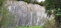
Quarries: the quarries at Maisoncelles-du-Maine are operated by SA Baglione. Various
types of sand and gravel are extracted there. The process involves several stages: extraction by
dredging, followed by processing involving drying, screening and bagging. The route offers some lovely views
of the quarries.

Jupellière Chapel: situated on the Jupellière estate, it served as a place of worship during the
Revolutionary period. Within the walls of this sanctuary, the refractory priest François Huchedé celebrated
numerous religious ceremonies between 1792 and 1798.

Reviews and comments

4 / 5
Based on 2 reviews

Reliability of the description
5 / 5
Ease of following the route
3 / 5
Route interest
4 / 5
Bella
Bella
• Edited:

Overall rating : 3.3 / 5

Date of your route : Nov 19, 2022
Reliability of the description : ★★★★★ Very good
Ease of following the route : ★☆☆☆☆ Very disappointing
Route interest : ★★★★☆ Good
Very busy route : Yes

The map isn’t clear, even when printed on a professional printer.
The directional signs haven’t been put up along the entire route!!! Halfway round the route there were none left, so it was hard to know where to go. Fortunately, we came across someone from the local council, who confirmed that half the signs were missing and that lots of people had been complaining, but nothing had been done about it.

Machine-translated

Lolo53
Lolo53
• Edited:

Overall rating : 4.7 / 5

Date of your route : Jan 23, 2022
Reliability of the description : ★★★★★ Very good
Ease of following the route : ★★★★★ Very good
Route interest : ★★★★☆ Good
Very busy route : No

First walk with Visorando – the GPS mode works perfectly: a useful addition to this well-signposted route where there’s little risk of getting lost. The walk is nice but not magical (a few muddy sections, but passable).

Machine-translated

Other walks in the area

For more walks, use our search engine .

The GPS track and description are the property of this route's author. Please do not copy them without permission.