Country:
 City:
City:


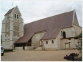
(S/E) From the Town Hall square, set off from the map display between the church and the town hall towards the children’s playground behind the school. You’ll enjoy the shade of an avenue of hundred-year-old lime trees. At the end of the avenue, turn left onto Rue du Prieuré.
(1) At the crossroads, cross through the shade of the woodland and turn right along the road leading to Langey.
(2) At the next crossroads, take the ‘Chemin forestier du Pendu’, which runs alongside the Bois des Plants.
(3) At the crossroads, turn left onto the path that runs between the two copses known as ‘La remise aux pies’ and ‘La remise Gaston’. Continue until you reach the D363.6.
(4) Walk along the road on the right, then take the forest track on the left which leads into the Bois du Jard to reach the Cité Taupineau.
(5) After a short stretch through the village of Cloyes-sur-le-Loir, you’ll reach the Chemin des Longères (GR®655) and its shaded areas along the banks of the Loir. Then head up the hillside alongside the Ravin de l’Abîme, where the atmosphere becomes rather gloomier. You’ll pass close to some ancient caves that are home to a large number of bats.
(6) Then turn left at the crossroads, after passing under the bridge, to return to the Bois du Jard.
(7) Turn right onto a picturesque, stony sunken path which leads out onto a clearing known as ‘Derrière la Motte’. A few hundred metres along the road or through the undergrowth opposite, and the first signs of the old village and the Basse-Cour farm are already visible.
(1) When you reach the crossroads, turn right facing the Château de Montigny-le-Gannelon, then take the first left to return to the town hall square (S/E).

 Visorando Member

 Association / Club / Walk leader
 Difficult
  Tourism professional
 Moderate
  Tourist office