Route de Montigny-le-Gannelon pour les cerfs

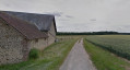
This route will allow you to explore the northern and north-eastern parts of the village. The route is signposted throughout with the image of a roe deer.

Details

1492122
Creation:
Last update:
Last review:
  • Walking
    Activity: Walking
  • ↔
    Distance: 3.74 mi
  • ◔
    Average duration: 1h 45 
  • ▲
    Difficulty: Easy

  • ⚐
    Back to start: Yes
  • ↗
    Ascent: + 56 ft
  • ↘
    Descent: - 56 ft

  • ▲
    Highest point: 486 ft
  • ▼
    Lowest point: 400 ft

Photos

Description of the walk

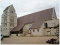
Starts from the Town Hall Square.
Yellow Route.

(S/E) Set off from the map display between the church and the town hall towards the children’s playground behind the school. You’ll enjoy the shade of an avenue lined with hundred-year-old lime trees. At the end of the avenue, turn left onto Rue du Prieuré.

(1) At the crossroads, cross through the shade of the woodland to turn right along the road leading to Langey.

(2) At the next crossroads, head towards La Proutière on the right.

(3) When you reach the farm, watch out for the dog – it barks to make its presence known but isn’t dangerous. Pass the farm, carry on straight ahead and enter the Bois de Montigny.

(4) Leave the woods, walk alongside the old football pitch—now converted into a dog training ground—then cross the road leading to the water tower (you’ll see it on your right) to head towards Les Gâts.

(5) At the end of the lane, turn right, then, at the end of the path, turn right again to join Rue du Rempart. Continue straight on to the end of the street. Cross Rue de Bel Air to head in the opposite direction.

(6) Take the path on the left which runs between the field and the fenced-off gardens. When you reach Rue du Vivier, turn left, then right onto Rue des Écoles.

(7) Walk round the town hall to return to the square (S/E).
Waypoints

  1. S/E : mi 0 - alt. 456 ft - Town Hall Square - Église Saint-Sauveur - Saint-Gilles
  2. 1 : mi 0.16 - alt. 469 ft - At the crossroads, turn right
  3. 2 : mi 0.41 - alt. 476 ft - Route de la Proutière
  4. 3 : mi 0.95 - alt. 479 ft - La Proutière Farm
  5. 4 : mi 1.98 - alt. 476 ft - Educdog28
  6. 5 : mi 2.26 - alt. 430 ft - Les Gâts and the Rempart
  7. 6 : mi 3.46 - alt. 463 ft - Along the field
  8. 7 : mi 3.69 - alt. 453 ft - Town Hall
  9. S/E : mi 3.74 - alt. 456 ft - Town Hall Square - Église Saint-Sauveur - Saint-Gilles

Notes

- No particular difficulties.
- Parking available at the starting point.

Worth a visit

Reviews and comments

4.7 / 5
Based on 2 reviews

Reliability of the description
5 / 5
Ease of following the route
5 / 5
Route interest
4 / 5
randonnee76
randonnee76

Overall rating : 5 / 5

Date of your route : Sep 16, 2024
Reliability of the description : ★★★★★ Very good
Ease of following the route : ★★★★★ Very good
Route interest : ★★★★★ Very good
Very busy route : Yes

A very pretty village well worth a visit, with a square behind the church where you can have a picnic.
The scenery is varied.
I preferred to set off from the large car park near the lakes; the climb up to the village is a bit steep, but it gives you a better view of the village.

Machine-translated

LL04
LL04

Overall rating : 4.3 / 5

Date of your route : Aug 10, 2024
Reliability of the description : ★★★★★ Very good
Ease of following the route : ★★★★★ Very good
Route interest : ★★★☆☆ Average
Very busy route : No

When I read the details of this walk, I was really looking forward to doing it.
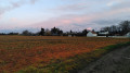
The woodland and fields we passed through were quite pleasant, but nothing out of the ordinary. Overall, I was disappointed with this walk.
On the other hand, the signposting is very good

Machine-translated

Other walks in the area

For more walks, use our search engine .

The GPS track and description are the property of this route's author. Please do not copy them without permission.