The watermills of Châteaudun

Between Beauce and Perche, the upper Loir Valley leads you along paths and trails to discover its contrasting landscapes, history and traditions. Among these, the presence of watermills bears witness to one of the main industries that flourished in Châteaudun from the 13th century onwards.

Details

n°2877434
Creation:
Last update:
Last review:
  • Walking
    Activity: Walking
  • ↔
    Distance: 6.32 mi
  • ◔
    Average duration: 3h 00 
  • ▲
    Difficulty: Easy

  • ⚐
    Back to start: Yes
  • ↗
    Ascent: + 135 ft
  • ↘
    Descent: - 135 ft

  • ▲
    Highest point: 486 ft
  • ▼
    Lowest point: 344 ft
  • ⚐ Country: France
  • ⚐ City: Châteaudun (28200)
  • ⚑
    Start/End: N 48.071618° / E 1.324081°
  • ❏
    IGN map(s): Ref. 2018SB, 2019SB
  • Hour-by-hour weather

Photos

Description of the walk

Starting point: Les Grands Moulins car park.

(S/E) Head towards the canoe and kayak centre, walk alongside it and take the footbridge crossing the River Loir. Continue along a path which soon turns left.

(1) You’ll come out onto Rue des Poulies; follow it to the right. When the street bends to the left, take a path on the right. The path soon bends to the left and runs alongside some gardens. At the stop sign, turn left.

(2) At the T-junction, turn right onto Rue de Chollet. Ignore the turn-offs to the right and walk past the campsite and the Moulin à Tan.

(3) Take the footbridge crossing a tributary of the Loir and continue for a few dozen metres along a path. At the T-junction, first turn left then right to follow a path that goes uphill.

(4) At the crossroads, turn right and walk alongside a sports ground. At the next junction, take the first turn left then right to follow Rue de Tarragon. Take thefirst right towards Bois des Gâts. Cross the bridge over the D9990.

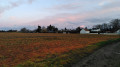
(5) Shortly after the bridge, turn into thefirst track on the left, then immediately right. Cross the plain, heading north-west.

(6) At the crossroads, turn left and enter the village of Châtenay. In the centre, first turn right then left and follow the D111.13.

(7) Follow the D955 to the right. Take thefirst small road on the left, which leads to La Triquetière (take care when crossing the D955). At the hamlet, take thefirst track on the left, head due south and follow the edge of the woods.

(8) At the junction, veer left and carry on straight ahead (south-east). Pass the hamlet of La Malassise and continue along the road, still heading in the same direction.

(9) At the end, turn left, cross the Route de Brou (take care) and continue along the path opposite, set back to the right. Walk behind the houses. At the end of the path, first turn left then right and follow Rue Saint-Jean, continuing in the same direction until you reach Saint-Jean Church.

(10) At the junction near the church, veer to the right, then turn right onto Rue de l’Église. At the T-junction, turn left onto Route de Brou.

(11) At the roundabout, go straight on and cross the bridge over the secondary branch of the River Loir. Continue straight on and cross the main branch of the River Loir. Immediately afterwards, turn left to quickly return to the Grands Moulins car park (S/E).

Waypoints

  1. S/E : mi 0 - alt. 351 ft - Les Grands-Moulins car park
  2. 1 : mi 0.17 - alt. 351 ft - Rue des Poulies
  3. 2 : mi 0.61 - alt. 351 ft - Rue de Chollet
  4. 3 : mi 0.99 - alt. 348 ft - Footbridge over a branch of the - Loir (rivière)
  5. 4 : mi 1.42 - alt. 384 ft - Crossroads
  6. 5 : mi 2.11 - alt. 413 ft - Les Gâts
  7. 6 : mi 2.99 - alt. 463 ft - Crossroads
  8. 7 : mi 3.58 - alt. 482 ft - D995 road
  9. 8 : mi 4.4 - alt. 476 ft - Crossroads
  10. 9 : mi 5.28 - alt. 413 ft - T-junction
  11. 10 : mi 5.76 - alt. 374 ft - Saint-Jean Church
  12. 11 : mi 5.97 - alt. 348 ft - Roundabout
  13. S/E : mi 6.32 - alt. 351 ft - Les Grands-Moulins car park

Worth a visit

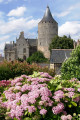
Châteaudun is built on a promontory and the castle overlooks the Loir valley.
Several watermills were situated on the River Loir. There were four in total: La Boissière, Les Grands-Moulins on the main branch of the Loir, and the mills at Tan and Chollet on the smaller branch of the Loir.
They were used in turn as flour mills, fulling mills and tanning mills.

On the suggested route, you will be able to see:
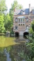
The industrialtanning mill, situated on the Chollet branch. The bark of deciduous trees, ground by the wheels of the tanning mill, was used to tan sheepskins, which were employed in the flourishing cloth and leather manufacturing industry from the 15th to the 18th century. These activities are reflected in a number of street names: ‘Poulies’, ‘Fouleries’ and ‘Cuirasserie’.
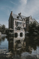
Les Grands Moulins: this is a former traditional wheat mill, once owned by the Duke of Luynes, which now houses a lodge and the canoe and kayak club.

Reviews and comments

4.2 / 5
Based on 2 reviews

Reliability of the description
4.5 / 5
Ease of following the route
4.5 / 5
Route interest
3.5 / 5
Alex Jauneau
Alex Jauneau

Overall rating : 4 / 5

Date of your route : Nov 30, 2021
Reliability of the description : ★★★★☆ Good
Ease of following the route : ★★★★☆ Good
Route interest : ★★★★☆ Good
Very busy route : No

A pleasant route starting from the château, following the River Loir and its mills; a misreading of the map took me as far as the Bois des Gats along the banks of the Loir, but we were able to rejoin the path to Chatenay in the lowlands, where the scenery was less picturesque
The 300-metre stretch along the A-road should be tackled with caution as it’s a very busy road; the return journey towards St Jean offers a superb view of the castle, even though the weather wasn’t on our side
Total distance, including this short detour: 10.5 km

Machine-translated

Coco Link
Coco Link

Overall rating : 4.3 / 5

Date of your route : Dec 23, 2020
Reliability of the description : ★★★★★ Very good
Ease of following the route : ★★★★★ Very good
Route interest : ★★★☆☆ Average
Very busy route : No

Nice for the first part of the walk, but less interesting after that.

Machine-translated

Other walks in the area

For more walks, use our search engine .

The GPS track and description are the property of this route's author. Please do not copy them without permission.