Around Bois Bertrand

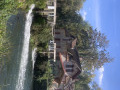
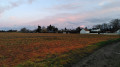
Near Châteaudun, this route takes you through the woods along a lovely little road where you might spot a few roe deer or other wildlife.

Details

n°24186336
Creation:
Last update:
Last review:
  • Walking
    Activity: Walking
  • ↔
    Distance: 6.88 mi
  • ◔
    Average duration: 3h 15 
  • ▲
    Difficulty: Moderate

  • ⚐
    Back to start: Yes
  • ↗
    Ascent: + 98 ft
  • ↘
    Descent: - 98 ft

  • ▲
    Highest point: 515 ft
  • ▼
    Lowest point: 404 ft
  • ⚐ Country: France
  • ⚐ City: Lanneray (28200)
  • ⚑
    Start/End: N 48.087221° / E 1.240157°
  • ❏
    IGN map(s): Ref. 2018SB, 2019SB
  • Hour-by-hour weather

Description of the walk

Parking is available around the church.

(S/E) From the church, head right onto the D23 (Rue de la Mairie) and take the first left onto the D111 (Route des Bois) to cross the woods. You will eventually reach a crossroads.

(1) At this junction, turn right onto the D23.1 and take the first track on the right.

(2) In Vilquier, continue along the track to the right through the hamlet, running parallel to the D927. At the end of the track, follow the D927 to the right for approximately 400 metres.

(3) Take the first road on the right towards Touchémont (D 111.14). At the second junction, turn onto the track on the right.

(4) At the edge of the woods, take the track on the left until you reach the D23.

(5) Turn right onto this road, then take the first track on the left. Pass close to Lamare.

(6) Turn onto the small road on the right, join the D1111.3, continue straight ahead, then turn right.

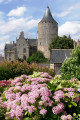
(7) Turn left onto the D111, then right at the edge of the woods. Pass Château Sainte-Raguedonde on your left. Continue to a crossroads.

(8) Turn right. At the entrance to Lanneray, turn right onto Rue de l’Oiselière, then left towards the church via Rue de l’Église to reach the car park (S/E).

Waypoints

  1. S/E : mi 0 - alt. 486 ft - Église Sant-Pierre (Lanneray)
  2. 1 : mi 1.73 - alt. 486 ft - Junction with the D23.1
  3. 2 : mi 2.6 - alt. 469 ft - Vilquier
  4. 3 : mi 3.5 - alt. 486 ft - Road D111.14
  5. 4 : mi 4.08 - alt. 456 ft - Edge of the woodland
  6. 5 : mi 4.51 - alt. 482 ft - D23 road
  7. 6 : mi 5.35 - alt. 505 ft - Junction after Lamare
  8. 7 : mi 5.82 - alt. 512 ft - D111 road
  9. 8 : mi 6.34 - alt. 502 ft - Junction on the path
  10. S/E : mi 6.88 - alt. 486 ft - Église Sant-Pierre (Lanneray)

Notes

This route was developed in collaboration with the Eure-et-Loir Departmental Hiking Committee. Follow the yellow markings.

Worth a visit

Cultural site: the Jardin de la Duchaylatière, created by Jean-Pierre Coffe.

Reviews and comments

5 / 5
Based on 1 review

Reliability of the description
5 / 5
Ease of following the route
5 / 5
Route interest
5 / 5
Francoise 28
Francoise 28

Overall rating : 5 / 5

Date of your route : Feb 24, 2025
Reliability of the description : ★★★★★ Very good
Ease of following the route : ★★★★★ Very good
Route interest : ★★★★★ Very good
Very busy route : Yes

A good route, but a bit too much tarmac.
A pleasant ride.

Machine-translated

Other walks in the area

For more walks, use our search engine .

The GPS track and description are the property of this route's author. Please do not copy them without permission.