The Talhouët Route in Hennebont

Walking the Talhouët route takes you through the heart of medieval alleyways and along the River Blavet, through woods and into Kerbihan Park, through the housing estates and into the heart of the town rebuilt after the war. These are all opportunities to discover the rich and turbulent history of Hennebont, a strategic location in the Blavet estuary.

Details

60363494
Creation:
Last update:
Last review:
  • Walking
    Activity: Walking
  • ↔
    Distance: 4.87 mi
  • ◔
    Average duration: 2h 25 
  • ▲
    Difficulty: Easy

  • ⚐
    Back to start: Yes
  • ↗
    Ascent: + 236 ft
  • ↘
    Descent: - 233 ft

  • ▲
    Highest point: 141 ft
  • ▼
    Lowest point: 10 ft
  • ⚐ Country: France
  • ⚐ City: Hennebont (56700)
  • ⚑
    Start/End: N 47.805709° / W 3.27745°
  • ❏
    IGN map(s): Ref. 0720ET, 0820SB
  • Hour-by-hour weather

Photos

Description of the walk

Parking available in Hennebont town centre. Bus stop at Place Foch nearby. Hennebont town centre, Place Mourdiah (please note: blue zone).

(S/E) Head towards the Puits Ferré (dating from 1623) on your left as you leave the car park. Turn left and continue to the Porte Broërec.

(1) Next, go straight on, then head down the street on the left. Turn right twice, then left onto Rue Anne. Continue straight on along Rue Capitaine. Admire the mansions and the former Maison du Sénéchal near the theatre. Cross the square and continue straight ahead, then turn left onto the footpath, passing the Lycée Notre-Dame du Vœux and the Tour des Carmes.

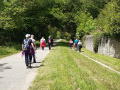
(2) Carry on straight ahead and admire the view over the Blavet estuary (signs on site). Head down to the left towards the Blavet, passing close to the wash house, and follow the towpath to the right. Continue to the Bergerie, walking alongside the walls of the stud farm and the former abbey. Admire the Maison des Confesseurs.

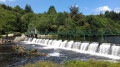
(3) After the car park, continue to the right along the track running parallel to the towpath (former railway line), ignoring any junctions. Pass the quarry buildings above the Polvern lock and head up to the right into the Talhouët woods. Continue straight on, then left (twice), straight on and then right. Join the GR® (three turns left and right). At the Blavet, look out for the Grand Barrage on your left and, opposite, the remains of the Lochrist Forges. Continue to the right.

(4) Head up to the right, then straight on along Rue du Meunier, admiring the houses of the Forges’ engineers. At the main road, head straight across, passing near the wash house, then turn right. Follow the path to the right (twice), then left, running along the edge of the housing estates. Cut across another street to reach a sports complex.

(5) Turn right and go round the sports ground, then turn left (twice). After the sports ground, turn right and head for the car park on the left. Cross the car park on the left-hand side, then cross the pedestrian crossing and continue straight on to the park.

(6) Cross over and enter Kerbihan Park on your left. After the footbridge, turn right, then walk along the pond on your left. Continue along the stream (to the left, then to the right), then cross it on the right.

(7) Turn left, go up the stairs and carry on straight ahead past the swimming pool. Continue to the left, then keep going straight on until you reach the basilica. Cross to the right and continue to the left along Place du Maréchal Foch to return to your starting point (S/E).

Waypoints

  1. S/E : mi 0 - alt. 59 ft - Place Mourdiah
  2. 1 : mi 0.09 - alt. 59 ft - Gate, Walled Town
  3. 2 : mi 0.48 - alt. 95 ft - Place - Blavet (fleuve)
  4. 3 : mi 1.29 - alt. 13 ft - La Bergerie
  5. 4 : mi 2.57 - alt. 30 ft - Rue des Meuniers
  6. 5 : mi 3.35 - alt. 115 ft - Sports complex
  7. 6 : mi 3.85 - alt. 102 ft - Kerbihan Park
  8. 7 : mi 4.27 - alt. 69 ft - Stream
  9. S/E : mi 4.87 - alt. 62 ft - Place Mourdiah

Notes

This route is included in the Morbihan Departmental Plan for Walking and Hiking Routes and has been accredited by the French Hiking Federation. You can follow the yellow signposts. There is an information board with a map and details of heritage sites at the start.

Worth a visit

This route is organised by Lorient Agglomération.

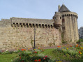
- Walled City (13th–15th centuries): city walls with the Porte Broërec (a prison in the17th century, now a museum), the Saint-Nicolas towers, the Maison du Sénéchal (16th century) and mansions (17th–18th centuries).
- Tour des Carmes (15th century)
- Bois au Duc (13th century) and the Blavet estuary (15 km): view of St-Caradec (13th–19th centuries), wash house.
- The stud farms (dating from 1857): a horse breeding centre, now the Espace de Découverte du Cheval.
- Site of the former Cistercian abbey of Notre-Dame-de-Joye (founded in 1275) and the House of the Confessors (built in 1669).
- The woods and village of Hingair (17th–19th centuries)
- Polvern Lock (1806–1825): a structure on the Nantes–Brest Canal, featuring a towpath.
- Talhouët Wood and the quarry trails: extraction sites (19th–20th centuries), former Forges railway line (from 1921).
- Kerglaw Forges (from 1860, right bank): the Goreds and Grand Barrage locks.
- Rue du Meunier: houses for the Forges’ engineers (1917–1919).
- Kerbihan Botanical Park (10 ha,19th century): arboretum and plant species from the five continents.
- Place du Maréchal Foch: Basilica of Notre-Dame-de-Paradis (from 1514 tothe 20th century), mansions (17thcentury), post-war reconstruction buildings (Paul Lindu, from 1946 to 1951).

Always be cautious and plan ahead when you're outdoors. Visorando and the author of this route cannot be held responsible for any accidents occurring on this route.

The GR® and PR® markings are the intellectual property of the Fédération Française de Randonnée Pédestre.

Reviews and comments

5 / 5
Based on 2 reviews

Reliability of the description
5 / 5
Ease of following the route
5 / 5
Route interest
5 / 5
User 8500711

Overall rating : 5 / 5

Date of your route : Jul 07, 2025
Reliability of the description : ★★★★★ Very good
Ease of following the route : ★★★★★ Very good
Route interest : ★★★★★ Very good
Very busy route : Yes

Great hike, well explained

Machine-translated

Emmanais
Emmanais

Overall rating : 5 / 5

Date of your route : Jun 06, 2025
Reliability of the description : ★★★★★ Very good
Ease of following the route : ★★★★★ Very good
Route interest : ★★★★★ Very good
Very busy route : No

It's another way to discover Hennebont, as you get a better view of the towpaths, which are dry and passable at this time of year. We crossed the superb Kerbihan park to reach the fortified town and its majestic church... We ended up on the ramparts, which offer a magnificent view of medieval Hennebont. Its cobbled streets are currently being renovated.

Machine-translated

Other walks in the area

For more walks, use our search engine .

The GPS track and description are the property of this route's author. Please do not copy them without permission.