The Three Bell Towers Route in Migennes and Laroche-Saint-Cydroine

A short walk between town and countryside to discover three religious buildings from entirely different eras and architectural styles, offering a historical insight into the expansion of the two closely linked communes of Laroche-Saint-Cydroine and Migennes.

Details

n°474575
Creation:
Last update:
–
Last review:
  • Walking
    Activity: Walking
  • ↔
    Distance: 7.95 mi
  • ◔
    Average duration: 4h 00 
  • ▲
    Difficulty: Moderate

  • ⚐
    Back to start: Yes
  • ↗
    Ascent: + 377 ft
  • ↘
    Descent: - 381 ft

  • ▲
    Highest point: 459 ft
  • ▼
    Lowest point: 272 ft
  • ⚐ Country: France
  • ⚐ City: Migennes (89400)
  • ⚑
    Start/End: N 47.962106° / E 3.513288°
  • Accessible from the train station Gare de Laroche-Migennes.
  • Hour-by-hour weather

Description of the walk

Starting point: the Migennois Tourist Office, Place François Mitterrand in Migennes.

(S/E) Turn your back on the Burgundy Canal and head down Avenue Roger Salengro (partly pedestrianised). Cross Avenue Jean Jaurès and walk up Avenue Marcelin Berthelot to the top.

(1) At the junction with Avenue des Cosmonautes, turn left and continue for about 600 metres. Turn left into Rue des Taissons, then take the first right into Rue du Maréchal Leclerc.

(2) Take the path that continues along this street as far as Laroche-Saint-Cydroine. Continue along the street opposite, which leads onto Rue du Pilon.

(3) Turn right onto Rue Jean Moulin and walk past the school. At the junction, turn left then right onto Rue Sous le Vau.

(4) Continue along the path of the same name towards Saint-Cydroine until you reach Ruelle du Prieuré.

(5) After passing the building, turn right onto Rue Paul Boursin, then right again onto Rue Pasteur. Pass Rue du Cimetière and turn left onto the first path (Chemin de Néprin). At the next junction, veer to the right, then left at the following one, and carry on straight ahead to reach the junction with the D181 (Route de Migennes à Brion).

(6) At the junction, cross the road and take the track opposite (ignore the one running almost parallel to the road). Carry on straight past the pumping station. You’ll reach a road on a bend; turn left. Cross the D233 straight ahead.

(7) Turn right onto Rue de la Fraternité and follow it to the end. Then turn left onto Rue du 14 Juillet and follow it until you reach Rue Ferdinand Buisson; turn left onto this street to reach Place Gambetta on your right.

(8) Go round the church, head back down Rue Descartes to the right and take Rue Pasteur on your left, then the first right onto Rue de la Cote aux Vaches towards the Montois Industrial Estate. Cross it via Rue Georges Clemenceau until you reach Avenue Édouard Branly (D943).

(9) Turn right and follow the road until you reach the entrance to Préblin Park. Enter the park on the left and, after a short route through the park, head towards the Canal de Bourgogne, which is situated behind the Maison de la Nature.

(10) Walk alongside the Canal de Bourgogne on your right until you reach Place François Mitterrand, then return to the starting point (S/E).

Waypoints

  1. S/E : mi 0 - alt. 285 ft - Tourist Information Centre, Place François Mitterrand - Canal de Bourgogne
  2. 1 : mi 0.4 - alt. 381 ft - On the left, Avenue des Cosmonautes
  3. 2 : mi 1.03 - alt. 384 ft - Path continuing on from here
  4. 3 : mi 1.66 - alt. 282 ft - On the right, Rue Jean Moulin
  5. 4 : mi 1.98 - alt. 272 ft - Chemin Sous le Vau
  6. 5 : mi 2.7 - alt. 331 ft - On the right: Rue Paul Boursin
  7. 6 : mi 3.91 - alt. 308 ft - D181, continue straight on
  8. 7 : mi 5.7 - alt. 354 ft - On the right is Rue de la Fraternité
  9. 8 : mi 6.1 - alt. 354 ft - Walk around the church
  10. 9 : mi 6.66 - alt. 285 ft - On the right: Avenue Édouard Branly
  11. 10 : mi 6.95 - alt. 289 ft - On the right, along the Burgundy Canal
  12. S/E : mi 7.95 - alt. 285 ft - Tourist Information Centre, Place François Mitterrand

Worth a visit

(S/E) Migennois Tourist Office: Display of a restored fragment of a Gallo-Roman mosaic, exhibition hall, bike hire…
Chantoiseau Park and Villa: the former villa of PLM director Eugène Laporte, set in a park filled with trees and flowers, including, amongst other things, a magnificent collection of hydrangeas.

Christ the King Church: known as the “Lourdes of the railway workers”, designed by architect Gaston Fontaine, it was the first church in France to be built of reinforced concrete. It features a 60-metre-high spire and a monumental statue of Christ the King. Inaugurated in 1935, it was commissioned by Father Pierre-Joseph Magne.
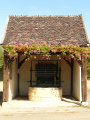
Church of Saint-Cydroine: a jewel of 11th-century Romanesque art, listed as a historic monument, it features three apses and an octagonal tower reminiscent of that at Cluny Abbey.

(9) Saint-Pancrace Church: dating from the 13th century, it is distinctive for its two turrets and the remains of a former drawbridge, making it one of the few fortified churches in the region.
Préblin Park: a 9-hectare nature reserve dedicated to the protection of flora and fauna, featuring a pond and a garden of aromatic and medicinal plants.
Analemmatic sundial: A horizontal sundial unveiled in 2014.
Nature and Environment Centre.

Reviews and comments

3.7 / 5
Based on 2 reviews

Reliability of the description
4 / 5
Ease of following the route
4 / 5
Route interest
3 / 5
Francis C4.
Francis C4.

Overall rating : 3.7 / 5

Date of your route : Feb 17, 2020
Reliability of the description : ★★★★☆ Good
Ease of following the route : ★★★★☆ Good
Route interest : ★★★☆☆ Average

The section along the paths in the lowlands is very monotonous. However, there are a few lovely views.

Machine-translated

Stealth
Stealth

Overall rating : 3.7 / 5

Date of your route : Jan 07, 2018
Reliability of the description : ★★★★☆ Good
Ease of following the route : ★★★★☆ Good
Route interest : ★★★☆☆ Average

Lovely views and lovely churches.
But also plenty of stretches through industrial areas...

Machine-translated

Other walks in the area

For more walks, use our search engine .

The GPS track and description are the property of this route's author. Please do not copy them without permission.