Route exploratoire autour du village de Jeu-Maloches

This is a route that allows you to explore the surroundings of Jeu-Maloches, a small village in the Boischaud-Nord area of the Indre, alternating between small roads and paths, with a few interesting viewpoints.

Details

n°799819
Creation:
Last update:
Last review:
  • Walking
    Activity: Walking
  • ↔
    Distance: 8.35 mi
  • ◔
    Average duration: 4h 05 
  • ▲
    Difficulty: Moderate

  • ⚐
    Back to start: Yes
  • ↗
    Ascent: + 279 ft
  • ↘
    Descent: - 249 ft

  • ▲
    Highest point: 614 ft
  • ▼
    Lowest point: 443 ft
  • ⚐ Country: France
  • ⚐ City: Jeu-Maloches (36240)
  • ⚑
    Start/End: N 47.036438° / E 1.45783°
  • ❏
    IGN map(s): Ref. 2024SB, 2124SB
  • Hour-by-hour weather

Photos

Description of the walk

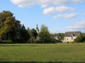
(S/E) The start is opposite the church. Head south-west along the D33. Follow the yellow signposts.
Cross two bridges; on your left, you’ll see a restored wash house and a lovely green space. Carry straight on along the D33 at the next junction.

(1) After a climb, follow the small road to the right towards Trompe-Souri and La Détourbe.

(2) After about 500 metres, take the grassy path on the left leading up towards a wood.
At the next junction of paths, turn onto the one on the right which leads back down towards the previous road.
Follow the path opposite, on the other side of the road, into the woods.
Cross the Jeu-Maloches stream, head back up towards the edge of the woodland and turn left to reach the hamlet of La Détourbe.

(3) Cut across the small road and take the path opposite which crosses the Bois de Miseray, then follows its edge to reach the D33c. Cross the road and continue straight on along the edge of the woodland, then across the field to reach the access road to the Maigrière farm.

(4) Turn right, heading north, onto the small road that crosses the D8 towards the Paillaudière farm.

(5) At a right-hand bend, leave the road and continue along a track suitable for vehicles for 400 metres, then turn right onto a dirt track which takes you round the back of La Paillaudière.

(6) At the farm entrance, turn left onto the road leading into the Bois des Chaumes.

(7) At the junction with the D33, carry on straight ahead along the small road leading to the Château des Echevées.

(8) 200 metres after the château, turn right up the forest track. As you emerge from the woods, you’ll reach the ruins of La Boitrie.

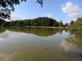
(9) At the next crossroads, take the path leading down to the right towards the Étang de Narbonne. Continue south-west, skirting the lake, until you rejoin the D8.

(10) At the junction, take the D33c straight ahead for 500m, then turn left onto the path cutting across the fields.

(11) Once you have passed through a copse, take the path on the left, cross the small road and head down a path that leads to the Domaine de Narbonne. Continue along a small road that joins the D33e.

(12) Turn right and head back down towards the village. At the junction by the Town Hall, turn right onto the D33 to return to the church (S/E).

Waypoints

  1. S/E : mi 0 - alt. 446 ft - Church at Jeu-Maloches
  2. 1 : mi 0.39 - alt. 492 ft - Junction: turn right towards Trompe-Souris
  3. 2 : mi 0.66 - alt. 479 ft - Turn left onto the grassy path
  4. 3 : mi 1.66 - alt. 568 ft - The hamlet of La Détourbe
  5. 4 : mi 3.13 - alt. 607 ft - La Maigrière, turn right heading north
  6. 5 : mi 3.66 - alt. 594 ft - A track suitable for vehicles runs straight ahead
  7. 6 : mi 4.09 - alt. 591 ft - Turn left at La Paillaudière
  8. 7 : mi 4.62 - alt. 528 ft - Cross the D33 and carry straight on
  9. 8 : mi 5.02 - alt. 499 ft - Turn right after Les Echevées
  10. 9 : mi 5.52 - alt. 574 ft - Junction: turn right towards the Étang de Narbonne
  11. 10 : mi 6.2 - alt. 548 ft - Straight on along the D33c
  12. 11 : mi 6.88 - alt. 587 ft - After the copse, turn left
  13. 12 : mi 7.72 - alt. 525 ft - Turn right onto the D33e
  14. S/E : mi 8.35 - alt. 449 ft - Church at Jeu-Maloches

Notes

No water sources apart from at Jeu-Maloches.
Wet sections at the Jeu-Maloches stream and the Étang de Narbonne (and sometimes in the woods too): make sure you wear suitable footwear.

Worth a visit

Reviews and comments

4 / 5
Based on 2 reviews

Reliability of the description
5 / 5
Ease of following the route
3 / 5
Route interest
4 / 5
martinelqe
martinelqe

We also go on lots of walks through the heathland. The paths are more or less mown. That’s just the way things are with local council services these days. Services are being consolidated and journeys are getting longer and longer.
But here, the section behind the haystack hasn’t been mown for many months; it’s the first time I’ve seen that on a local path.

Machine-translated

lolo36
lolo36

Martinelge, I’m sorry to hear about the inconvenience you’ve experienced. It’s now been over five years since I walked that route. Perhaps the route has been altered since then. I know the FFRP is currently updating routes in that area...
But as Éric Martine pointed out, the current trend is towards late mowing, and I often come across this problem of tall grass, even on recently updated routes...
Hence the need to often pack trousers and long sleeves!

Machine-translated

Eric Martine
Eric Martine

Unfortunately, more and more local roads are no longer being properly maintained; I think we need to pass this information on to the town hall.

Machine-translated

martinelqe
martinelqe
• Edited:

Overall rating : 3.3 / 5

Date of your route : Jun 12, 2023
Reliability of the description : ★★★★★ Very good
Ease of following the route : ★☆☆☆☆ Very disappointing
Route interest : ★★★★☆ Good
Very busy route : No

This walk was rather unpleasant. When we reached point 3, the path through the woods was blocked by a chain, so we followed the road (which was quite busy) as far as a place called Le Prieuré to rejoin the route a little further on. When we reached point 5, we came across a path with tall grass and large stinging nettles; then, after turning right, it got worse: we could no longer see the path. With vegetation over 1.5 metres high, we were forced to make our way through the neighbouring wheat field. We were glad to arrive behind the Paillaudière estate. From point 8 onwards, it was once again a path through tall grass, almost all the way to the Narbonne pond.
This route is also partly marked on the walking map located in the centre of the village; it’s a shame that these paths weren’t mown in 2023. The current condition, due to the lack of spring maintenance, does not encourage us to return or to recommend it.

Machine-translated

Eric Martine
Eric Martine

Overall rating : 4.7 / 5

Date of your route : May 31, 2020
Reliability of the description : ★★★★★ Very good
Ease of following the route : ★★★★★ Very good
Route interest : ★★★★☆ Good
Very busy route : No

A lovely walk – we did it as a day trip with a picnic along the way; it was absolutely perfect,

Machine-translated

Other walks in the area

For more walks, use our search engine .

The GPS track and description are the property of this route's author. Please do not copy them without permission.