Country:
 City:


The start is at the foot of the church, near the small railway station.
Follow the yellow signposts marked ‘La campagne argycienne
’.
(S/E) With your back to the church, turn left onto the Route de la Gare, heading north. Turn left onto the Route de Chezelles, then left again onto the Rue du Four. Pass the wash house and carry on straight ahead at the next junction.
(1) At the stone Croix Saint-Bruno, cross the D11 carefully to reach the main entrance to the castle. Then walk alongside the D11 northwards towards the town hall. Continue along this road to pass through the village of Argy. You’ll reach a junction by a wayside cross.
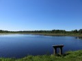
(2) Take the Chemin Creux lane on the left and follow it until you rejoin the D11. Follow it to the left for 30 metres, then cross carefully to go over a footbridge and reach the Étang des Augères.
(3) Go round the pond to the left, climbing the tree-lined embankment. Then continue along the main access road to the south until you reach a gantry.
(4) Turn left onto the small road and cross the railway line. At the next junction, turn left and carry on to Argiette.
(5) Turn left onto the small road, head towards La Bonduaire, cross the D28 with care, carry on straight ahead, passing a small road on your left, and reach the next junction.
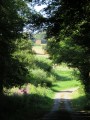
(6) Turn right, pass a small road on the left and head towards the Domaine de Cornebarioux. Continue straight on along a farm track which curves to the right and reach a fork in the road by a hedge of trees.
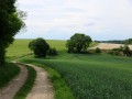
(7) Follow the yellow markings for the Argycienne countryside route (signs) to the right, continuing between the fields to the south-east. At the next fork, turn left, heading due east. The track becomes a small road at the Baugy farm. Then turn right at the fork.
(8) At the road junction (waycross), cross the D28 carefully and take the small access road opposite leading to the Grange de Bauchet. Pass the farm and continue straight on southwards along a farm track, following the yellow markings for the Argycienne countryside route (signs). Ignore a track on the right and reach a small stream (elevation 131).
(9) Turn left, keeping the stream on your right, pass a pond and turn right a few metres further on. Then continue straight on until you reach Montlevrier. Turn right and follow the road ahead, which then becomes a track.
(10) At the fork, turn left and carry on straight ahead to cross the ford via a footbridge. Follow the road to the right, which leads to La Boursaudière. Pass a ford whilst following a bend to the left and carry on straight ahead, skirting a farm building.
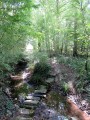
(11) At the wayside cross, follow the D63 to the right for a good fifty metres and turn off onto a track to the left. Descend to a small stream, then climb back up to reach the D76.
(12) Follow it carefully to the left as far as the Croix de Baugerais and turn right onto the small road towards Gravet. Turn right onto a farm track and carry on straight ahead to rejoin the D76.
(13) Follow the road carefully to the left, cross the railway line and turn right. Continue straight on until you reach the station and the church apse (S/E).

 Visorando Member




 Easy