Country:
 City:


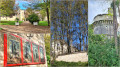
The start is at the car park near Veuil church.
(S/E) Follow the blue markings and head up the Côte des Buis, to the north-east. Pass the Chemin des Souchets on your right, then the Chemin de la Tour on your left. You’ll reach La Garenne (cross). Follow the main road (red and yellow markings forthe GRP® du Pays de Valençay, or orange for the Benjamin Rabier route), passing the access road to Les Gallards on your right, then the one to La Grossinière on your left.
(1) Turn right towards Le Mesnil, then immediately left onto a grassy path that winds down alongside a copse. At the T-junction, turn left, then head up the small road.
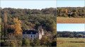
(2) At the junction, turn left, letting theGRP® continue straight on (views of the Château de la Tour du Breuil and the Moulin de Fourchaume). At the crossroads, leave Les Rôtis opposite and turn right for 40 metres (view of the rooftops of the Château de Valençay). Turn left to follow the small road towards Les Gauthiers (wooden sign on the left amongst the foliage with a blue mark).
(3) Just before Les Gauthiers, take a grassy farm track on the left. Walk uphill to La Grossinière, ignoring a path on the right leading to Les Garivets.
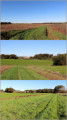
(4) Turn right onto a grassy track; cross a small road and continue straight ahead, with Les Garivets on your right. The track descends, with the Basse Butte farm in sight, then turns right to reach a small road. Follow it to the left (following a yellow marker).
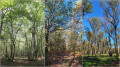
(5) At La Butte, carry on straight ahead along a wide farm track (GRP® du Pays de Valençay). Pass a path on your left and enter the Gâtine Forest.
(6) Carefully cross the D960, then the railway line of a tourist train. Pass the Allée de Luçay on your left and continue straight on, heading north-west (information board for the Benjamin Rabier discovery trail). At the next junction, continue straight ahead. At the following crossroads, turn slightly left and leave the forest.
(7) Follow the grassy path to the left, along the edge of the woods, keeping theGRP® straight ahead. Pass a path on your right and continue straight on along a farm track until you reach the D128. Cross it carefully to reach Les Bernets (yellow markings on a wooden sign).
(8) After the Lacour vineyard, turn left twice, then turn right onto a farm track (yellow markings on a wooden post). The track descends into a woodland, turns right and then, in a left-hand bend, crosses the Saint-Fiacre stream. It climbs back up to the hamlet of La Sarrazinière.
(9) Turn left onto the grassy track which leads back down to a pond. It becomes a track suitable for vehicles and climbs back up to Touche-Gautier. Follow the small road to the left, pass the stables at Fontbray and head downhill to join the Saint-Fiacre. The road climbs again to reach La Gauterie.
(10) 250 m after this hamlet, just before a ‘Stop’ sign, turn right onto a grassy track. Reach a pond, cross the tourist railway line again, then carefully cross the D 960 to enter a woodland. Continue south. The track leaves the woodland and stays along the edge.
(11) At the T-junction, turn left and continue along the edge of the woodland, heading east. Pass a path on the left, then another on the right, and enter a logging area (stone marker). Pass a path on the left, and continue to the right along the main forest track. Carry on straight ahead to reach Bellevue Farm. Follow the small road.
(12) At the crossroads, carry on straight ahead to cross Les Vaudettes (yellow markings). The road becomes a track suitable for vehicles. On the descent, ignore the tracks on the right and head for Les Charrons.
(13) Take the road on the left, cross the hamlet and turn right onto a grassy farm track. It descends initially. At the bottom, ignore a track on the right and head straight up the opposite side. After a left-hand bend, join a track suitable for vehicles; follow it to the right.
(14) Continue straight on along Rue du Prieuré until you reach Rue du Château. Walk down this street, keeping slightly to the right, towards the church. Pass Impasse du Provisoire on your right and turn right onto Rue de la Fontaine. Pass the town hall and continue to the ancient fountain and its wash house. Then turn back to return to the starting point at the church (S/E).

 Visorando Member