Country:
 City:


Park in a small car park on Rue des Tilleuls, behind the community hall.
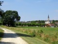
(S/E) Head north, towards the church. Cross the D34 (Rue du Château) to take Rue du Nichat: then follow the yellow signposting or the (more recent) signposting for mountain bike route no. 8 (symbolised by a Yellow Triangle and two Yellow Discs).
Pass the Moulin de la Cour.
(1) At a place called Godechoux, carry on straight ahead towards the west, leaving the road leading to La Jambronnière on your right, until you reach the junction of La Reuille and La Thibaudière.
(2) Turn right onto a grassy path heading northwards. At the end, turn left and head southwards. The path becomes stony before joining a small tarmac road.
(3) Head straight down south for 200 metres, then turn onto a stony track on the right. The track leads into a small wood.
(4) Ignore the path straight ahead, which is difficult to follow, and head up to the left, carefully following the signposting for the mountain bike route. The path runs alongside a small wood then turns right across fields, heading west.
(5) At the next junction, head down the path on the left towards the south. It joins a small road; take this on the left.
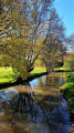
(6) Turn left at the corner of a house, heading east, onto a path which initially runs alongside the little Nichat stream, then leads to several private ponds. At the crossroads, carry on straight ahead towards the east until you reach a small road.
(7) Turn right, heading south, towards the Moulin de Trez.
Cross the D34 and carry on straight on towards the Boisseloup farm, then continue south along the grassy track.
(8) At the junction, by a cross, carry on straight ahead, south-east, and take the small road leading to La Pinellerie, then the stony track.
(9) At the junction of the tracks, turn left towards the west to skirt a small wood and reach the hamlet of Les Vallières. Cut across the small road and go straight on along a track, which you should follow until you reach another small road, the D23 departmental road.
(10) Then turn left, and at the next junction, turn right onto the small departmental road D34a for about 800 metres.
(11) Turn left towards the Renouvellerie farm and take the path leading down to the right. Continue straight on towards the east at the next junction, along a stony path which leads to an isolated house. The path then becomes grassy and crosses through, then runs alongside, a deciduous woodland. It branches off to the north to run alongside a pine forest, then emerges across fields to join a stony path.
(12) Turn left and continue straight on until you reach a private pond. The path then climbs up towards the football ground. The tarmac road joins the D23 departmental road, which you should follow to the right.
(13) Turn left onto the D34, which passes through the village of Baudres and takes you back to the small road opposite the church, on the left, leading to the car park at the starting point (S/E).

 Visorando Member
 Easy