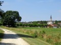
Circular route through the countryside around Selles-sur-Nahon

This walk allows you to explore the area around the village of Selles-sur-Nahon, taking in a variety of rural landscapes.

Details

n°1083511
Creation:
Last update:
Last review:
  • Walking
    Activity: Walking
  • ↔
    Distance: 6.69 mi
  • ◔
    Average duration: 3h 15 
  • ▲
    Difficulty: Moderate

  • ⚐
    Back to start: Yes
  • ↗
    Ascent: + 167 ft
  • ↘
    Descent: - 174 ft

  • ▲
    Highest point: 541 ft
  • ▼
    Lowest point: 400 ft

Photos

Description of the walk

Park in the car park at Selles-sur-Nahon town hall.

(S/E) On leaving the car park, turn left onto the D33b and follow the road, passing the access road to Bellevue Farm on your right as you round a bend.

(1) At the crossroads, turn right and head uphill to the junction with the D15d. Continue straight on for 50 metres, then turn right onto the access track to the motocross route (blue markings).

(2) Carry on to the hamlet known as Le Carroir.

(3) Cross the road and continue along the path opposite (leave the blue markings here).
Pass a track on your left, enter the Bois Millet and pass a private track on your right.

(4) At the next junction, take the path on the right along the edge of the woods, which leads onto a small road. Turn right to join the D33, then follow it to the right. You’ll come to a crossroads at the top of the hill.

(5) Take the path on the left which crosses the fields. You’ll come to another crossroads.

(6) Carry on straight ahead; the markings are now yellow. Cross the D8d and reach a small rest area.
Continue along the path until you reach a copse.

(7) Turn right onto a grassy path (leaving the yellow markings). At the next junction, turn right again onto the stony path.
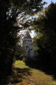
After walking alongside a small pond, you’ll reach the hamlet of Foussard; continue straight on along a small road, then turn right at the next junction (blue and yellow markings). You’ll reach a crossroads where there is a small chapel.

(8) Take the D33b to the right, then turn left onto a stony track.
Carry on straight ahead at the next junction (leaving the yellow markings) until you reach another crossroads.

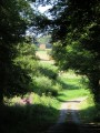
(9) Leave the road on the right and continue along a grassy track (end of the blue markings).
The track becomes a stony track again as you approach the hamlet of Les Touches.

(10) Head up the grassy track to the right across the fields to reach the Rousseaux estate.

(11) Turn right onto the small road which takes you back to the first junction you passed at the start, the D33b.

(1) Take the road on the left to return to the town hall car park (S/E).

Waypoints

  1. S/E : mi 0 - alt. 509 ft - Town hall car park
  2. 1 : mi 0.3 - alt. 509 ft - Turn right on the way there and go straight on the way back
  3. 2 : mi 0.6 - alt. 538 ft - Motocross route
  4. 3 : mi 1.03 - alt. 509 ft - Le Carroir: road crossing
  5. 4 : mi 1.73 - alt. 525 ft - On the right, at the edge of the woods
  6. 5 : mi 2.56 - alt. 525 ft - At the top of the hill, take the path on the left
  7. 6 : mi 3.22 - alt. 509 ft - Straight ahead (yellow markings)
  8. 7 : mi 3.77 - alt. 466 ft - 100m past the copse, take the grassy path on the right
  9. 8 : mi 4.72 - alt. 407 ft - Turn right at the crossroads by the chapel. Near the - Nahon (rivière) - Affluent du Fouzon
  10. 9 : mi 5.21 - alt. 417 ft - Straight ahead along the grassy track
  11. 10 : mi 5.71 - alt. 443 ft - Grassy path leading uphill to the right
  12. 11 : mi 6.21 - alt. 518 ft - Go round the Rousseaux estate on the left
  13. S/E : mi 6.69 - alt. 509 ft - Town hall car park

Notes

No water points apart from at the town hall.
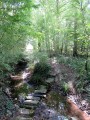
No particular difficulties apart from grassy paths with deep ruts.

Worth a visit

Reviews and comments

4.7 / 5
Based on 1 review

Reliability of the description
5 / 5
Ease of following the route
5 / 5
Route interest
4 / 5
Filver95
Filver95

Overall rating : 4.7 / 5

Date of your route : Sep 17, 2020
Reliability of the description : ★★★★★ Very good
Ease of following the route : ★★★★★ Very good
Route interest : ★★★★☆ Good
Very busy route : No

Interesting

Machine-translated

Other walks in the area

For more walks, use our search engine .

The GPS track and description are the property of this route's author. Please do not copy them without permission.