Country:
 City:


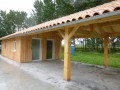
The route starts from the motorhome site near the town hall. The route is signposted in yellow, with an alternative route signposted in green.
(S/E) Head south along the road and leave the village. Take the first limestone track on your right and go round the small wood on the left. Take the limestone track on the left at the junction. Continue straight on (south-west) until you reach the houses.
(1) At the fork in the road, turn left onto a limestone track towards the woodland and cross through it. Take the path on your left as you come out of the copse to cross the copse again. Carry on straight ahead as you leave the copse. Cross the road and carry on straight ahead, leaving the Homandie house on your right. At the junction, turn right and carry on straight ahead. Cross the road and take the limestone path to join the D418.
(2) Cross the road, continue along the path opposite and immediately take the path on your right towards the trees. Walk past the edge of the woodland, carry on straight ahead and pass the hamlet of Peulbert on your left.
(3) At the Fork in the road, turn slightly left onto a track. At the crossroads, carry on straight ahead (south-east), ignore a track on the right and head for the hamlet of Le Mas.
(4) Turn slightly right through the vineyards and head towards the next hamlet. Turn left (east) at the hamlet and carry on straight ahead between the trees and vineyards.
(5) At the junction, turn left onto the limestone track, then turn right straight away to skirt the woodland on the left. After about a hundred metres, turn at a right angle onto the track on the right (not shown on the map) and enter the woodland. After about a hundred metres, turn left. Carry on straight ahead as you leave the woodland and, about 250 metres further on, turn right.
(6) At the T-junction, turn left towards the houses. Cross the road at the hamlet of Chez Rochefort and carry on straight ahead along the path opposite. At a Fork in the road, take the left-hand path (not shown on the map) and cross the woodland.
(7) Cross the D44 and carry on straight ahead (north-west). You will reach the hamlet of Trotte les Brousses.
(8) Turn left towards the woodland just before the end of the limestone track. Walk through the woodland and carry on straight ahead. Once you’ve left the woodland, cross the road and continue along the path opposite.
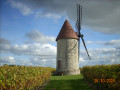
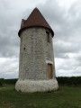
(9) After about 200 metres, take a path on the left and walk round the mill. Retrace your steps.
(9) Carry on to the left (west-south-west), then turn left straight away to walk round the mill. When you reach the county road, take the path that branches off to the right at an acute angle through the vineyards.
(10) At the T-junction, turn left onto a limestone track towards the village. Join the D44 and follow it to the right. Take the first street on your left to return to the motorhome park (S/E).

 Local authority

 Visorando Member
 Moderate
 Difficult