Country:
 City:


Start from Place Claude Aussurin, on the outskirts of Juillac, heading towards Segonzac. The square is on the left as you approach from Verrières (after the road leading down to the church).
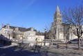
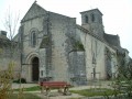
(S/E) Leave the car park and turn right onto the small Rue Gustave Eiffel and go straight on. Pass the church on your right and continue along the road until you reach the T-junction.
(1) Turn left, and after about 150 metres, at the T-junction, turn right and then immediately left at the first road, towards Le Foucaudat. Follow the road to the crossroads with Rue du Logis du Frêne on the left and the ‘Euronegoce’ sign on the right. Carry on to the left to see the beautiful house in the hamlet of Le Frêne. Go round the estate, then continue straight on towards the Euronegoce factory, pass it, and turn left at the first street, Rue du Foucaudat.
(2) Take this road, follow it round a right-hand bend, and after about 40 metres, continue along Rue de Foucaudat. As you leave the hamlet, veer slightly to the left, staying on the same road. About 250 m further on, leave the road as it bends left and take the unpaved track opposite. Continue straight ahead along this long track, passing a wood on your left and then another on your right. Immediately after the latter,
turn left and, about 75 metres further on, take the path on the right, marked with yellow signposts. Continue to the road.
(3) Turn right and follow the small road and then the track for about 600 m until you reach the four-way junction. Follow the white track to the right for about 300 m. At the right-hand bend, go straight on along the grassy track which climbs past trees on the left and vineyards on the right. Continue to the top and turn left onto the first track. Follow this path, passing (perhaps) a water tank on the left and then a large house on the right. Continue along the road until you reach the T-junction in the hamlet of L’Échalotte.
(4) Turn left and, after about 100 m, turn right onto the first road, Rue du Martin-Pécheur. Follow this road straight on, ignoring the road on the right. You’ll reach the top and a crossroad, Route de Boucqueville. Turn right, pass through the hamlet of Boucqueville and continue straight on until you reach the four-way junction.
(5) Cross the D44 with care, turn left and walk uphill along the edge of the vineyard until you reach the road on the right. Follow this road towards the hamlet known as La Plante.
Follow the road and continue along the track. This takes a 90° left-hand bend and then another 90° right-hand bend. Carry on until you reach the road.
(6) Turn right, follow the small road for about 500 m and turn right onto the first track. Continue along this long track through the vineyards until you reach the second junction (the two junctions are very close together, about 60 m apart).
(7) Turn left, walk alongside the fence of a mountain bike training ground on your right and head towards the Croix Boutonnier. Walk past the base of the cross, which is on your right. Continue straight ahead along the track and then turn right onto the first road, Rue Pierre et Marie Curie.
(1) Turn left onto Rue Gustave Eiffel, pass by the church again and continue straight on to reach Place Claude Aussurin (S/E).


 Local authority
 Difficult

 Easy