Pas à Pas in the centre of Verrières

A parish until the Revolution (1789), Verrières became a commune under the Constitution of Year VIII, dated 28 Pluviose. At that time, Verrières fell under the jurisdiction of two neighbouring seigneuries: Juillac-le-Coq and Ambleville, both subject to the chapter of Angoulême Cathedral. Verrières formed part of the canton of Lignières until 16 Brumaire, Year VI, after which it was attached to Segonzac. The commune now has a population of 375 (857 in 1870).

Details

n°319050
Creation:
Last update:
Last review:
  • Walking
    Activity: Walking
  • ↔
    Distance: 0.77 mi
  • ◔
    Average duration: 0h 25 
  • ▲
    Difficulty: Easy

  • ⚐
    Back to start: Yes
  • ↗
    Ascent: + 56 ft
  • ↘
    Descent: - 56 ft

  • ▲
    Highest point: 213 ft
  • ▼
    Lowest point: 157 ft

Photos

Description of the walk

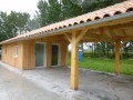
The start of this route is at the hikers’ rest area and motorhome stopover, which are located next to the town hall.

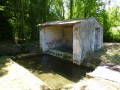
(S/E) Turn left as you leave the motorhome site and head towards the main road running through the village. Turn left and follow the road until you reach the junction, where you’ll turn right towards Juillac-le-Coq. Continue straight on until you reach the wash house.

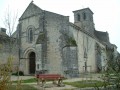
(1) Retrace your steps and turn left. Head towards a large estate and a fountain. Retrace your steps again and turn left to reach the church.

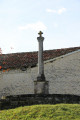
(2) Walk round the church to reach the square and admire the building and the Hosanière Cross.
Then walk round the small square around the Hosanière Cross to rejoin the road on your left.
Carry on straight ahead until you reach the crossroads. Cross the road and continue straight ahead. Carry on towards the town hall to return to the starting point (S/E).

Waypoints

  1. S/E : mi 0 - alt. 213 ft - Hikers’ Rest Area
  2. 1 : mi 0.32 - alt. 157 ft - Washing house
  3. 2 : mi 0.6 - alt. 187 ft - Church
  4. S/E : mi 0.77 - alt. 213 ft - Finish: Town Hall and School

Notes

A motorhome stopover, a hikers’ information point and a picnic area are available at the start of the route.
At the start of the “Pas à Pas” route, a map showing the start of the 10km “Bellevue, Coteaux et Vallée” route (yellow markings) is available, along with a 6.6km alternative route (blue markings).

Worth a visit

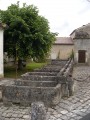
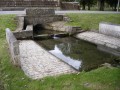
The Wash House
A fine example of cut stone, with a constant supply of water.

Former estate and spring
One of the oldest properties in the parish. In days gone by, processions would set off every 15 August,
at the spring.

Saint-Palais Church
A 12th-century church, altered in the 14th century, and largely demolished by the Protestants.
Inside, there is a beautiful 17th-century altarpiece made of natural wood, not to mention several listed architectural features.

The Hosanna Cross
Standing on the site of the old cemetery, it served as a place of worship during the Revolution, as it was forbidden to pray in churches.

Former boys’ school.
Nowadays, it is the village hall.

Reviews and comments

5 / 5
Based on 1 review

Reliability of the description
Not used
Ease of following the route
5 / 5
Route interest
5 / 5
chipie33290
chipie33290

Overall rating : 5 / 5

Date of your route : May 26, 2024
Reliability of the description : Not used / Not applicable
Ease of following the route : ★★★★★ Very good
Route interest : ★★★★★ Very good
Very busy route : No

Thank you for this route. It’s a very easy walk to explore the village’s heritage.

Machine-translated

Other walks in the area

For more walks, use our search engine .

The GPS track and description are the property of this route's author. Please do not copy them without permission.