Around the Né, through woods and vineyards

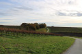
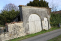
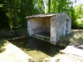
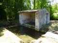
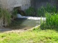
A lovely walk through the woods and vineyards of Petite Champagne around the River Né. Along the route, you’ll see fine examples of farmhouses with Charente-style gates, as well as old mills. The walk crosses the Île de Breuil after fording a stream. There are also fountains dotted along the route or nearby, including the Fontaine de Zade.

Details

n°1337568
Creation:
Last update:
Last review:
  • Walking
    Activity: Walking
  • ↔
    Distance: 7.16 mi
  • ◔
    Average duration: 3h 30 
  • ▲
    Difficulty: Moderate

  • ⚐
    Back to start: Yes
  • ↗
    Ascent: + 249 ft
  • ↘
    Descent: - 276 ft

  • ▲
    Highest point: 207 ft
  • ▼
    Lowest point: 72 ft

Photos

Description of the walk

(S/E) Take the main street (Le Bourg) to the left (south-west). At the end, continue along a path. This turns right and leads to a T-junction on the edge of the vineyards. Turn left here, walk between the vines and reach the Bois de la Grange.

(1) Turn right onto the path that leads into the woods. You’ll come out onto the D418 road; follow it carefully to the right until you reach the entrance to the hamlet of Chez Menuisier.

(2) Then turn left onto a slightly downhill path. Cross an intermittent stream and walk gently uphill towards the Mottards area.

(3) At the junction, turn right. At the next junction, which comes immediately after, continue straight on along the edge of the woodland on your right. Carry on along the edge of the woodland on your left until you reach a T-junction.

(4) Turn right here. Further on, walk straight through a small copse and then follow a small pond on your left. At the T-junction, turn left. At the next crossroads, turn right and walk through the village of Le Grand Breuil.

(5) At the Fork in the road, take the left-hand road. Immediately afterwards (house), turn right onto a path. Walk between the fields and, at the next junction, continue straight on until you reach the River Le Né.

(6) Cross the Gué du Né (if necessary, there is a small footbridge). Continue along the path that branches off to the left. Walk alongside a woodland on your left, then enter the woodland. Keep heading north-west. At a Fork in the road, turn right, cross a branch of the river (the Né again) immediately, and then another a little further on via a small bridge.

(7) Cross the D151 road with care and take the road opposite, which climbs straight up the hillside. Pass the hamlet of La Ménardière on your left, then enter the hamlet of Chabran.

(8) In the centre of the hamlet, take a road on the left. After about a hundred metres, take the first path on the right. At the next junction, turn right; the path soon gives way to a small road.

(9) You’ll come out onto the D418 and follow it to the left for about ten metres. Then turn right onto a track and immediately right again (south-east). After passing through the vineyards, the track runs alongside two small copses. Continue through the vineyards and, at the next junction (marker 58), go straight on. Pass the hamlet of Peulbert on your left. When the road bends to the right, veer slightly left onto a track that crosses the Combe Jarnac and climbs up the other side.

(10) Cross the junction carefully and take the road opposite (south-east). At the hamlet of Le Mas (an old Saintonge-style farm), turn right onto a track. At the Fork in the road, take the track on the right and head down to the bottom of the vineyards.

(11) At the fork in the road, take the path on the right. Cross the D151 road with care and continue along the path opposite. Cross a branch of the River Né via a bridge. The track then enters a wooded area and curves to the right. Cross the woodland and emerge onto the D418 road. Follow the road to the left and cross the River Né, then a leat of the Moulin du Breuil.

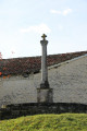
(12) Immediately afterwards, turn left onto a path. Reach the Moulin de Rouille and turn right onto the tarmac road. At the T-junction (with the wayside cross), follow the D38 to the left. At the corner by the town hall, turn right to return immediately to the starting car park (S/E).


Waypoints

  1. S/E : mi 0 - alt. 131 ft - Car park at Saint-Palais-du-Né Town Hall
  2. 1 : mi 1 - alt. 164 ft - Crossroads
  3. 2 : mi 1.45 - alt. 154 ft - At Menuisier’s
  4. 3 : mi 1.9 - alt. 151 ft - Crossroads
  5. 4 : mi 2.23 - alt. 125 ft - T-junction
  6. 5 : mi 2.8 - alt. 135 ft - Le Grand Breuil
  7. 6 : mi 3.09 - alt. 82 ft - Ford on the - Né (rivière)
  8. 7 : mi 3.6 - alt. 85 ft - D151 road
  9. 8 : mi 4.02 - alt. 187 ft - Chabran
  10. 9 : mi 4.39 - alt. 203 ft - D48 road
  11. 10 : mi 5.28 - alt. 187 ft - Crossroads
  12. 11 : mi 5.78 - alt. 95 ft - Three-way junction at the foot of the vineyards
  13. 12 : mi 6.69 - alt. 95 ft - Moulin du Breuil
  14. S/E : mi 7.16 - alt. 131 ft - Car park at Saint-Palais-du-Né Town Hall

Notes

The car park is located in Saint Palais du Né, next to the town hall. Alternatively, you can use the car park at the community centre to the north-east of the D38 road (north-west to south-east axis), roughly opposite Rue de la Mairie

This walk across varied terrain requires suitable footwear.

This route, which presents no particular difficulties, is unmarked. Consequently, it is advisable to follow the directions in the description and on the map, whilst keeping a close eye on the landscape. The distances to the various waypoints from the start are also useful guides for walkers (see description).

Walk completed by the author on 29 November 2018

Worth a visit

The terrain of the commune is that of a low plateau sloping gently down towards the Né valley to the north-east. The highest point is at an altitude of 86 m, at the Moulin des Justices, a former windmill situated not far from the southern boundary near Archiac. The lowest point is at 21 m, situated along the River Né at the northern end. The village centre lies at an altitude of 40 m.
The commune lies on the left bank of the River Né, a tributary of the Charente downstream from Cognac, which forms the commune’s north-eastern boundary. The river is divided into several islands within the commune, the largest of which is the Île du Breuil. A stream originating from the Font de Jau near the commune of Archiac flows into the River Né on its left bank near the village.

History
In the Middle Ages, the church of Saint-Palais was under the jurisdiction of the priory of Saint-Eutrope in Saintes.
In the 18th century, the de Sallegourde family were the lords of the fief of Saint-Palais.
In the early 20th century, industry was represented by a mill on the River Né. Before that time, windmills stood on the hilltops in the southern part of the commune. Local customs were more akin to those of the canton of Segonzac than to those of the canton of Barbezieux, to which the commune was connected by an isthmus.

Agriculture
Wine-growing is an important activity in Saint-Palais, which is situated in Petite Champagne, within the Cognac Appellation d’Origine Contrôlée (AOC) area.
Some producers sell cognac, Pineau des Charentes and local wine directly from the estate.

Places and monuments
The parish church of Saint-Palais dates from the 12th or 13th century. Built in the shape of a Latin cross, a chapel was added to its south side in the 16th or 17th century, and it was restored in the 19th century. Its furnishings are listed in the Palissy database.

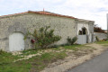
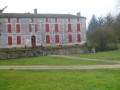
The village has numerous farmhouses and a few dwellings with Charente-style gateways

Reviews and comments

4.2 / 5
Based on 2 reviews

Reliability of the description
4 / 5
Ease of following the route
5 / 5
Route interest
3.5 / 5
chipie33290
chipie33290

Overall rating : 5 / 5

Date of your route : Feb 05, 2022
Reliability of the description : Not used / Not applicable
Ease of following the route : ★★★★★ Very good
Route interest : ★★★★★ Very good
Very busy route : Yes

A very pleasant route with few roads.
Very pleasant paths dotted with interesting heritage sites.
Paths that are easy to walk along.
Thank you for this route.

Machine-translated

pgetrochon
pgetrochon

Thank you for your message.
The issue of overgrown, or even heavily overgrown, paths is a consequence of the long lockdown we have endured. Nearly three months without anyone walking on the paths has allowed nature to reclaim its space. Two of the areas you have highlighted are in the bed of the River Né and are maintained… mainly by walkers. In the meantime, there is tall grass, which will disappear as walkers return and the heatwave sets in. Hiking has resumed just as the grass has finished its main growth spurt (as you can see from the farmers who are all making hay at the moment). This explains the situation. It does make it more difficult to spot certain sections of the route, though it does not render the route unusable.
As for the point (4), it’s much the same story. The suggested route is more characteristic and more pleasant for walkers, especially in those areas where there are lots of vineyards with paths running alongside or between the vines – paths that are very wide, almost too wide at times. The paths near the vineyards are maintained by the winegrowers themselves, and we benefit from this. Elsewhere, this work may be carried out by council staff, but many have been unable to work due to the virus, resulting in a significant backlog at the moment in non-priority areas… which are often the ones we walk through.
If you get the chance, do this walk again in six months’ or a year’s time, and I think you’ll have a different view on the state of the paths.
Happy walking

Machine-translated

MatthieuGD
MatthieuGD

Overall rating : 3.7 / 5

Date of your route : Jun 02, 2020
Reliability of the description : ★★★★☆ Good
Ease of following the route : ★★★★★ Very good
Route interest : ★★☆☆☆ Disappointing
Very busy route : No

The route has the advantage of being varied; it’s not just white paths and vineyards, which makes for an enjoyable walk.
However, please note that this is not an official walking route (there are no signposts), and as it is not maintained, some sections are difficult to access:
- At point 4: It’s difficult to walk along the edge of the copse if you stick to the route as marked; in this case, I suggest taking the path on the right as you come out of the woods, which leads to the vineyards and goes round the pond.
- Between points 6 and 7: After crossing the Né for the first time via the concrete footbridge, the tall grass hides the path; follow the track’s rutted path.
- Between points 11 and 12: After crossing the bridge, the same problem as at the previous point – the tall grass makes the path difficult to follow.

I would not recommend this walk as it stands; perhaps the route could be altered. However, some of the viewpoints are well worth a visit, even if only those accessible by car.

Machine-translated

Other walks in the area

For more walks, use our search engine .

The GPS track and description are the property of this route's author. Please do not copy them without permission.