A walk through the Azel countryside

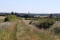
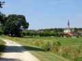
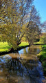
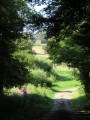
This is a pleasant walk through the countryside surrounding the village of Aize, situated in the northern Boischaut region of the Indre department.

Details

3323703
Creation:
Last update:
Last review:
  • Walking
    Activity: Walking
  • ↔
    Distance: 6.19 mi
  • ◔
    Average duration: 3h 00 
  • ▲
    Difficulty: Easy

  • ⚐
    Back to start: Yes
  • ↗
    Ascent: + 197 ft
  • ↘
    Descent: - 174 ft

  • ▲
    Highest point: 528 ft
  • ▼
    Lowest point: 348 ft
  • ⚐ Country: France
  • ⚐ City: Aize (36150)
  • ⚑
    Start/End: N 47.103774° / E 1.701278°
  • ❏
    IGN map(s): Ref. 2124SB
  • Hour-by-hour weather

Photos

Description of the walk

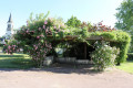
The starting point is at the foot of Saint-Hilaire Church.

(Start/End) Take Rue Principale southwards (D56).

(1) At the bottom of the descent, before the bridge, take the path on the left.

(2) At the next junction, take the sharp left-hand bend and continue to the junction with the D31.

(3) Take this road on the right, then, after passing under the power line, turn left onto a track. Continue along this track until the next junction, after passing under another high-voltage power line.

(4) At the junction, carry on straight ahead towards the east.

(5) Turn left at elevation 159, on the edge of the woodland, then left again.

(6) At the next junction (marker 138), turn left onto a grassy track to reach La Bannoterie. Take the small road on the right, cross the D56 straight ahead at La Carillonnerie, then turn left onto a track that goes round a copse. Continue until you reach a small road.

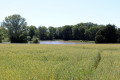
(7) Cross this road and carry on straight ahead along a path that runs alongside a small pond and a wood.

(8) Turn left onto a grassy path, pass under a power line and, at the end, at marker 139, turn right to join a road.

(9) Turn left onto this road, then take the left-hand path at La Goubardière. Follow it to the next road.

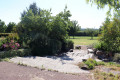
(10) Follow the D56 to the right to return to the village of Aize and turn left towards the village hall and its landscaped park at the rear, then return to Saint-Hilaire Church (S/E).

Waypoints

  1. S/E : mi 0 - alt. 394 ft - Saint-Hilaire Church
  2. 1 : mi 0.3 - alt. 354 ft - Before the bridge, take the path on the left
  3. 2 : mi 0.63 - alt. 351 ft - Turn left at the fork
  4. 3 : mi 1.14 - alt. 390 ft - Turn right onto the D31
  5. 4 : mi 2.32 - alt. 453 ft - Straight on towards the east
  6. 5 : mi 2.77 - alt. 522 ft - Turn left at the edge of the woods
  7. 6 : mi 3.43 - alt. 456 ft - Grassy path to the left
  8. 7 : mi 4.37 - alt. 472 ft - Road crossing
  9. 8 : mi 4.52 - alt. 495 ft - Turn left at the fork
  10. 9 : mi 5.13 - alt. 463 ft - Turn left onto the road
  11. 10 : mi 5.88 - alt. 413 ft - D56, turn right
  12. S/E : mi 6.19 - alt. 394 ft - Saint-Hilaire Church

Notes

No particular difficulties; no water sources.
No signposting: this walk was kindly suggested to me by Mr Favrault, chairman of the festival committee and organiser of walking events (semi-nocturnal walks on thefourth Saturday in May), who informed me that the FFRP sign was out of date (at the time I went on this walk).

Worth a visit

Other walks in the area

For more walks, use our search engine .

The GPS track and description are the property of this route's author. Please do not copy them without permission.