


Refine your search for walks in Rocher du Coq (Sure-en-Chartreuse)
Rocher du Coq (Sure-en-Chartreuse) walks


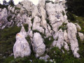
 La Grande Sure via the Jusson Chimney and the Pas de Pierre Taillée
 Visorando Member
 7.19 mi
 +4,629 ft
 -4,649 ft
 7h 20
 Difficult
 Departure from Pommiers-la-Placette (Isère)
Randonnée en huit partant des Trois Fontaines, un lieu baigné de fraicheur où il fait bon s'attarder en plein été.Le sentier commence dans la forêt en s'élevant dans une rude pente par de nombreux lacets. Il franchit des gradins rocheux pour rejoindre une bergerie d'alpage, le Chalet de Jusson. En haut de la prairie se présente la Cheminée de Jusson qui s'escalade sans difficulté pour parvenir au sommet et profiter d'un magnifique panorama. Descendre la crête et une partie du vallon de l'Hérétang puis remonter la Combe des Veaux pour retrouver le Chalet de Jusson. La descente par le Pas des Rochers de Pierre Taillée s'effectuant sur une sente en déshérence puis dans la forêt pour retrouver le parking conviendra aux randonneurs en quête de lieu secret.
GPS ou application Visorando recommandé.Ce parcours s'adresse à des randonneurs bien préparés physiquement.
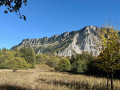
Charminelle circular loop, via the Pas de l’Aronde and Pas de Miséricorde
 5.72 mi
+2,874 ft
-2,864 ft
5h 10
 Very difficult
Departure from Pommiers-la-Placette (Isère)
A low-altitude circular loop that can be completed in half a day starting from La Placette on the western slope of the Grande Sure massif; best tackled in the afternoon to make the most of the light. The ascent via the Pas de l’Aronde requires caution, particularly when crossing exposed ledges on the cliff face and, above all, when traversing earthy gullies where sliding is prohibited. The return route via the Pas de Miséricorde is also exposed and is currently closed due to rockfalls => you must take the detour via the Combe des Veaux and Jusson until it reopens officially.
Walks near Rocher du Coq (Sure-en-Chartreuse)
Tour of the two highest peaks in the Chartreuse
 17.39 mi
+6,673 ft
-8,005 ft
7 hrs
Very difficult
Departure from Sarcenas (Isère)
Chamechaude (2,082 m) and the Dent de Crolles (2,062 m) are the two highest peaks in the Chartreuse; allow for a walk of around 30 km – fancy a go?
Col de Porte – Saint-Pierre-de-Chartreuse
17.45 mi
+5,075 ft
-6,824 ft
12h 25
Very difficult
Departure from Sarcenas (Isère)
This second stage of the Tour of the 10 Highest Peaks of the Chartreuse links the Col de Porte to St-Pierre-de-Chartreuse, via the Charmant Som and then the Grande Sûre. Whilst presenting no particular technical difficulties, this stage is nevertheless one of the longest on the Tour.
Saint-Pierre-de-Chartreuse – Saint-Pierre-d’Entremont
9.00 mi
+4,160 ft
-4,633 ft
7h 45
Difficult
Departure from Saint-Pierre-de-Chartreuse (Isère)
This third stage of the Tour of the Ten Highest Peaks of the Chartreuse links Saint-Pierre-de-Chartreuse to Saint-Pierre-d’Entremont, via the Grand Som. There are no technical difficulties, unless you decide to follow the southern ridge of the Grand Som, which offers some very beautiful and exposed rock climbing.
 Cabane de Pravouta - La Plagne
15.41 mi
+4,469 ft
-6,211 ft
12 hrs
Very difficult
Departure from Saint-Pierre-de-Chartreuse (Isère)
Third and final day of this trip to the Chartreuse to collect the car.
Col du Coq – Col de Porte
7.76 mi
+2,972 ft
-3,219 ft
6h 10
Difficult
Departure from Saint-Pierre-de-Chartreuse (Isère)
This first stage of the Tour of the Ten Highest Peaks of the Chartreuse links the Col du Coq to the Col de Porte, via Chamechaude, the highest point of the Chartreuse massif. However, with the passage through the Double Arche, situated at the foot of Chamechaude, followed by the Rampe de l’Écureuil (or Pas du Lapin), and the canyon on the descent, these gems of the Chartreuse massif do require sure-footedness, combined with a good sense of direction.
From Col du Coq to Sainte-Marie-du-Mont
 14.29 mi
+4,423 ft
-5,938 ft
10h 25
Very difficult
Departure from Saint-Pancrasse (Isère)
The route runs mainly through the Chartreuse Natural Park, passing through the massif's iconic passes and mountains. The route combines fairly steep climbs, passages through plateaus, mountain pastures and a village.
From Sassenage to Noyarey on the slopes of the Vercors
 3.77 mi
+1,125 ft
-1,119 ft
2h 45
 Moderate
Departure from Sassenage (Isère)
This exploratory hike along the paths on the northern flank of the Vercors should be treated as a training session if it is cold higher up. There are three viewpoints, two of which have been developed.
That said, the constant change in gradient along this route is sure to please any hiker or runner hoping to tackle the drovers' road leading to the Sornin plateau at a later date.
This walk is only enjoyable in dry weather, as the slopes become slippery after rain.
Col de Bellefont via Le Chaos and back via the Col de Saulce
6.85 mi
+3,720 ft
-3,678 ft
6h 25
Difficult
Departure from Saint-Pierre-de-Chartreuse (Isère)
A beautiful, wild hike in the heart of the Chartreuse and on the edge of its nature reserve. The route starts in the woodland, to the sound of the waterfall and the source of the Guiers, climbs up the cliff face, crosses the wild and rugged Chaos de Bellefont, passes through mountain pastures, and reaches the ridge with its stunning views.
 Easy