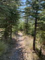
Circular route to the summit of Le Cousson, starting from Le Pigeonnier

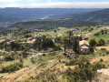
To enjoy a lovely view of the Digne basin, this walk to the summit of Le Cousson is highly recommended.

Details

66122555
Creation:
Last update:
Last review:
  • Walking
    Activity: Walking
  • ↔
    Distance: 11.09 mi
  • ◔
    Average duration: 7h 50 
  • ▲
    Difficulty: Difficult

  • ⚐
    Back to start: Yes
  • ↗
    Ascent: + 3,136 ft
  • ↘
    Descent: - 3,120 ft

  • ▲
    Highest point: 4,961 ft
  • ▼
    Lowest point: 2,005 ft

Description of the walk

Park in the Pigeonnier car park.

(S/E) Follow the Route des Thermes for a few metres; turn right to cross the Vallon des Sources estate. At the exit of the estate, join the fitness trail.

(1) Follow this trail past the various spots, then emerge onto the D20 at the Thermes.

(2) Take this road and follow it until you reach the Cousson track.

(3) Leave the road and turn right onto this track. Pass through the gate, then cross the ford over the Torrent des Eaux Chaudes, and begin a steeper climb. Then veer right to look out over the right bank of the Ravin de Richelme. Further up, you’ll reach a crossroads of footpaths.

(4) Leave the track here by veering to the right and cross the Ravin de Richelme. Continue the climb, passing the Ravin de la Fonse, then follow a series of tight hairpin bends to reach the multi-way junction at Les Hautes Bâties de Cousson.

(5) Here, take the wide track on the right and follow it to its end.

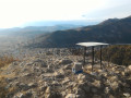
(6) Carry on along the path that follows on from it; stay on this path, ignoring all the turn-offs to the right or left. You’ll emerge at the Sommet du Cousson, marked by its paragliding launch site.

(7) Start the descent opposite, passing at the foot of the mast. Continue along a series of tight hairpin bends to reach thePR® junction, near a wayside shrine.

(8) Turn right onto this yellow-marked path, then head towards the Hautes Bâties de Cousson junction, which you passed earlier.

(5) Take the track straight ahead, which winds through the forest. Pass the Ravin des Saint-Jean, then reach the Chemin Saint-Jean junction, marked by a sign.

(9) Stay on the track, which joins theGR®406here, and continue to the Chemin des Basses Bâties junction.

(10) Keep to the right on the track, pass the base of another mast, head downhill and, after a few hairpin bends, make your way past the sports grounds to the Pigeonnier car park (S/E).

Waypoints

  1. S/E : mi 0 - alt. 2,011 ft - Pigeonnier car park
  2. 1 : mi 0.62 - alt. 2,077 ft - Vallon des Sources
  3. 2 : mi 1.36 - alt. 2,185 ft - Digne Thermal Baths
  4. 3 : mi 2.17 - alt. 2,277 ft - Crossroads: track and barrier
  5. 4 : mi 3.43 - alt. 2,762 ft - Richelme Valley
  6. 5 : mi 4.87 - alt. 3,553 ft - Hautes Bâties de Cousson
  7. 6 : mi 6.34 - alt. 4,354 ft - End of track
  8. 7 : mi 6.97 - alt. 4,951 ft - Sommet de Cousson (1516m)
  9. 8 : mi 7.57 - alt. 4,163 ft - Crossroads with a wayside shrine
  10. 9 : mi 9.12 - alt. 3,222 ft - Signpost: Chemin de Saint-Jean
  11. 10 : mi 9.43 - alt. 3,107 ft - Basses Bâties signpost
  12. S/E : mi 11.09 - alt. 2,011 ft - Pigeonnier car park

Worth a visit

Always be cautious and plan ahead when you're outdoors. Visorando and the author of this route cannot be held responsible for any accidents occurring on this route.

The GR® and PR® markings are the intellectual property of the Fédération Française de Randonnée Pédestre.

Reviews and comments

4.8 / 5
Based on 2 reviews

Reliability of the description
5 / 5
Ease of following the route
4.5 / 5
Route interest
5 / 5
lepapou
lepapou

Overall rating : 4.7 / 5

Date of your route : Sep 14, 2025
Reliability of the description : ★★★★★ Very good
Ease of following the route : ★★★★☆ Good
Route interest : ★★★★★ Very good
Very busy route : No

A very beautiful hike from Digne.
Magnificent view from the top of Cousson.
The descent on the way back is a bit steep and difficult for the first few kilometres.
Otherwise, no particular difficulties.
Point 5 (Haute Bäties des coussons) is indeed ideal for a picnic.
We left at 8:45 a.m. and returned at 4:30 p.m. with a 1 hour 22 minute stop.
Allow about 6 hours for this route.
Beautiful sunny weather.

Machine-translated

Winnieexplo.🐻
Winnieexplo.🐻
• Edited:

Overall rating : 5 / 5

Date of your route : Jan 19, 2025
Reliability of the description : Not used / Not applicable
Ease of following the route : ★★★★★ Very good
Route interest : ★★★★★ Very good
Very busy route : Yes

A route completed in 4 hours 50 minutes, covering 18.70 km
- The first 3 kilometres aren’t very interesting (along the roadside), then you cross a river – be careful depending on the time of year ⚠️ (water in January) – after that, the walk really gets going!
A magnificent walk, well signposted and easy to follow.
Around the 8th kilometre (halfway through the two circular loops) there’s a great spot to eat, with tables in the shade or in the sun, and a fountain.
Then a gentle climb to the summit! Magnificent, unobstructed views.
Then a fairly steep and technical descent – take care – down to the picnic tables (2–3 kilometres), and the return to the car is straightforward.
Definitely worth doing again!

Machine-translated

Other walks in the area

For more walks, use our search engine .

The GPS track and description are the property of this route's author. Please do not copy them without permission.