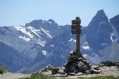
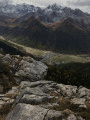
Col de Bramousse via the Aiguillettes path

The Col de Bramousse via the back roads...
This route veers slightly off the classic route and is a little wilder.
(!) Erosion of a path has created a tricky section; see reviews

Details

10895116
Creation:
Last update:
Last review:
  • Walking
    Activity: Walking
  • ↔
    Distance: 6.32 mi
  • ◔
    Average duration: 4h 55 
  • ▲
    Difficulty: Moderate

  • ⚐
    Back to start: Yes
  • ↗
    Ascent: + 2,306 ft
  • ↘
    Descent: - 2,280 ft

  • ▲
    Highest point: 7,372 ft
  • ▼
    Lowest point: 5,381 ft

Description of the walk

Park in the car park by the Ceillac village hall, to the south-east of the village.

(S/E) Head north towards the village centre. At the church square, turn left then right to follow the tarmac roads to the junction ofthe GR®58and the Sentier des Aiguillettes in the Le Queyras district.

(1) Leave theGR® on your right and turn left onto the Sentier des Aiguillettes, marked in yellow; there is also a sign indicating this path. You will soon reach another junction. Turn sharply right to head up into the Enguysson woods. You will reach a junction in a scree slope.

(2) Continue to the right, still on the yellow-marked path, and after a few tight hairpin bends, then heading east, join theGR®58after crossing the Ravin des Aiguillettes.
Turn left onto the red and white-markedGR® and you’ll soon reach the Villard crossroads.

(3) Keep left and take the new route ofthe GR®; please note that the IGN map is not up to date here, so you must follow the route described in this guide. Continue the climb and you will easily reach the Col de Bramousse.

(4) Return along the same route to the previous junction.

(3) Turn left onto the yellow-marked path; follow it first through the forest and then across mountain pastures to reach the hamlet of Le Villard. Here, you’ll rejoin theGR®5and 58.

(5) Turn right onto the wide track marked in red and white, which forms part of theseGR® routes. Continue on this track until you reach a crossroads marked by a cross.

(6) Leave the track and turn left onto the downhill path – this is theGR®. Further down, you’ll come to a tarmac road.

(7) Turn right onto it and follow it, passing through Ceillac to return to the car park at the village hall (S/E).

Waypoints

  1. S/E : mi 0 - alt. 5,384 ft - Car park near the Ceillac village hall
  2. 1 : mi 0.88 - alt. 5,620 ft - Aiguillettes Trail
  3. 2 : mi 1.14 - alt. 5,984 ft - Before the scree slope
  4. 3 : mi 2.34 - alt. 6,604 ft - GR PR junction
  5. 4 : mi 3.21 - alt. 7,369 ft - Col de Bramousse
  6. 5 : mi 5.11 - alt. 5,997 ft - Le Villard
  7. 6 : mi 5.62 - alt. 5,814 ft - Crossroads with a cross
  8. 7 : mi 5.85 - alt. 5,600 ft - Road junction
  9. S/E : mi 6.32 - alt. 5,381 ft - Car park near the Ceillac village hall

Notes

Ceillac has plenty of shops where you can stock up on provisions (grocery shops, bakeries, cafés)

Always be cautious and plan ahead when you're outdoors. Visorando and the author of this route cannot be held responsible for any accidents occurring on this route.

The GR® and PR® markings are the intellectual property of the Fédération Française de Randonnée Pédestre.

Reviews and comments

4.6 / 5
Based on 3 reviews

Reliability of the description
4.7 / 5
Ease of following the route
4.7 / 5
Route interest
4.3 / 5
ericbret
ericbret

Thank you, Guillaume, for keeping me up to date with this ‘old’ course.
I’m not there to go round it regularly

Machine-translated

conde guillaume
conde guillaume

Overall rating : 4 / 5

Date of your route : Jun 24, 2026
Reliability of the description : ★★★★☆ Good
Ease of following the route : ★★★★☆ Good
Route interest : ★★★★☆ Good
Very busy route : No

I completed this lovely, unchallenging circular trail run today. It’s true that the section through the ravine is a bit tricky around the 4 km mark, but it’s fine with good shoes and poles. The route is slightly different from the one suggested due to rockfalls, but it’s a single track that’s easy to follow.

Machine-translated

PatSal52
PatSal52

Overall rating : 4.7 / 5

Date of your route : Sep 04, 2023
Reliability of the description : ★★★★★ Very good
Ease of following the route : ★★★★★ Very good
Route interest : ★★★★☆ Good
Very busy route : No

A lovely walk. The path is in poor condition in places.

Machine-translated

a.chazal
a.chazal

Overall rating : 5 / 5

Date of your route : Jul 20, 2023
Reliability of the description : ★★★★★ Very good
Ease of following the route : ★★★★★ Very good
Route interest : ★★★★★ Very good
Very busy route : No

A lovely route up to the Col de Bramousse via a little-used but very well-marked path through the forest. There is a tricky section near the Ravin des Aiguillettes where the path has been eroded.

Machine-translated

Other walks in the area

For more walks, use our search engine .

The GPS track and description are the property of this route's author. Please do not copy them without permission.