Refine your search for walks in Cazavet
Cazavet walks


 The Bourdaous trail from Cazavet
 Association / Club / Walk leader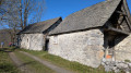
 7.71 mi
 +2,474 ft
 -2,457 ft
 5h 40
5h 40
 Moderate
 Departure from Cazavet (Ariège)
Discover the bourdaous, which are pastoral mountain hamlets, groups of barns and stables used in the past during the summer months. A bourdaou can also be an isolated barn with an adjoining hut, a very basic dwelling for shepherds. This route offers the chance to discover some of them, starting from Cazavet and climbing up to the Cours mountain pasture. The route passes by the summit of Roc de Maléchart, where a 360° view allows you to discover the Pyrenees mountain range.
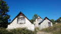
The barns of Balagué
 Visorando Member
 4.12 mi
+1,316 ft
-1,316 ft
3h 00
Moderate
Departure from Balaguères (Ariège)
4.12 mi
+1,316 ft
-1,316 ft
3h 00
Moderate
Departure from Balaguères (Ariège)
Sunshine, panoramic views of the Vallier massif and the Pyrenees, and barns are all on the agenda for this loop above the village of Balagué.
Montégut-en-Couserans - Tuc de Casterot and Char de Lique via the three passes
 4.13 mi
+1,060 ft
-1,063 ft
2h 50
Moderate
Departure from Montégut-en-Couserans (Ariège)
4.13 mi
+1,060 ft
-1,063 ft
2h 50
Moderate
Departure from Montégut-en-Couserans (Ariège)
An accessible and charming hike with varied terrain and landscapes and panoramic views of over 180°.
Circular route starting from Engomer
 3.12 mi
+1,325 ft
-1,316 ft
2h 35
Moderate
Departure from Engomer (Ariège)
3.12 mi
+1,325 ft
-1,316 ft
2h 35
Moderate
Departure from Engomer (Ariège)
A pleasant climb towards Compussan under the beech trees accompanies the summer pastures. It continues across high-altitude meadows and leads to the rocky massif of Cap de Broc with a beautiful view of the valley floor, returning via Alas and theGR®® which follows the Lez river a little higher up.
Saleich loop via Urau and Castelbiague
 8.67 mi
+1,020 ft
-1,040 ft
4h 55
Moderate
Departure from Saleich (Haute-Garonne)
8.67 mi
+1,020 ft
-1,040 ft
4h 55
Moderate
Departure from Saleich (Haute-Garonne)
This easy hike is located on the border of Haute-Garonne and at the gateway to Ariège. You will walk along the foothills of the Pyrenees. Varied landscapes and architectural sites are waiting to be discovered on this interesting walk.
Circular Pré Carré and Artigues from Saleich
8.01 mi
+2,064 ft
-2,054 ft
5h 30
Moderate
Departure from Saleich (Haute-Garonne)
This hike takes place on good tracks and forest roads, through beautiful forests of beech, ash, chestnut, boxwood and other trees. The descent is mainly on less comfortable paths, which require a little more attention as they are less well-trodden. The yellow markings are good, but seem to have been scratched and partially erased between points (8) and (9). The route, which is mostly in the shade, can be done in any season. However, avoid periods of fog due to the reported problem of poor markings on part of the route.
Le belvédère du Couserans
 5.99 mi
+1,168 ft
-1,168 ft
3h 45
Moderate
Departure from Saint-Lizier (Ariège)
5.99 mi
+1,168 ft
-1,168 ft
3h 45
Moderate
Departure from Saint-Lizier (Ariège)
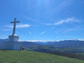
From narrow streets to footpaths, this route takes walkers from Saint-Lizier to Montcaliver, a viewpoint overlooking the entire Couseranne valleys and the splendid peaks dominated by the lord of the Couseranne: Mont Vallier.⚠️ On 18 May 2026, a user reported:>Between points (5) and (6), the route passes through private property. Following misconduct by inconsiderate walkers and horse riders (destruction of a >chicane and other damage), the owner has decided, in agreement with the local council, to no longer permit >access. Please take this >ban into account in route no. 5230.
From the Bishops’ Palace to the Marsan Chapel in Saint-Lizier
 2.91 mi
+397 ft
-420 ft
1h 40
2.91 mi
+397 ft
-420 ft
1h 40
 Easy
Departure from Saint-Lizier (Ariège)
Easy
Departure from Saint-Lizier (Ariège)
An easy walk, mostly in the shade. Mainly a dirt track, tarmac only in Saint-Lizier. You’ll enjoy superb views of the Pyrenees, the Bishops’ Palace and Saint-Lizier Cathedral.
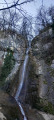
The Aubert Waterfall from Saint-Girons
 6.83 mi
+1,394 ft
-1,401 ft
4h 20
Moderate
Departure from Saint-Girons (Ariège)
6.83 mi
+1,394 ft
-1,401 ft
4h 20
Moderate
Departure from Saint-Girons (Ariège)
A circular from the centre to the Aubert Waterfall via Cap de la Bouiche. Beautiful view of Saint-Girons and the heights above Moulis.
Trémau sinkhole, starting from Saint-Girons
 6.96 mi
+1,138 ft
-1,138 ft
4h 10
Moderate
Departure from Saint-Girons (Ariège)
6.96 mi
+1,138 ft
-1,138 ft
4h 10
Moderate
Departure from Saint-Girons (Ariège)
This mostly shaded walk offers varied views of the valleys and hills at the foot of the Sourroque massif, with a wild feel in places, all close to Saint-Girons.
Circular around the village of Bagert
 3.99 mi
+837 ft
-814 ft
2h 35
Easy
Departure from Bagert (Ariège)
3.99 mi
+837 ft
-814 ft
2h 35
Easy
Departure from Bagert (Ariège)
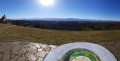
A family walk on wide, well-maintained and marked trails between forest and pastures with splendid views of the Pyrenees. The route can be done in both directions: the opposite direction to the one described is perhaps even more beautiful! The markings are easy to follow.
La Table des Quatre Seigneurs via the Crêtes trail from Ouerdes
8.92 mi
+1,982 ft
-1,972 ft
5h 50
 Difficult
Departure from Eycheil (Ariège)
Difficult
Departure from Eycheil (Ariège)
A very pleasant walk through beautiful forests along forest tracks and a few well-marked paths. A fairly difficult section that is fully roped off (to be avoided with dogs, otherwise you’ll have to carry them), with numerous short detours to see the entrances to chasms or viewpoints that are not to be missed. Beautiful beech woods and the regrowth of boxwood give this path a touch of magic. The app will be useful as numerous paths cross at various points.
Circular Mont Aragnoué from Castelbiague
 8.85 mi
+1,604 ft
-1,621 ft
5h 30
Moderate
Departure from Castelbiague (Haute-Garonne)
8.85 mi
+1,604 ft
-1,621 ft
5h 30
Moderate
Departure from Castelbiague (Haute-Garonne)
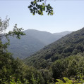
This long, fairly challenging circular route takes you up to Mont Aragnoué and its paragliding launch site via a well-shaded forest track, allowing for a relatively quick ascent, before a gentler descent via the Col d’Arbas and the western face of the Tucas, before returning to your starting point, the small village of Castelbiague.
Col de la Mothe from Montgaillard-de-Salies
5.51 mi
+443 ft
-436 ft
2h 55
Easy
Departure from Montgaillard-de-Salies (Haute-Garonne)
A pleasant walk on quiet roads, mainly on the heights, offering beautiful views of the Cornudère ridge and the Cagire, after passing through a beautiful forest. Then, the descent along the Arbas, to the sound of running water, should charm walkers. Please respect the gates.