


Refine your search for walks in Cabane des Aires (Vallée des Gaves-Cirque de Troumousse)
Cabane des Aires (Vallée des Gaves-Cirque de Troumousse) walks


 Circular route of the Cirque de Troumouse from the Chapelle de Héas
 Visorando Member
 7.71 mi
 +2,169 ft
 -2,169 ft
 5h 25
5h 25
 Moderate
 Departure from Gèdre (Hautes-Pyrénées)
Circular trail starting from the Chapelle de Héas to explore the magnificent Cirque de Troumouse. The trail offers panoramic views of the entire cirque, passing by the Lac des Aires, before continuing towards La Vierge and the Cabane de la Vierge.A varied hike with superb scenery, which returns gently to the Chapelle de Héas to complete a circular route.
⚠️ Following a discussion with the Gavarnie-Gèvre Tourist Office, here is some information about this hike:Road access to Héas and the Maillet plateau has been restored, and the road is considered to be open again. Works will resume in the spring and may occasionally affect traffic.However, the access road to the Chapelle de Héas is closed every winter and early spring due to snow and avalanche risks. The road reopens gradually from March–April and then in late May–early June.To find out when the road is open , pleasevisit the website.
Route of the three cirques: Gavarnie, Estaubé and Troumouse
29.94 mi
+9,777 ft
-9,252 ft
4 days
Moderate
Departure from Gavarnie (Hautes-Pyrénées)
A four-day route of the three cirques of Gavarnie, Estaubé and Troumouse, including the ascent of the Piméné. A self-guided route with nights spent in bivouacs.
Walks near Cabane des Aires (Vallée des Gaves-Cirque de Troumousse)
Estaubé Cirque – Troumouse Cirque
9.52 mi
+2,106 ft
-1,237 ft
6h 15
Moderate
Departure from Gèdre (Hautes-Pyrénées)
Set off from the Cirque d’Estaubé, passing by the Lac des Gloriettes, to the Cirque de Troumouse for a completely self-catering bivouac.
From the Espuguettes refuge to the Tuquerouye refuge via the Piméné
 5.82 mi
+4,114 ft
-2,044 ft
8 hrs
5.82 mi
+4,114 ft
-2,044 ft
8 hrs
 Very difficult
Departure from Gavarnie (Hautes-Pyrénées)
Very difficult
Departure from Gavarnie (Hautes-Pyrénées)
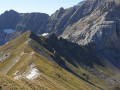
Day 2This beautiful day-long high-mountain hike offers breathtaking views of the Cirque de Gavarnie from the summit of the Pic de Pimené (2,801 m), as well as a 360° panorama of the entire Pyrenean border range and the French Piedmont region of the Hautes-Pyrénées.The walk then follows the Pimené ridge, offering a fun and exhilarating experience.The highlight of the day is the gruelling ascent of the Couloir de Tuquerouye to reach the highest unmanned mountain hut in the Pyrenees.
Refuge des Espugettes – Cirque d’Estaubé.
7.61 mi
+3,235 ft
-3,740 ft
6h 20
 Difficult
Departure from Gavarnie (Hautes-Pyrénées)
Difficult
Departure from Gavarnie (Hautes-Pyrénées)
Route from the Espuguettes refuge to the Cirque d’Estaubé, including the ascent of the Petit and Grand Piméné (2,801 m) via the Hourquette d’Alans. Bivouac in the cirque, entirely self-sufficient.
Gavarnie – Refuge des Espuguettes
7.36 mi
+3,901 ft
-1,759 ft
6h 45
Difficult
Departure from Gavarnie (Hautes-Pyrénées)
Start from Gavarnie and climb towards the Plateau de Bellevue, then descend to the Grande Waterfall. From the Hôtellerie du Cirque, climb via the ledges to the Refuge des Espuguettes, with a campsite nearby.
Gavarnie to the Espuguettes Refuge
 7.16 mi
+3,868 ft
-1,677 ft
6h 40
Difficult
Departure from Gavarnie (Hautes-Pyrénées)
7.16 mi
+3,868 ft
-1,677 ft
6h 40
Difficult
Departure from Gavarnie (Hautes-Pyrénées)
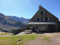
Day 1The Cirque de Gavarnie needs no introduction; it is a monument, a cathedral, a colossus.The route via the Plateau de Bellevue allows you to discover it from this remarkable vantage point.The path running along the slopes of the Bosquet Long adds an element of excitement, allowing you to appreciate it in all its splendour, whilst offering a tranquillity not found on the better-known routes.The return route along the ledge on the right-hand side takes you back to the Refuge des Espuguettes, where you’ll spend the first night.
The Spanish ledges
13.20 mi
+4,432 ft
-5,043 ft
9h 55
Difficult
Departure from Fanlo (Huesca)
Second day of the trek between the Mont Perdu massif and the ledges overlooking the Ordesa Canyon: Faja Luenga, Faja de las Flores, Faja Tardiador and Faja Escuzana, with a passage via Pico Mondarruego. This hike leaves the mineral landscape of the high mountains for a succession of vertiginous ledges and grassy sections between the peaks. A long route offering thrilling experiences on the ledges and spectacular views of the mountains around Ordesa. Not recommended for those who suffer from vertigo.
Chalet Hôtel d'Orédon - Tournaboup
 9.05 mi
+2,096 ft
-3,494 ft
6h 00
Moderate
Departure from Aragnouet (Hautes-Pyrénées)
9.05 mi
+2,096 ft
-3,494 ft
6h 00
Moderate
Departure from Aragnouet (Hautes-Pyrénées)
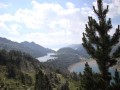
Third stage of the Three Days in the Néouvielle Reserve and its lakesFrom the Chalet-Hôtel d'Orédon to the Tournaboup car park.The multi-day hike is coming to an end, but the beauty of the 20 lakes remains.You are entering the Néouvielle National Nature Reserve, which is protected by regulations. Please respect these regulations (see practical information).
From the Refuge de l’Oule to the village of Artigues
10.75 mi
+2,365 ft
-4,377 ft
7h 00
Moderate
Departure from Saint-Lary-Soulan (Hautes-Pyrénées)
Second day of a three-day circular route. You can book a packed lunch if you’re staying overnight at the Refuge de l’Oule, as well as top up your water flasks. Afterwards, the trail is lovely as it runs alongside the lake. It passes through the Col de Bastanet and takes in magnificent lakes all along the route. At the Campana de Cloutou mountain refuge, you can sit at a table to eat your packed lunch and refill your water flask. The trail then descends, passing by pretty lakes, to the village of Artigues.
Col de Tentes - Goritz Refuge
9.92 mi
+4,829 ft
-4,265 ft
8h 45
Very difficult
Departure from Gavarnie (Hautes-Pyrénées)
First day of the trek to Mont Perdu. Departure from Col de Tentes, passage through Brèche de Roland, at the foot of Pic du Marboré, and ascent of Mont Perdu. The first day is the most technical. You quickly reach the high mountain ranges of the Gavarnie massif.
Refugio San Vicenda - San Urbez
 9.79 mi
+2,799 ft
-5,331 ft
6h 55
Difficult
Departure from Puértolas (Huesca)
9.79 mi
+2,799 ft
-5,331 ft
6h 55
Difficult
Departure from Puértolas (Huesca)
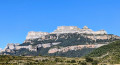
Second day of this superb two-day trip with a bivouac at the Refugio de San Vicenda. It is possible to go as far as Fuenblanca for the bivouac. In the Añisclo Canyon, bivouacking is permitted from 1,650 metres.
If you plan to sleep in your van the night before the hike, it is best to park 5-8 km before the canyon car park. The road to the car park is one-way, and crossing the canyon during the day must be magnificent (night crossing for the hike).