From the Espuguettes refuge to the Tuquerouye refuge via the Piméné

Day 2
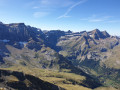
This beautiful day-long high-mountain hike offers breathtaking views of the Cirque de Gavarnie from the summit of the Pic de Pimené (2,801 m), as well as a 360° panorama of the entire Pyrenean border range and the French Piedmont region of the Hautes-Pyrénées.
The walk then follows the Pimené ridge, offering a fun and exhilarating experience.
The highlight of the day is the gruelling ascent of the Couloir de Tuquerouye to reach the highest unmanned mountain hut in the Pyrenees.

This walk is part of a multi-day hike: Boucle de 3 jours entre Gavarnie, le Pimené et Tuquerouye

Details

n°2673302
Creation:
Last update:
Last review:
–
  • Walking
    Activity: Walking
  • ↔
    Distance: 5.82 mi
  • ◔
    Duration according to the author: 8 hrs 
  • ▲
    Difficulty: Very difficult

  • ⚐
    Back to start: No
  • ↗
    Ascent: + 4,114 ft
  • ↘
    Descent: - 2,044 ft

  • ▲
    Highest point: 9,098 ft
  • ▼
    Lowest point: 6,627 ft

Photos

Description of the walk

Leave the refuge early in the morning.

(S) From the refuge, on the grassy summer pasture plateau, take care to stay on the main path. Head north-east towards the Col du Piméné, below the Petit Piméné. Pass the watering hole and the Espuguettes marsh on your right and continue up the slope, which becomes steeper again.
Circumvent the Plateau des Cardous to the north, straightening your course towards the east-south-east and then towards the south-east via several hairpin bends; pass the 2232-metre hillock, keeping it on your right, then take one final hairpin bend. You’ll reach a junction with a signpost.

(1) Turn left here, heading north-north-west along the south-western flank of the Piméné.
After several hairpin bends, you’ll reach the Col du Pimené (2,482 m).

(2) Head left to stay on the ridge and continue climbing. Reach the summit of the Petit Pimené.

(3) Descend due north to the false pass (2,647 m).

(4) Resume the ascent of the ridge to the north. The slope becomes very steep.
Follow the Pyrenees National Park markings, indicated by the letters ‘PN’ and red chamois on a white square background.
Caution: after a very gruelling 150m climb where you’ll need to use your hands and navigate a few exposed sections, you’ll reach the Pic de Pimené (2,801m). On the final metres of the ascent, make sure you stay on the ridge line – this is the safest route.

(5) The descent follows the same route back to the false pass.

(4) Then take a path to the left, skirting the Petit Pimené to the east (marked in purple on the IGN map).
This will take you back to the Col du Pimené.

(2) Continue south-east along the ridge leading to the Hourquette d’Alans path.
This path is fairly well marked, but these ridges remain challenging nonetheless.
Pass the unnamed summits at 2,487 m, 2,465 m and 2,521 m. There is no longer any marked path for the final 300 metres. On the summit at 2,521 m, a cairn is visible from a distance.

(6) The final rocky spur or outcrop is very difficult to access (erroneously marked as 2,505 m, but is in fact higher than the one crossed at 2,521 m).
You must bypass it to the left (east) as soon as the rock face rises steeply opposite the ridge line.
Descend then towards the Cirque d’Estaubé, following the dotted blue line on the map (the so-called ‘winter’ route). This section of the route is easy but completely off-track. Take great care, as there are numerous rocky outcrops.
You will easily rejoin the path coming from the Barrage des Gloriettes, which is visible from the ridge.
Avoid at all costs in the event of low cloud, fog, heavy rain, snow or hail.

(7) Continue downhill, then you’ll soon reach the junction with the Turquerouye path.

(8) Take the path that climbs to the right, skirting the Cirque d’Estaubé. You’ll reach the Y-junction where the paths to Turquerouye and Port Neuf de Pinède meet.

(9) Turn right; a yellow sign on a rock indicates the directions.
Leave the Deux Bornes on your right and the Borne de Tuquerouye (2,471m)—a striking cone visible from a great distance—on your left.
Reach the base of the Couloir de Tuquerouye, a very, very steep section of scree, 45° in places, bordered by the remains of a small glacier, between the Pic de Tuquerouye and the Pic de Pinède.
Take particular care in the couloir (approximately 300m long). The final section of the couloir becomes even steeper.
At the top, reach the pass and the Tuquerouye Refuge (E).

Waypoints

  1. S : mi 0 - alt. 6,627 ft
  2. 1 : mi 1.06 - alt. 7,425 ft - North-North-West fork
  3. 2 : mi 1.91 - alt. 8,291 ft - Col du Pimené (2,530 m)
  4. 3 : mi 2.23 - alt. 8,711 ft - Petit Piméné
  5. 4 : mi 2.33 - alt. 8,720 ft - False pass
  6. 5 : mi 2.59 - alt. 9,065 ft - Pic de Pimené
  7. 6 : mi 3.85 - alt. 8,182 ft - Summit in front of the rocky outcrop
  8. 7 : mi 4.14 - alt. 7,441 ft - Gloriettes path junction
  9. 8 : mi 4.57 - alt. 7,149 ft - Turquerouye crossroads
  10. 9 : mi 5.11 - alt. 7,326 ft - Turquerouye–Port Neuf de Pinède junction
  11. E : mi 5.82 - alt. 8,698 ft

Notes

This description relates to a hike undertaken in summer.

Alternative route: (2) For greater safety, you may wish to take the following alternative route:
To avoid the Pimené ridge (in case of rain, for example), descend from Pimené via the same path used on the ascent until you reach the junction (1), then resume the ascent straight ahead, taking the more common route to the Hourquette d’Alans. Continue downhill to rejoin the (7)

In both summer and winter, check the mountain weather forecast and, in winter in particular, the snow and avalanche bulletin from Météo-France for the Haute-Bigorre massif in the Hautes-Pyrénées. A call to the Haute-Montagne Gendarmerie unit may also reassure you about current conditions.
I do not recommend this hike in severe autumnal conditions (snow, heavy rain or hail), unless you have extensive mountain experience and are suitably equipped. Indeed, the Couloir de Tuquerouye can be particularly dangerous in the rain or when covered in snow.
For your information, another Visorando route, La Hourquette d’Alans, covers part of the route on snowshoes in snowy conditions.

Estimated time
Allow 9 hours, including breaks and a picnic, when hiking solo; add half an hour when hiking in a group. This is a fairly generous estimate.

Difficulty
The hike is classified as Very Difficult (summer) due to the significant elevation gain, the Pimené ridge – which is exposed and unmarked – and the Tuquerouye Couloir (E), considered to be very exposed. Access requires no specific technical skills when dry, but as it is tackled at the end of the day, fatigue can make the ascent arduous. If it is snow-covered or icy, it is extremely difficult for inexperienced hikers. Some even recommend turning back to avoid taking any risks either during the ascent or, even more so, during the descent the following day. There have been numerous accidents at this site. Please note: the final section may be snow-covered, even though this is not visible from the bottom of the couloir.

This is a challenging route, off the beaten track, where you must keep your cool.
Watch out for rockfalls in the couloir. If in a group, stay alert and do not line up one behind the other.

Water points
Except in the depths of winter, there is an outdoor tap with drinking water at the Refuge des Espuguettes (S).
At the Refuge de Tuquerouye, when there is no snow, Lac Glacé is a quarter of an hour’s walk away, but the water is not guaranteed to be safe to drink.
Otherwise, don’t forget to allow for around 2 litres per person in summer from the Refuge des Espuguettes (S) to the Refuge de Tuquerouye (E).

Shelters
(S) The Refuge des Espuguettes is open all year round. In winter, it is unstaffed and has 8 beds available.
See the refuge’s website.
In the event of bad weather, as you reach the Hourquette d’Alans and head down towards the fork in the path (1), there is a fine rock shelter that can serve as a temporary refuge for several people.
(E) The Tuquerouye Refuge is unstaffed and open all year round. There are 12 beds available, with mattresses and blankets. There is also a table and a stove.
See the refuge’s website.

Equipment
In summer, bring the usual equipment for high-mountain hiking (hiking boots, walking poles, suitable clothing, rainwear, water, food, survival blanket, knife, compass, map, whistle, etc.).
In autumn and spring, add gloves and a hat. If there is a risk of snow, add an ice axe and crampons.

Traffic
In summer, the route is fairly busy. However, from autumn onwards, once the Espuguettes refuge is closed, it is common not to come across anyone, even at weekends. So do make sure you inform your friends and family of the route you are taking and your planned times.

Mobile phone or radio communications
There used to be a radio, but there is now no radio communication at the Tuquerouye Refuge (E) (as of 2019). There is also no mobile phone coverage.
Mobile phone coverage is non-existent from the Tuquerouye Refuge (S) to the Hourquette d’Alans. From there to Les Espuguettes (2), coverage is very poor. You’ll find a signal (though not necessarily from all operators) at Les Espuguettes.

This route passes through a protected area, which may be subject to special regulations:

Worth a visit

(E) At the Tuquerouye Refuge (E) (2,666 m), there is a view of the glacial lake and the imposing north face of Mont Perdu (3,348 m) and the Cylindre du Marboré (3,325 m). The refuge is an exceptional site in more ways than one: geologically, geographically, naturalistically, historically, and so on.
A 75 kg cast-iron statue of the Virgin Mary has overlooked the refuge since 1890, the year it was built.

All along the route
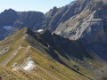
Petit Piméné: already splendid views, particularly from the Pimené ridge to the Hourquette d’Alans, with the Couloir de Tuquerouye in the background.
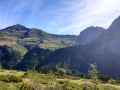
Plenty of vantage points for taking photos of the surrounding wonders.

Nearby
- The Balcon de Pinéta, 1 hour from the refuge on the Spanish side, with its remarkable view over the valley of the same name.
- The Pic de Pinéta (2,859 m), half an hour from the refuge, with another remarkable view.
- The village of Gavarnie and its church
See theGavarnie Tourist Office website.

Other walks in the area

For more walks, use our search engine .

The GPS track and description are the property of this route's author. Please do not copy them without permission.